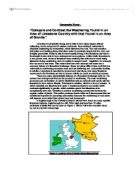
Figure 2: Simplified cross section of Ingleborough
Limestone Pavements are common on the surface of the limestone shown in Figure 2. Limestone pavements contain a large number of features that make them easily recognisable. The surface is made up of clints and grykes that are widened by the weathering process of carbonation. The clints are not porous and therefore are not weathered as fast, but the grykes allow water to penetrate and are therefore weathered much more quickly and are widened much faster than the clints are worn. The grykes are widened joints that have allowed the water to percolate and have been widened by carbonation leading to solution. The bedding planes allow water to percolate into rocks so carbonation can occur leading to widening. Pavements such as these can be seen in Figure 3.
Figure 3: A Limestone Pavement
Swallow holes and sinkholes are also commonly found in Ingleborough, the most famous of these being Gaping Gill, which is a swallow hole containing a 100m waterfall, south east of Ingleborough’s peak. Braithwaite Wife Hole is another swallow hole that can be seen on Figure 8 north of Ingleborough. Swallow holes are formed when water is running over an impermeable rock, but then reaches limestone. The limestone allows the water to percolate through joints fissures and bedding planes and weathering processes such as carbonation cause the opening of joints and bedding planes that open wide enough to allow the river to flow through completely.
Sinkholes are similar to swallow holes, but do not swallow the river, but may have done previously. They show how the course of the water has changed over time.
Figure 4: Swallow holes and their formation
Shake holes, also called Dolines, are surface depressions in a limestone area with dense joints and bedding planes. They can be formed in two separate ways. Firstly, limestone may often be covered in boulder clay two or three metres thick. The shake holes are formed when surface water washes boulder clay into joints in the limestone, making a depression. Secondly they are formed when a glacial drift holds water against a limestone rock surface. The joints are weathered by carbonation leading to solution under the areas with the greatest weight of the glacier. The longer the water is held against the limestone, the deeper the shake hole will be. They are approximately 3 metres in diameter and one to three metres deep, and may occur in groups where the glacier has been heaviest.
Underground caverns are also a main feature of the area of Ingleborough. The caverns contain features such as stalactites and stalagmites, curtains and columns. Stalactites are formed as calcium carbonate is deposited like an icicle formed in caves by chemical precipitation from drips or films of water. They are built up from many successive growth layers and almost always have pointed tips. Drops of water leave a few crystals of calcite mineral behind, and a stalactite begins to grow.
Stalagmites are formed when water containing dissolved limestone falls to the floor of a cave causing a build up of deposits forming a mound growing up from the floor. Columns are formed when stalactite and a stalagmite grow so much that they join together to form a vertical limestone pillar from floor to ceiling.
Other features in the cave are curtains, formed when water seeps down along the length of a joint, producing a type of stalactite, which resembles a curtain of calcite. They can, after many years reach the ground.
Caverns themselves are formed solely due to carbonation leading to solution, sped up by the possible occurrence of humus, or vegetation remains. The water flows trough the bedding joints and cracks and expands them, forming tunnels that join up caves. The caves themselves are large enough for a person to stand in, and where daylight does not penetrate. The water flows through the caves and tunnels in a cave system. The underground streams, in times of heavy rain, can erode the roof of the cave away further, enlarging it more. This mainly happened during the end of the ice age, when the melt water was flowing through the caves in massive volumes. Caverns may collapse when the roof is worn away either by erosion or carbonation and solution leaving gorges, which are common in limestone landscapes. The collapse exposes the underground streams that are surrounded by steep walls.
Dry valleys occur and are a feature of limestone landscapes. An example of a dry valley is Incombe Hole, Chilterns. Dry valleys occurred after the end of the ice age. They were formed when the limestone was frozen therefore making it impermeable. When the ice melted it carved out valleys in the frozen rock, but when the limestone thawed out, the water was able to percolate through the joints and bedding planes and the dry valleys were left.
Dartmoor has a very different landscape to Ingleborough; it’s predominant rock type being granite. Granite forms below the ground as an intrusive igneous rock, and is only exposed after millions of years of erosion. It is physically tough and resistant to erosion. The most common feature associated with granite is a Tor (see Figure 5). Tors are formed by weathering underground long before the granite is exposed on the surface. Although resistant to erosion, granite is very vulnerable to chemical weathering. This is because granite is made up of a collection of different minerals. Feldspar readily reacts with acidic water to form china clay in a weathering process called hydrolysis. Quartz on the other hand reacts extremely slowly when in contact with the water. This weakens the rock and causes it to crumble. Granite is heavily jointed. The density of joints is a critical factor when determining the formation of tors. Areas that have granite protruding towards the surface are Land’s End, Carnmenellis, St Austell, Bodmin Moor and Dartmoor.
Figure 5: A tor found in Dartmoor National Park
Dartmoor National Park (see figure 9) contains a large number of granite features. 65% of Dartmoor is made up of granite, surrounded by limestones sandstones and shales. There are over 160 tors on Dartmoor, the highest of these being High Willhays, 621 metres high. The major land use in the National Park is moorland, which is 47% of 954 square kilometres.
The processes of weathering that affect granite are primarily hydrolysis and often pressure release. Hydrolysis occurs in rocks containing feldspar, there it affects granite. The feldspar reacts with water made acidic by carbon dioxide, and forms kaolin, also known as china clay. The acid is removed from the solution leaving behind only the china clay as the end product. Other materials in the granite such as quartz, ferromagnesians and mica remain unaffected by the process of hydrolysis. This process considerably weakens the rock, making it weak.
Pressure release occurs when overlying rocks are exerting a huge force on the underlying rocks. When the overlying rocks are removed by erosion, there is less pressure on the underlying rocks causing them to expand and fracture. Granite has many joints and is therefore susceptible to this form of weathering. The removal of a glacier has a similar affect on the granite.
Figure 6 shows Linton’s model, depicting the formation of a tor, typical of the Dartmoor landscape. Steps 1 and 2 show that where the joints are closest together, more erosion occurs, and where the joints are widely spaced, comparatively little erosion occurs. The regolith surrounding the tor is made up of soil and loose pieces of rock.
1 Pliocene Age
Stage 1
2 Pleistocene Age
Stage 2
3 Present day
Stage 3
Figure 6: Linton’s Model – the theory behind the formation of a tor
Stage one shows the joints in the rock. These are formed by cooling of granite, and widened by chemical weathering processes. Stage two shows how much the regolith has been removed, maybe due to solifluction, but this would only be in tundrid areas, so in Dartmoor it would be due to erosion of the surface and being washed off by melt water at the end of the ice age. The rapid weathering can be seen where the joints are closest, and the core stones of the tors can be distinguished. All of the regolith has been removed in stage three, and the core stones are left protruding the surface. The tors are made of rectangular blocks of granite in a pillar formation. The depressions where the joints were most dense are now filled with china clay (kaolin) that is left when the feldspar in the granite is chemically weathered.
Granite has a very different type of landscape to limestone, and different types of weathering are the cause of this. Granite’s main features are above ground, but limestone has features both above and below the surface. On the other hand, they are similar because in both, the areas that are most heavily jointed are the areas that are weathered the most rapidly. Granite and limestone features are both protected by national parks, but each of them is also exploited for different reasons, for example granite is exploited for furniture decoration and as bulk aggregate for roads. Limestone is quarried for use in fuel production. Therefore I conclude that there are a few similarities and many differences in the weathering of granite and limestone.