At a local level, most people cited the low levels of income as the most important aspect of vulnerability – 54% of people have incomes equivalent to the national minimum wage (US$ 145/month) set by the government in 1990, a minimum on which to survive.
The methods and nature of building and the buildings adds vulnerability to the local people. Most homes were in a bad way and had little protection from flooding, such as being elevated and only 1% of buildings were built to any seismic specification, including public buildings, despite the high level of earthquakes in the region.
Social Vulnerability
Local organisations can mitigate the impacts of a disaster by preparing the people. However in the villages surveyed, this was not the case due to class structure and hazard perception. So, hazard acceptance was a common belief with;
- 27% believing that hazards were acts of nature
- 11% the punishment or will of god
- 24% did not know the cause
When asked who could reduce disasters, the people obviously believed that disasters were out of their control (externalisation). There was no incentive to act by forming local groups, this hazard acceptance is mainly due to religious factors and the view that they are a part of everyday life. Income and other problems (employment) have a higher profile in their concerns.
Educational and Informational Vulnerability
Education within and beyond school is important in reducing hazard vulnerability as people can be taught how to deal with emergencies. However there are few emergency preparedness programmes and most of these relate to seismic and volcanic action as opposed to flooding. Hazard zoning aims to reduce vulnerability by pinpointing high-risk areas and then avoiding siting vulnerable land uses in these areas. In spite of this Parrita is sited on high-risk land, designated as uninhabitable. In spite of this, the area is still supplied with water and electricity by the state and has a growing population as the water protecting dykes are repaired.
Early warning systems can be effective, (for hurricanes, landslides, floods and volcanic activity) so long as the message is clear easily understood and acted upon by the target population. The poor state of the country makes this hard to achieve, due to lack of economic resources.
Environmental Vulnerability
Changes in environmental conditions, such as deforestation and poor land management, can increase flooding, landslides and avalanches. Urbanisation of slopes and hilltops increase runoff and the vulnerability of lower lying communities. It is likely to be the urban poor who occupy the higher-risk floodplain land.
Social and Economic Data
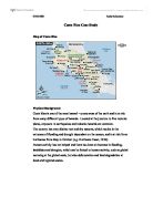
Full country name: Republic of Costa Rica
Area: 51,100 sq km (19,929 sq mi)
Population: 3.8 million
Capital city: San José (pop 340,000)
People: 96% Spanish descent, 2% African descent, 1% indigenous Indians, 1% Chinese
Language: Spanish, Creole English and Indian dialects
Religion: 85% Roman Catholic, 14% Protestant
Government: Democracy
President-elect: Abel Pacheco
GDP: US$16.6 billion
GDP per head: US$4300
Annual growth: 1%
Inflation: 11.6%
Major industries: Tourism, electronics, coffee, bananas, sugar, food processing, textiles and clothing, construction materials, fertilizer, plastic products,
Major trading partners: USA, Germany, Italy, Japan, Guatemala, Mexico
Needs for the Future
Lavell, in 1994 identified three main changes in order to reduce vulnerability:
- Government organisation needs to be less centralized and to focus on the local scale.
- Priorities: governments have difficult economic problems and many social demands on them, which means that hazards are not a priority. However, disasters must not be viewed as entirely unpredictable, abnormal and uncontrollable events.
- Participation at the local level: this needs to include disaster preparedness and prevention as part of a programme to improve housing, employment, education and health, as well as environmental management.