Methodology (Footpath Erosion)
Date: 14th May 2004 Friday
Weather conditions: Warm, Dry and Breezy.
Site: Footpath in car park, Hambury Tout and Stair Hole
Diagram:
Equipment:
Tape measure, Metre ruler
Method:
- First we laid a tape measure for 20 metres along a path
- Every 2m we measured the width using a tape measure and the depth using a ruler
- We continued until we ad covered 20 metres.
Methodology (Beach Profile)
Date: 14th May 2004 Friday
Weather Condition: Dry and Cloudy
Site: Lulworth Cove Beach
Diagram:
Equipment:
Clinometer, Tape measure and ranging poles.
Method:
- First we put a tape measure along the beach from the sea to the cliff.
- We placed ranging poles at 1-metre intervals.
- Then we used a clinometer to measure the angle between the poles.
- We repeated this until we reached the base of the cliff.
Methodology (Questionnaire)
Date: 14th May 2004 Friday
Equipment: Pen or Pencil and Questionnaire paper.
Method:
- We took a copy of the questionnaire and asked 2 separate people
- Later, when we returned to school, all of the questionnaire results were entered into a spreadsheet.
Methodology (Environmental Impact Survey)
We have looked at the general environment quality of different sites within the area. First of all we have chosen three sites: Car park, Lulworth beach and Hambury Tout.
We were given 8 categories to analyse for each site we have been to.
The categories were:
- Litter
- Noisy
- Unpleasant smell
- Much erosion
- Crowded
- Traffic
- No vegetation
- Unnatural and spoilt
For each category, we had to give a score out of 10, 10 is highest score and 1 is lowest score. This was dependant on how good or bad the place was in the present time. This was done in a subjective judgment.
Result Table (Footpath Erosion 2)
Date: 14th May 2004 Friday
Site: Hambury Tout
Result Table (Footpath Erosion 1)
Date: 14th May 2004 Friday
Site: Footpath in Car park
Result Table (Footpath Erosion 3)
Date: 14th May 2004 Friday
Site: Stair Hole
Result Table (Beach Profile1)
Date: 14th May 2004 Friday
Site: Lulworth Cove Beach
Result Table (Beach Profile 2)
Date: 14th May 2004 Friday
Site: Lulworth Cove Beach
Result Table (E.I.A)
Date: 14th May 2004 Friday
Site: Car Park
Result Table (E.I.A)
Date: 14th May 2004 Friday
Site: Lulworth Cove Beach
Result Table (E.I.A)
Date: 14th May 2004 Friday
Site: Hambury Tout
Footpath Erosion Analysis and Conclusion
Site: Car Park
As you can see as you go up along the path towards hill, path is eroded badly. I can tell this by looking at depth of path and distance.
Site: Hambury Tout
As you can see the path is eroded badly as you go along the path. As you go along the path width get narrower and path is less eroded.
Site: Stair hole
As you can see as you go along the path, it is eroded differently. When width is wider the path is eroded less; when width is narrower the path is eroded badly.
Conclusion
Generally the footpath has been eroded very badly, because the amount of footpath erosion is influenced by human factors:
- Walkers-
- Cars at car park-
- Winter use –
Physical factors:
- Position of Lulworth and geological history
Therefore the hypothesis is rejected. Footpaths have been eroded badly. Lulworth cove needs maintenance.
Beach Profile Analysis and Conclusion
Site: Site 1 and Site 2
As you go away from sea, the land (beach) rises up. By comparing these two sites you can see that site 2 has higher height than site 1. That means site 1 has eroded badly than site 2.
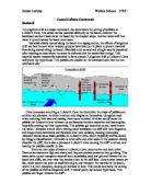
Sediments moved along the beach by longshore cliff and material from cliff erosion maintains the beach volume. Beaches absorb wave energy high, wide beaches. At Lulworth Cove the sea has broken through the limestone. The soft sands and clays are more easily eroded.
From the results and graph we can tell generally beach sites have been eroded.
Therefore the hypothesis is rejected.
Environmental Impact Survey Analysis and Conclusion
Site: Car park, Lulworth Cove Beach and Hambury Tout
From the result you can see Lulworth cove and Hambury tout have no litter, quite, pleasant smell, not crowded, no traffic, much vegetation, natural and unchanged but both sites have been badly eroded. Therefore both sites have been affected by physical factors, which are angle of slope, soil compaction, amount of rain and geological history.
Car park has no litter, quite, pleasant smell, no traffic and much vegetation but this site is crowded, unnatural and spoilt and also it has been eroded. Therefore this site has been affected by human factors, which are number of walkers, cars in car park and winter use.
Therefore hypothesis is rejected. Three sites have been eroded so Lulworth cove needs maintenance.
Questionnaire Analysis and conclusion
The results from the questionnaire show that nearly 50% of visitors from Dorset; most people visit to walk and to visit the beach; 51% of people come to Lulworth because of beautiful scenery; 77% of people come again and 68% of people visit at least twice a year; the visitors are unsure of the change of Lulworth; most people agree that people have not obviously affected Lulworth cove; most people agree that Lulworth cove has not been affected by nature; most people agree that Lulworth cove will be changed in the future because of the demand being placed on it by tourists.
Therefore people visits Lulworth cove again and many people visit Lulworth. People think that Lulworth has beautiful scenery.
Therefore Lulworth cove needs maintenance for the tourists.
Overall conclusion
According to rangers talk Lulworth has many different designations.
- World heritage site for all mankind
- Area of outstanding natural beauty
- Heritage coastline
- Site of special scientific interest
- Village conservation area
- Peaceful, quite and beautiful
People continuously visit Lulworth cove and rangers are maintaining the area to protect habitats and reduce erosions.
One of the maintenance is stone pitching.
From this coursework I found out that Lulworth cove needs continuous maintaining. Therefore I reject the hypothesis.
Evaluation
To investigate the given hypothesis, I used method of measuring, questionnaires and EIA. Some of the results obtained are reliable.
Questionnaire can have possibility of biased opinions; methods can have human error and Environmental impact Survey can also have biased opinions.
If I do this coursework again next time I will make sure all my results obtained are reliable. To do this I will ask more random people for the questionnaire; I will repeat measurements and take average to make sure the error is smaller; I will compare my EIA result with my friend to make sure there is no biased opinion by myself.
In my conclusion I have rejected my hypothesis, through my project I can put forward my new hypothesis.
“Lulworth Cove does need to be managed as it remains affected by physical and human geographical processes.”