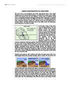
Waterfalls and rapids are other landforms that define the upper course of the Tees, both brought about by the processes assisting vertical erosion. The Tees flows over layers of Whin Sill, hard resistant rock which is mounted upon layers of sandstone, limestone and shale which are comparatively soft and easily eroded away by the river. Rapids can be seen to form when layers of Whin sill and soft rock are located together flatly and thinly, with the water being exposed to only some softer rock which is eroded away. These rapids can eventually develop into waterfalls as the softer rock is eroded away leaving a precipitous vertical edge, with Whin Sill being layered on top of the softer rock. The undercutting of the soft rock results in the collapse of hard, resistant rock. This process repeats constantly, with the retreating waterfall forming a gorge. Vertical erosion plays an evident part in defining the features of the upper course of the Tees.
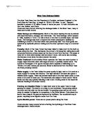
The middle course of the Tees comprises of less of the versatility seen in the upper course, with the most recognizable features in the landscape being highly similar. With the middle course, the gradient of the land decreases dramatically and becomes much flatter. This factor results in the abrupt conversion of potential energy held by the river into kinetic energy. Combined with the increased water received from tributaries and a widened smoother channel and relatively low wetted perimeter compared with the volume of water (which was not present in the upper course), the river has great amounts of kinetic energy held within it and less friction in a flat landscape. Therefore the fast flowing current begins to erode the banks of the river laterally, employing the processes of abrasion and hydraulic action to cut away at the banks. The fastest current, or Thalweg, flows naturally on the outside of the river when it bends and the slower current flows on the inside of the river when it bends. This results in processes of erosion dominating on the outside of the river and deposition on the inside. Meander bends develop from theses processes which migrate sideways and downstream due to the erosion and deposition occurring in the river. Landforms at the meanders include slip off slopes on the inside of the bend with point bar deposits. On the outside bank, undercutting of the bank forms slight river cliffs which could collapse with persistent erosion.
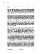
Meanders may also migrate to form oxbow lakes, with the processes of erosion narrows the neck of meander which can be breached at a time of flood, when excess water is discharge into a river. A new straighter course can then be followed by the river, leaving an abandoned meander which eventually dries up leaving a meander scar with deposited material from the stagnant water at its bottom. Lateral erosion can be seen to cause these meanders and oxbow lake features which change the landscape of the rivers middle course.
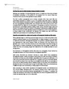
The dominant river processes once again changes in the lower course of the river, where the gradient becomes much flatter and the water of the river meets a large and relatively still body of water. The river contains far less energy at the lower course with there being no gravitational potential energy to convert into kinetic energy at the flat lower course of the Tees. Floodplains and levees are formed as water bursts the channel and layers of silt deposits are left to from a flat floodplain. Due to friction and lack of energy, the heaviest and coarsest deposits are dropped closer to the banks, building up a natural embankment called a levee. Higher rates of deposition occur at the estuary upon meeting the sea. As the Tees has not the energy in its flow to hold material in suspension any longer, these materials are deposited at the estuary forming large flats of sand. At the lower course, a delta s formed at the Tees with deposits blocking the main channel out to the sea, causing the river to divide into several distributaries. Over time, constant deposition leads to the expansion of the delta and the creation of marshy land. The amount of material deposited is too great to be taken away by the current and so a delta is created at the mouth. Deposition is the key process that causes the formation of there landforms in the lower course.
Changes in river energy result in changes in the dominant processes of the rive which in turn affects the way the landscape is shaped and what landforms are found at each stage of the rivers course. The high amounts of potential energy and steep gradient meant that landforms such as waterfalls and V-shaped valleys were formed by the processes of abrasion and hydraulic action acting vertically in vertical erosion. The decrease in gradient and increase in river energy levels through increased water and proportionally less wetted perimeter to volume, meant that the high amount of kinetic energy were used to erode thorough abrasion and hydraulic action laterally forming meanders with river cliffs and oxbow lakes. In the lower course the flat gradient and lack of energy means that any material transported by the river is deposited which creates estuaries, levees and deltas. It is clear that changes in the profile can have a significant impact of the landforms found at each stage of the rivers course.
In conclusion the landforms found at each stage of the river are of great variety, but can be rationalized by considering the effect the profile has on the energy levels and dominant processes that occur in the river. The high gradient at the upper course encourages vertical erosion, with the less steep middle course has an abundance of kinetic energy to erode laterally. The lower course has relatively little kinetic energy which means that deposition is the major process which occurs. It is understandable that these processes define the landforms at each stage of the rivers course, and are responsible for the great versatility seen in the landscape as the river progresses.