For more than four terrifying hours rocks, ash and boiling hot mud bombarded the peaceful village. By 5:30 am the eruption was over, although ash continued to fall, and steam vented from the mountain for days. The death toll was 153, a relatively small number due to the low population of the area, but two whole Maori villages were wiped out.
The fiery glow in the night sky and the thunderous roar of the explosions were seen and heard as far away as Auckland.
In the gloom of the day the wreckage of the hotels and houses, and the burial of 5000 square miles of scenic countryside brought awe and dismay to rescuers.
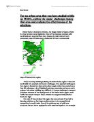
Today you can enjoy living history at Rotorua's Buried Village and inspect the place where nature displayed her most fierce and unforgiving forces.
Museum of Te Wairoa
Journey through time and watch the captivating tale of Te Wairoa unfold. Artefacts and exhibits, photographs and models recreate the thunderous calamity.
Blacksmith's shop
Inspect the tools and implements used to shoe the horses and maintain the coaches and wagons that brought visitors and supplies to the village.
Tohunga's whare
In this house the Maori high priest who predicted the destruction remained buried for 100 hours. Reputedly aged 110 years, the man died several days later.
Maori whare
Excavated to original floor level, this site displays a fireplace and an assortment of relics recovered when digging first began in 1931.
Maori whare
Excavated to original floor level, this site displays a fireplace and an assortment of relics recovered when digging first began in 1931.
Flour Mill
Parts of the mill, including millstones and gears. Wheat was grown in the Te Wairoa Valley and the stream was diverted to drive the mill's waterwheel.
Aspen poplars
Among the tallest in New Zealand, these trees grew from fence posts that formed a property boundary before the eruption. Tops of posts can be seen above ground.
Barman's house
Plates and household items were found here, along with bottles, tools and implements, and a well preserved fireplace and cast iron bed frame.
Stone Chimney
On the hill in the bush, across Tarawera Road, are the remains of the home of one of the two local Maori leaders at Te Wairoa.
Faloona's Store
One of two general stores in Te Wairoa selling everything from tobacco to toothbrushes, this was apparently looted in the days following the eruption.
Rotomahana Hotel
This two storey wooden building collapsed six hours after the eruption started, killing an English tourist. Travellers stayed here en route to the terraces.
Baker's oven
Bread was baked in this large unit from locally produced flour. It is built of hewn volcanic stone and imported firebricks.
Stone storehouse
Te Wairoa people stored various foods for winter usage in this storehouse, which features rare Maori stone carvings. One of two on the property.
Trout stream
Runs three kilometres from the Green Lake to Lake Tarawera, 100 metres lower in altitude. Rainbow trout can be seen feeding and spawning.
Te Wairoa falls
The steep track follows the falls and cascades, down through dense native bush and a cave; then up to the Buried Village tearooms and souvenir shop.
Plate Tectonics
Plate tectonics are the theory that the surface of the Earth is divided into a series of plates, consisting of continental and oceanic crust. Movements within the Earth caused earthquakes and volcanic eruptions. While there are many thousand gentle Earth movements each year, occasionally one is sufficiently violent to cause severe damage to property, to disrupt human activity and to result in loss of life. Earth movements, cannot, as yet, be predicted. Scientists do, however, know which parts of the world are most likely to be affected by these movements, even if they cannot say when or with what severity they will occur.
The eruption of Mount Tarawera was triggered by destructive margins, these occur where plates consisting of oceanic crust move towards plates of continental crust. For example, to the west of South America, the Nazca Plate (oceanic crust) is moving towards the American Plate (continental crust). Where they meet, the Nazca Plate is forced downwards to form a subduction zone and an associated deep-sea trench (the Peru-Chile trench). The increase in pressure, as the plate is forced upwards, can trigger severe earthquakes. As the oceanic crust continues to descend, it melts, partly due to heat resulting from friction caused by contact with the American Plate and partly due to the increase in temperature as it re-enters the mantle. Some of the newly formed magma, being lighter than the mantle, rises to the surface to form volcanoes (eg. Chimborazo and Cotopaxi) and a long chain of fold mountains (the Andes).
Sometimes, at destructive margins, the magma rises offshore to form island arcs such as the West Indies, Japan and off the south coast of Alaska, the Aleutian Islands.