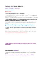
The diagram below shows the different Tectonic Plates placed around the world.
Earthquakes, Volcanoes and Fold Mountains are all separated in different areas around the world. Although landforms are separated there is all the same explanation for landform hot spots, two being the Himalayas and Andes. The explanation is that both of these formations are all on active plate boundaries. As you can see in the diagram on the previous page both of these formations are all collisions of at least three plate boundaries. To the west side of Mexico (The Andes) there is the North American Plate, Cocus Plate, Pacific Plate, Caribbean Plate and stretching further north there is Juan De Fuca and further south Nazca Plate all along the same coastline.
By the Himalayas there is the Arabian Plate, Indian Plate and Eurasian Plate, which creates another hot spot for landform formation.
At Divergent Boundaries, plates move away from each other such as the Mid-Atlantic Ridge. Where the plates separate hot, molten rock rises up (Basaltic Magma) and cools adding new material to Sima’s. This process is known as Sea Spreading, operating over millions of years forming the 50,000km-long system of mid-ocean ridges. Divergent plates, also known as Constructive plates, are causing the formation called The Mid-Atlantic Ridge. Tectonic plates diverting away from each other are forming this formation. This is happening because the down the middle of the Atlantic, plate boundary’s are aligned right down the middle which is causing the crust in the middle of the ocean to pull apart and open up, splitting the land in the middle. One country stands on the middle of these boundaries, Iceland, which will eventually separate and become two islands. This country gives scientists a natural laboratory for studying on land the processes also occurring in the sea. Iceland is splitting down the middle by the North American plate and Eurasian Plate. The diagram below shows how this is happening and how eventually at the rate of 25km over a million years, Iceland will separate.
The types of Landforms at Divergent boundaries are Earthquakes and Volcanoes. Earthquakes are more common from the ground splitting; this is easy to see in the northwestern part of Iceland around Krafla Volcano. We can see here that over time the existing cracks in the ground have widened and new ones have been formed, especially in between 1975 and 1984, when numerous episodes of rifting took place. Some of the rifting was accompanied by volcanic activity; the ground would rise 1-2m before dropping and signalling an eruption.
At convergent boundaries plates are moving towards each other and collide. Where a Sima and a Sial collide, a Sima slides under a Sial forming a deep ocean trench, which is also called a subduction zone. An example of this occurs at the boundaries of the Sima Nazca plate and the Sial South American plate. When continental plates (Sial) collide, they form huge mountain ranges such as the Himalayas. A man named Harry Hess discovered that the earth’s unchanged size over million and billions of years suggests that as some of the land is being destroyed by being pushed under one another, land must also be created at the same rate. This is now called recycling and also the reason why convergent boundaries are also called destructive.
Just off the coast of South America, the oceanic (Sima) Nazca Plate is being pushed under the continental South American plate. Although the Nazca plate is being pushed under, there is also and opposite resultant as the South American plate is being pushed upwards, creating the Andes. This is also what is meant by the term ‘recycling’ because some of the land is being destroyed by being pushed under, but some is being formed in the shape of Mountains. This can be seen in the diagram below.
When two continental plates collide it forms a range of mountains and volcanoes, such as the Himalayas. Neither of the plates are subducted because both of the plates are light, and like icebergs, resist downward motion. Instead the crusts push upwards or sideways. The collision of Indian into Asia 50 millions years ago caused the Eurasian plate to crumple over the Indian plate and continuously form the Himalayas. This can be seen in the diagram below.
Transform boundaries are where plates move along side each other and collide by rubbing against each other. Transform boundaries originated from J. Tuzo Wilson who proposed that these large boundaries connect two divergent boundaries or, less commonly, convergent boundaries. Transform boundaries mainly occur on the cean floor and create zig-zag shape ridges form earthquakes. But they also occur on land, one example being the San Andreas fault zone in California. This connects the East Pacific Rise, a divergent boundary to the south with another divergent boundary to the north with South Gorda, Juan De Fuca. The diagram below shows a picture of how this happens.
Oceanic fracture zones are ocean floor valleys horizontally offset spreading ridges. Examples of this include Clarion, Molokai, and Pioneer fracture zones in the northeast off the coast of California. These zones are currently inactive but the offset of the pattern of magnetic striping provide evidence of their previous transform-fault activity.
The earth has undergone different changes and formation over the 5.6 billion years since its beginning and since Pangaea. Tectonic plates have determine the shape and separation of the earths crust, but we still can’t determine when and how these changes will occur, the only thing we do know is that they will. Tectonic plates shows how earth in itself is a process and how the processes within it determine the process of it. Plate boundaries are places of highest activity and formation where such landforms such as the Himalayas and Andes were formed.