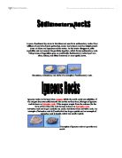
The theory of plate tectonics is that the world was made up of a single continent through most of geologic time. That continent eventually separated and drifted apart, forming into the seven continents we have today. Scientists believe that Earth's surface is broken into a number of shifting slabs or tectonic plates, which average about 50 miles in thickness. These plates move relative to one another above a hotter, deeper, liquid part of the earth called the mantle, at average rates as great as a few centre meters per year. Most of the world's active volcanoes are located along or near the boundaries between shifting plates and are called plate-boundary volcanoes
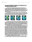
Wegener first noticed a close similarity between fossils found on opposite continents, intrigued by this he explored the phenomenon finding that when studied large geographical areas of separate continent matched almost perfectly. Leading him to believe that all the continents must one day have been connected as one land mass called Pangaea (See map over page/ below.)
Wegener’s theory, when first proposed, was not well received by the scientific world and was seen as ridiculous.
"Utter, damned rot!" said the president of the prestigious American Philosophical Society.
Another American scientist said "If we are to believe [this] hypothesis, we must forget everything we have learned in the last 70 years and start all over again,"
Many scientist spotted huge and quite genuine flaws in Wegener’s originally proposed idea. Largely due to the fact that Wegener had no substantial mechanism as to how, or in fact why, the continents might move. For example he thought that the continents were pushing through the earths crust ‘like ice breakers ploughing through ice sheets’ he also thought that tidal forces were responsible for continents movement. Both of theses are fantastic as continent ploughing through the earths crust would rip continents apart and centrifugal tidal forces are simply not strong enough.
Since Wegener's day, scientists have mapped and explored the great system of oceanic ridges, the sites of frequent earthquakes, where molten rock rises from below the crust and hardens into new crust. We now know that the farther away you travel from a ridge, the older the crust is, and the older the sediments on top of the crust are. It is clear that the ridges are the sites where plates are moving apart. Where plates collide, great mountain ranges may be pushed up, such as the Himalayas, or if one plate sinks below another, deep oceanic trenches and chains of volcanoes are formed. Earthquakes are by far most common along plate boundaries and rift zones: plotting the location of earthquakes allows seismologists to map plate boundaries and depths Paleomagnetic data have allowed us to map past plate movements much more precisely than before. It is even possible to measure the speed of continental plates extremely accurately, using satellite technology. Nevertheless, Wegener's basic insights remain sound, and the lines of evidence that he used to support his theory are still actively being researched and expanded.