At druridge bay the dunes are much different 10m from strand line the angle of the dune is 5˚ with the angle being so small suggests that there is no embryo and that it goes straight to a yellow. After another 10m the angle increases to 8˚. After another 10m the angle of the dune dramatically increases to 36˚ at this point there is a yellow dune formed. After another 10m the angle is 6˚ at this point this is the peak of the dune. After another 10m the dune starts to decline -7˚, -9˚,-10˚, 0˚,-2˚, -11˚,-12˚,-20˚,5˚, -2˚,-2˚. At druridge bay there is only one dune compared to the models 4 this is because of the severe winds that hit the beach and the tank traps that line the beach. These traps protect the yellow dunes from wind erosion at the bottom. Another explanation for the mutation in the dunes is that humans walk over the dunes and break down the dunes.
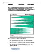
Vegetation
The vegetation found on an embryo dune sea couch grass that should be found. With the tide coming in and depositing there waste.
A yellow dune should have marram grass growing on top of it according to the model sand dune. But at druridge bay there is very little.
a semi-fixed dune has any kind of plant growing on it due to the decomposed marram grass making the soil fertile.
Fixed dune should have much mire plants growning on it because of the damper soil and richer soil e.g mosses wild thymes, grass etc.
Results from vegetation survey
20m from the strand line there is 47% marram grass
40 m from the strand line there is 10% marram grass
60m from the strand line there is 49% marram grass
80 m from the strand line there is 9% marram grass
100m from the strand line there is 7% marram grass
120m from the strand line there is 18% marram grass
140 m from strand line there is 0% marram grass
compared to the model dune for vegetation there at druridge bay is very little marram grass where there should be much more grass instead of the small percentages found. I think the reasons for the lack of marram grass at duridge bay unmanaged site is that there is no designated footpaths for people to walk along because many people go to the part of druridge bay because there is no parking fees so that encourages many locals and them walking on it chews up the vegetation on the dues. At druridge bay there was some but very little other vegetation the odd bush and thistle but very little other different species.
Conclusion
The dunes at druridge bay in vegetation and shape and size is very different from the model dune. With the dunes at druridge bay the there is an embryo dune but after the embryo dune there is nothing. According to the model dune there should be a yellow dune a semi-fixed dune and a fixed dune but there is none of those. The marram grass is lacking too. All of this is due to humans walking and destroying the dunes and their vegetation. The vegetation at druridge bay mainly consist on marram grass and other little things. This shows how unfertile the soil is in these areas.
Key question 2
“how are visitors damaging the sand dunes at Druridge bay?”
Introduction
I am investigation why the dunes at druridge bay are noting like the model dune I think one reason is due to human activity on and off. I am describing and analysing the path profiles and the litter on the dunes in this key question to show how building boardwalks will be beneficial for the dunes and the bay itself.
Path profile
This part of the path was 425cm wide and a maximum depth of 98cm. the path at this stage has average lateral and vertical x-section to it.
The next measurement of the path is 825cm wide the widest part of the whole path. Its depth is 198cm. the path has a lot of vertical erosion and a lot of lateral at
this stage with drops of 96cm. at this point the path is widening this is due to people walking onto the beach in the direction of their travel.
This part of the path is still quite wide but very sallow. 600cm wide and a maximum depth of 45cm. the path here has a lot of lateral erosion. The path is narrowing again.
The path at this stage is much narrower than before, 300cm wide but is much deeper going down to 118cm. there is a lot of vertical erosion on the sides of the path this is because the sand is much softer.
The path at this stage is getting smaller at 275cm but still fairly deep at 99cm. there is a lot of vertical erosion still.
Here the path stays the same width at 275cm but gets sallower at 54cm deep. Here there is not much erosion compared to the rest of the stages and the path is narrowing.
Here the path stays the same at 275 but even more depth has gone at 23cm deep.
The path for some reason probably human erosion has got wider at this stage. The path width is 425cm and a depth of 24cm.
The path at this point gets dramatically smaller in width at 125cm. the depth is a mere 10cm.
The path at this stage stays the same in width but get slightly deeper at 18cm.
The path starts to get wider adding on a 75 cm to the previous path profile. The depth stats to get shallower too at 12cm.
The path gets even wider adding on an extra 25cm and the depth increasing to 19cm.
The path at this part of the beach has eroded because of humans waking in the same place revealing the soft sand. This soft sand that is revealed is blown away by the wind that comes onto the land from the sea. The blow out of these paths causes them to get wider near the beach where it is exposed to the terror of the winds power. The path after the embryo dune is should be narrower due to the shelter of the massive dune. Onto of the dunes I found a few blow outs a blow out is where at the top of a dune where e.g a family have sat and had a picnic and caused a small crater onto where the wind that blows over the top gets stuck in and erodes the dune away completely.
Litter Survey
When I was at Druridge bay we did a litter survey recording what the litter was and where it was in comparison to the start of the path from the beach itself. For 60m.
To the left of the path:
10m from beach-coke can, fosters can
20m from beach-coke can sweet wrapper
30m from beach-plastic sheet
40m from beach-tissue, dog bag
50m from beach-plastic sheet x2, black bag, bus ticket, dog poo
The path itself:
10m from beach-bottle cap, crisp packet, sweet wrapper
20m from beach-plasticx2
30m from beach-dog poo, plastic, mint wrapper.
40m from beach-plasticx2
50m from beach-plastic, cigarette, sock
To the right of the path:
10m from beach-redbull can, ripple packet, bottle cap, plastic x2
20m from beach-firex2,water bottle, fork
30m from beach-plastic sheet, burger relish
40m from beach-tissue x2, mars bar wrapper
50m from beach-painted wood x2, condom
60m from beach-tissue, black plastic, dog bag, coke can
The litter we found mainly consisted of dog waste and cans of some description. I think that the amount of litter is due to the lack of litter bins in the area of the bay. This part of the bay is unmanaged so there is no bins the management should place bins all the way along the bay.
Conclusion
The path profiles, the path has eroded because of humans waking in the same place revealing the soft sand which is blown away by the wind that comes onto the land from the sea. Causing these paths to get wider near the beach where it is exposed to most of the winds power and the get small because it is protected by the embryo dune. This could be prevented by putting wooden walk boards along the tops of the dunes or down them. The litter was mainly caused by the lack of bins in the unmanaged area I feel that the managed area should protect the whole bay from the one thing that detracts people from the area.
Key question 3
“How effectively are the dunes a Duridge bay managed?”
Introduction
On my field trip to Druridge bay I visited two sites a managed site where there was litter bins walkways onto where there was nothing. I am also going to be annoting some pictures taken of the managed site and some of the unmanaged site to show how the area can be managed more effectively.
Managed site
I am now going to annote some pictures of the managed site.
Waste bin
This picture of a bin is to encourage people to put their rubbish into the bin so it doesn’t damage to park.
Boardwalk
This picture is of the boardwalks show where people can walk therefore concentrating movement on the paths rather than anywhere they want. And minimal erosion will occur.
Car park
This is parking facilities so it doesn’t damage the grass and showing where people can park rather than them parking where they want. The car parks are charged which the money can go towards the sustailibility of the park
Dog waste bin
This dog waste bin is something that should be around every coastal area the beach is somewhere that will always have dogs running around and this bin is showing people where to put there dogs waste. These bins can reduce the waste that is
Visitor centre
This visitor centre is somewhere where people can use the toilet and waste can be deposed of inside. It also has so information about the park and how it can be conserved by you. A small café is also inside.
Tank barricades
These tank barricades where placed here during the Second World War. They could be removed from the beach but the protect the dunes from erosion.
I am now going to look at the unmanaged site and say what techniques can be used from the managed site into the unmanaged site.
Unmanaged site
I am going to look at some photos now and suggest what management techniques can be introduced to save the area.
Eroded path
This path has no walk boardwalk which could be made to prevent the easy erosion and make people walk in the right places conserving the dune.
Dunes
In this picture I would place some boardwalk steps down the dunes to stop erosion. Where as you can see people don’t know where to walk destroying the dunes in the process.
Boardwalk?
In this picture I would want to have those Tank traps to protect the dunes and that’s why there is only the one dune. (Pictured)
Miss Shipley
In this picture I would encourage a notice to be placed on the side of the path to tell people to keep off the dunes and stay on the path itself and add a boardwalk. To stop erosion.
Conclusion
There are many good things about the managed site but some minor things that could be added. The boardwalks are a very good idea showing people where to walk so they don’t damage the sand dunes. The tank traps I feel save the dunes at that managed part of the dunes which will keep the dunes there for along time. Whereas at the unmanaged site there is nothing protecting the dunes so they are gradually moving back and the sea is coming further up the beach if some sort of protection was put into place the dunes would look more like the model dune. At both sites I think that they should place a notice at the start and end of the beach so people no what they are doing walking on the sand dune and that will encourage some concerned people to walk on the boardwalk saving the dunes. I would suggest there to be more bins at the unmanaged site there’s nothing more than off putting than dog bags dotted about and rubbish lying everywhere. Overall the unmanaged site needs to be sorted out or it will loss all its natural beauty.