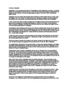
Map 3: Parana River Picture1
Source: Source:
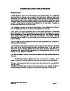
Salado River: is a river that crosses several provinces of Argentina, flowing 1,500 kilometres from its source in the Salta Province to end in the Parana River, in the Santa Fe Province ( Map4). Its origin, its flow varies widely within the year, and it can dry out in some parts of its path during the winter. The only important tributary to the river is the Horcones River, which is born in Salta as Cajon River, and joins the Salado in the Santiago del Estero Province. After a course of 800 kilometres inside Santiago del Estero, the river reaches the Santa Fe Province as Salado del Norte ("Northern Salty") to finally join the Paraná River in that province, being the last important tributary to the Paraná. During rainy summers, the river can overflow its riverbed producing floods; the last important one severely affected the city of Santa Fe.
Picture2
Source:
Map4:Sketch Salado River
Map5: sketch of Parana and Salado River.
Santa Fe is a city that has flood many times.These are the 14 major floods that have surpassed the 6 meters according to the Hydrometer of the Port of Santa Fe:
- 14 of June 1905. 7, 83m.
- 23 of March 1929. 6. 55m.
- 6 of March 1959. 6, 12m.
- 17 of April 1961. 6, 15m.
- 17 of March 1966. 6, 94m.
- 07 of March 1977. 6, 36m.
- 23 of December 1982. 6, 95m.
- 05 of July 1983. 7,35m.
- 17 of February 1990. 6, 53m.
- 22 of July 1992. 7, 35m.
- 25 of March 1995. 6,16m.
- 05 of March 1997. 6,54m.
- 16 of May 1998. 7, 24m.
- 28 0f April 2003. 8,79m.
Time line of floods in Santa Fe
Us we can see most of the floods were from March to July, this means that the autumn and the winter are the rainy seasons in Santa Fe. The worst flood was in 2003.It´s floods 8.79m and destroys most of the city and the agriculture of the north province. In 1905 there was a strong flood too, but the methods that the province used were different, you can see in picture5 that they use sang bags to keep the water out the city but, this method wasn’t good, because although they use lots and lots of sand bags the water will go in the city.
In the flood of 2003 the method was different they made a wall along the Salado River, that was the river that floods and they put hydraulic pumps, to put the water out the city. This method was good, because they could put the water out faster and they could recue something, also it’s good because they are prevented for next flooding
Pictures of different Floods in Santa Fe
Picture3 Picture4
Source: http://www.taringa.net/posts/1021362 Source:
Picture5 Picture6
Source: http://www.taringa.net/posts/1021362 Source:
Description of the Flooding
On 28 April of 2003, after several days of intense rain, the province of Santa Fé, one of the richest in Argentina in terms of harvest and cattle, suffered a devastating flood when the Salado River broke its banks. Within just a few hours, one third of the capital city, Santa Fé, and a vast area of the province was flooded. It rains more than 500 ml.
The Most affects cities were: Garay, some parts of San Just and Helvecias, that are the cities that are near Parana an Salado River.
The lower lands were the faster floods. The water comes from the City of Recreo, (in the North of the capital), the water comes very strong and in 48 hours all the city of Santa Fe was down Water.
The flood affects public buildings, hospitals, schools, health centers, farms, factories and shops, but the most affect part was the agriculture, because all the production was under water, most of the flats were flood and people lose their production, the one´s that had caws loose most of them, because the flats were under water, you can see it in picture 1 and 2.
A very big part of Santa Fe was destroy it will take several years for the provincial economy, infrastructure and agriculture to recover.
Santa Fe After Flood
Picture7 Picture8
Source Source
Picture 9: Picture10:
Source: .
Method use to prevent flooding
The government after the food decided to build a wall to protect the city from the river. The wall goes across the Salado River, they also but some pumps to take the water out the City. With this machines they could extract the water from the city and be prepared if this happened again.
The company that made all the construction and the plan to put the water out was Falmet, this company is In Goya Corrientes, they prepared the entire plan and until today this construction work very well.
For me the method that the province used was good because they could extract the water and they are prepared if there´s a new flood, the wall helped them because if there’s other’s flood the flood must be very high to pass the wall and if it goes in the city the hydraulic pumps put the water out.
Natural or human causes?
It is not the first time that the waters of the Salty one bring about floods, in this occasion flooded great part of Santa Fe and the south of Santiago of the Matting The floods that took place in Santiago of the Matting in 1974 caused more than 90,000 evacuees and half of its territory was covered by waters, the same hardly happened 3 years ago. But which are the causes of these floods? We begin to remember that Santiago of the Matting had at the beginning of century XX a wooded surface of excellent quebrachales, superior to the 10 million hectares; which at present, does not reach the 500,000 hectares. Something similar happened in the province of Santa Fe where famous the sadly Forest one of the Chaco, English company monopolist of the tannin, almost extinguished the quebracho forests, with the complicity of the provincial governments. Also, the movement Farmer of Santiago of Estero (MOCASE) denounced that “one of the factors that have deepened the flood warnings in the zones of the coast and Chaco Santiagueño and Santafesino and in the river basin of the Salty one it must to the progressive destruction of the forest of Carob trees, Quebrachos, Mistoles, Tars, Itnes, and its immense nourishing and lumber wealth” The then floods, are not natural but human causes, because man is the person in charge of them. This time the waters of the Salado river covered the deforested fields, eroded but colonized with soybean. The companies that took our forest no longer are, they devastated with them and soon they went away; today they replace the multinationals that export grains for the cattle of the north. Meaning that the tragedy was not product only of extraordinary rain but several factors took part; all produced by the man: ü grounds exhausted by monocultures ü irrational deforestation in all the river basin ü routes badly constructed ü global heating
Impact of Flood
• 23 died (recognized officially the 8 of May of 2003)
• 28,000 affected houses • 75,000 evacuated people
• 5,000 farming establishments out of service
• 2.000.000 of hectares were the affected ones in the field.
• 1.500 million dollars are the considered cost to reconstruct the infrastructure of the city, the farming houses and losses. The secretary of Agriculture and Cattle ranch of the province, Oscar Alloatti, maintained that losses are " very big" in the farming sector, and it added that " the bulk than is horticulture, milk, meat production and grains, reached 1,226 million of weights in provincia". "The main loss is in cattle ranch, with 510 million weights, and in dairy also important" are losses; , it indicated the secretary.
Solutions:
- In my opinion to make a dock to regulate the flow of the Salado river, serious expensive, but as the floods of the Salado river do not take place very often the dock could be made. To others to construct to a dock, bring many benefits, since there is people who this ready to invest in energy sources, like the hydroelectric one which it is produced by a dock, since these have turbines produce that it, and simultaneously the dock, this regulating the volume of the river, since when the level of the same raises, the floodgates are close, letting a small openings that control the water.
- The references of the system of monitoring of the Salado must be taken into account. This simply does not require of any cost but attention
- Also for my, they may plant trees in great amount, since that does not have any COST, and the function will be serious to filter water so that the ground is not saturated by her.
- The rubbish dumps of the environs of the Salty River in my opinion the rubbish could be removed to zones none flooding since they aggravate the situation, they contaminate the water and they scatter the sweepings by all sides, then after the flood all place will be full of rubbish. This method in my opinion must be made the before possible thing so that it has been time to move the sweepings from a site to another one (Foto 11)
Picture11: Santa Fe after flooding
Source:
Final Revision
Bibliography
Web pages:
Rains that caused the flood of Santa Fe:
Flood of Santa Fe
Flood of Santa Fe April 2003:
Strong water:
New Paper:
La Nación, 2 of May 2003. Pages 19 and 17.
Disaster after flood:
General Information: