2. The Width of the river will increase as you go downstream.
I think this because in order to keep the river from flooding, the river will hold the additional water from the tributaries and will erode the banks laterally and vertically. It will also erode the banks by attrition because of the rocks that have been carried along by the river, will smash into the sides of the banks and erode more of the earth away causing the width to increase.
3. The Velocity of the river will increase as you go downstream.
The tributaries will give the river flowing downstream greater energy due to gravity and erosion of the banks. This will provide enough energy to increase its river water volume quickening the rate the water flows downstream.
4. The Gradient of the river will increase as you go downstream.
The land is flatter downstream and so I presume it will have a lower gradient.
5. The long axis length of 10 pebbles found in the river will decrease as you go downstream.
I think this because the river transports the bedload by traction and the rocks erode by attrition.
Choice:
Our investigation was carried out at Epping Forest as it is relatively close to our school. We had to investigate how a river changes downstream and this helped me to reflect upon a number of river processes and their effect on the environment. My hypothesis’ account for many of the key river features like the depth, velocity, width etc, making it all possible of investigating at Loughton Brook.
Location
Epping Forest is slightly North East of London, in the district of Epping Forest. Epping is in South West Essex and is part of South East England. South East England has cold winters, receiving little of the prevailing winds which blow over the warm Atlantic Ocean waters. Epping receives little rainfall every year. Cold, dry winters decrease the water volume of streams, further declining erosion rates.
Epping Forest stretches over 12 miles (19km) and covers 2,400 hectares (6,000 acres); from Wanstead (East London) to North Epping (Essex). East of the centre of Epping Forest is Loughton Brook, which runs through Loughton after leaving Epping Forest.
Loughton Brook is a tributary of the River Roding, which flows south into the River Thames, joining it near Dagenham. River Lea is west of Epping Forest, while River Roding is east.
Epping Forest
The largest public open space in London and Essex, Epping Forest is owned by the Corporation of London, and used primarily for recreational and conservational purposes. Being a Site of Specific Scientific Interest (SSSI), research is undertaken here. Epping Forest Field Centre offers throughout the year many educational and recreational events for all.
Epping Forest lies mainly on a ridge of high land, with much ancient woodland, and home to many environments – including river, grassland and woodland habitats.
The Epping Forest Act of 1878 prevented development and urbanisation of the forest. Commoners (people who live in the forest) were ensured their rights; to graze their animals and cut wood. Pollarding ended in 1878. Coppicing finished in the early 13th Century.
Epping Forest is a good site for the investigation, as much of the forest is preserved, so much ancient and deciduous woodland remains, acquiring relatively little human influence.
Geology
Site 1 upland is likely to contain Pebble gravel and also Bagshot Beds, which offer quick infiltration into the soil and reduces surface runoff. This reduces the river water volumes preventing floods and decreasing erosion rates. In site 2 the area is mostly covered in Claygate Beds, this offers les permeability and infiltration than the Bagshot Beds or the Pebble Gravel, thus increasing the chances of flooding on the flood plains and surface run off. Site 3 consists of London Clay which is hard and impermeable consequently increasing the erosion rates of the river and water volume.
Below show some maps of where Epping Forest is located.
Method:
Each experiment that was undertaken allowed a fair investigation of the aim; the experiments that were conducted were at different sites that were at different heights of land. Site 1 was upland near the surface close to the source; Site 2 was near the middle of the river focused mainly around the meanders and ox-bow lakes and Site 3 was at a lowland land area of the river close to the mouth.
We needed to record our results down in order to carry out this investigation and so we had to carry a paper and pencil with us to note down the results.
Measuring the width of the river
At each site we had to measure the width of the river, by doing this it will let me prove my first hypothesis, which is the water will increase as you go downstream.
-To measure the water width we had to start the tape measure from where the water touches the channel edge.
-Also we had to measure up to the opposite channel edge where our partner was.
The measurement that was taken was done for each site and can be placed on top of the surface of the water in order to take the length.
Measuring the depth of the water
The reason for doing this is because at each site it told us the depth of the left hand side, middle and right hand side of the river.
To measure the depth of the river we had to place a ruler of size 1m/30 cm vertically so it touches the river bed and record the point where it touches the surface of the water. We had to do this in the middle of the river, the left hand side and the right hand side; also we did this for all 3 sites.
LHS M RHS
Measuring the Velocity of the river
This was done because it tells us how fast the flow of the river was at each site, to do this we used a cork in order to see how fast it flowed given a specific distance i.e. 1 metre in length.
To measure the time taken for the cork to flow this distance we had to drop it about 20cm at the start of the 1 metre ruler on the water surface. We started the stopwatch as soon as the cork was just beside the 1 metre ruler at the beginning of it. Finally we stopped the watch when the cork had finished its distance of the 1 metre ruler, we repeated it three times each, for each site.
Stopwatch
Cork 1m Ruler
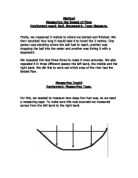
Measuring the river Gradient
At each site we found out the angle at which the flowed downstream by finding out the river channel Gradient.
To measure the Gradient we had to have two people hold the ranging poles opposite each other in a vertical position.
While you are doing this place the Clinometer beside the alternating colours on the ranging poles and look through the Clinometer to your partner’s pole.
Finally you record the angle given by the Clinometer.
Clinometer Distance around 2-3 meters
Measuring the pebble size
This was used to find out if the pebbles were being damaged as we went downstream due to attrition. We had to measure the long axis of the pebble to see if this was true
To measure the length of the pebble we measured from one edge of the long side to the opposite side giving us an accurate length.
Pebble
Measured using 15cm ruler
Equipment List
- Tape Measure
- 1m Ruler
- 30 cm Ruler
- Stopwatch
- Cork
- Pot
- Ranging Poles (2)
- Clinometer
Data Presentation
To give a more detailed look at the experiments that were undertaken it is best to use a bar chart to show the results as it gives a better representation of the data, also it is easier to analyse the data and compare with the other sites.
The graph shows that at Loughton Brook site 2 had the shortest water width being 0.5m and site 3 had the longest water width, which was 3.5m. At site 1 the water width slightly exceeded the water width of site 2; the water width at site 1 was 0.7m. Seeing as that the water width at site 2 doesn’t fall in the category between 0.7m and 3.5m, this means that it is an anomaly, because it didn’t follow the natural trend in water width the other sites were showing.
The Loughton Brook stream was most likely to have been caused by rainfall, this can happen because of the soil that is on the side of the banks that get deposited into the river, by gravity. This load then erodes the banks away and corrasion occurs, also more energy is gathered by the river as confluencing tributaries join the river and water energy increases. The banks erode downstream through hydraulic action and the load increases; this would suggest that the water width would increase as well because of the load eroding away at the banks allowing even greater corrasion to occur.
At meanders and sinuous parts of a river inside river bends require a lot of deposition thus decreasing the water width. Outside parts of the river bend get eroded more due to undercutting from fast flowing rivers, so the point I am saying is that water widths at river bends are shorter than straight rivers due to this. So the anomaly that I got from my results may have been due to deposition on the river bend or the banks of the river may have started to draw into each other
There are also other factors that can influence water width downstream such as fertile soils downstream have a copious supply of vegetation growth thus leading to photosynthesis. This can reduce water volume because of plants absorbing water from the river and can lead to reducing erosion rates; this may have affected the water width at site 2.
Water depths- LHS, M, and RHS
Site 1 had depths of 0.06m, 0.05m and 0.025m. At site 2 the depths were 0.01m, 0.06m and 0.05m which shows there is an increase in depth in the M, and RHS of site 2. This shows that there is a slight increase in depth for site 2 in the M and RHS than for site 1, though the LHS had decreased in depth in site 2 compared to site 1. Site 3 poses a new view to the data as both the LHS and the M have increased in depth again compared to the other two sites, however the RHS has decreased again so this could be an anomalous result. There seems to be a pattern that follows for the M depth in all 3 sites as it increases at all 3 sites. Contrary to that there seems to be no pattern for the LHS or the RHS in all 3 sites which suggest that the results so far could be anomalous, and therefore could be due to inaccurate measuring of the water depth.
The bedload upland is mainly rocks and fertile soil, fallen from steep valley sides due to gravity. The river flow moves this bedload, which cuts into the ground by gravity – increasing the river depth. Valley rocks roll over (traction) breaking down by attrition, when too heavy to be held at once. Water energy near the banks promotes lateral erosion, and deposition on the inside river bend (middle stage of river), while water energy in the middle only encourages vertical erosion. Extra water from confluencing tributaries helps pick up more sediment, making the larger load apply higher pressure on the river bed – increasing the depth downstream. The results show this, shallower banks rather than deeper river beds in the middle.
The anomalies that have occurred on the outer parts of the river such as the LHS and RHS could be due to measuring too close to the banks itself or not measuring from the river bed but rather on different material that has been deposited by the river.
Float times of cork
At site 1 the cork covered the 1m distance in 1s, 5s and 8s. At site 2 the times are slightly faster as the cork travels the 1m distance in 4.17s, 5.12s and 3.95s. However site 3 had the quickest times at 2.27s, 2.86s and 1.89s. The average float times for the three sites were 4.67s for site 1, 4.413s for site 2 and 2.34s for site 3. This was expected because lateral and vertical erosion increase the river width and depth and channel area, allowing water from connected tributaries to flow, which gives the river more energy flowing downstream. Water energy is greater downstream, but unable to transport the heavier loads in suspension, resulting in greater deposition downstream. However Rivers are slower flowing downstream, which transfers less energy, in relation to load sizes.
Gradient of the river
The graph shows that the gradient of the river seems to be steeper as you go downstream. From upstream to downstream, the river sloped 1°at site 1, 1°at site 2, and 7°at site 3.
This is contrary to my hypothesis which I believed to be that the gradient decreases as you go downstream. Nevertheless I still think my hypothesis is correct because the result that we have got at site 3 is an anomalous result because of the fact that there is too much a difference in gradient compared to the other sites. Therefore I still maintain my hypothesis and my explanation is thus as follows.
Rain from precipitation collects at the source upland, flowing down steep valley sides. River depths increase by large valley rocks forming dense bedloads which sever into the ground by gravity. Gravity has greater impact on increasing river depths than the force of a bedload, thus causing the depth and river gradient to decrease downstream. Large bedloads cannot force the bed to descend down. Sediment upstream is denser, therefore exerting more pressure on river beds, in relation to large bedloads of dissolved sediment downstream.
Lengths of pebbles
8 of the 10 pebbles found at site 1 had a long axis between 2cm and 5cm. The other two pebbles were 7cm. Site 2 had eight pebbles with a long axis between 1.5cm and 4cm, the long axis of the other 2 – 4.5cm. 5 pebbles at site 3 had a long axis between 2cm and 2.5cm, with three of the remaining five 3cm and one 3.5cm, the other 4cm.
The mean average long axis of site 1 was 3.9cm, 3.4cm at site 2, and 2.7cm at site 3.
Site 1 should have had more pebbles with long axis lengths greater than (>) 4cm, and fewer pebbles less than (<) 3cm. All 3 sites show that the pebble size decreases as you go downstream due to abrasion. Having fallen from steep valley sides, rocks at site 1 should have been large and angular. Transportation by traction causes attrition, whilst saltation further decreased pebble sizes.
Conclusion
- Water width and depth increase downstream – more erosion through increased water volumes.
- Velocity increases downstream due to greater energy levels of higher volumes.
- Gradient decreases due to slower rate of depth increase downstream.
- Long axis of pebbles decrease downstream, eroded in transportational processes.
Evaluation:
Strengths of Method:
- Can take measure on water width however wide
- Read off value on ruler
- Easily recognisable when doing the experiments
- Easy to perform methods
- Cork does not sink
- Can vary the distance for float time of cork
- Clinometer easy to use in order to look exactly opposite at partner’s Clinometer
- Easy to keep ranging poles upright while taking the gradient
- Can choose number of pebbles selected
Weaknesses of Method:
- Tape measure inaccurate for measuring banks of river
- When measuring at meanders or sinuous parts of rivers, results inaccurate
- River bed may not have been flat and so it may have given a inaccurate result for the river depth.
- Clinometer may move when finding out the gradient because it is difficult to make the ranging poles stay in one position and so it may have moved when measuring the gradients
- Cannot take exact measurement of pebble as the surface is curved, so the results are not entirely accurate.
Improvements:
- Collecting 2/3 of each water width and depth measurement, rather than 1, would have removed anomalies, ensured accurate results.
- Velocity results could have been performed over longer distances to guarantee more accuracy.
- Using a tripod and Clinometer would have removed problems with instability of hand in measuring gradients of each site.
- Using callipers would provide increased accuracy in distance measurements.
- Each experiment met investigation aims and gave fairly accurate results. Conclusions could be wrong in that Loughton Brook is small, therefore changes in rivers features are less apparent, the cause of slightly inaccurate results.
- Experiments were performed well overall, excluding pebble long axis measurements.
Bibliography:
Key words:
Attrition – bedload material colliding into other material and becoming smaller
Bedload – load on river bed
Confluence – point of 2 or more streams joining the main river
Corrasion – sediment rubbing against river banks, making them collapse and wear away
Cross sectional area – area in which water can flow
Discharge – volume of water transported by river in given time
Load – material transported by river
Meander – large bend in river (found downstream)
Permeable – rock/soil allowing water to pass through
Flood Plain – land over which river meanders
Frontal Rainfall – warm air cooling when rising over highland, condensing to form clouds and water droplets (rain)
Hydraulic action – force of water hitting the river banks, wearing it away