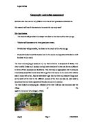
Geography controlled assessment
Stretches of a river can be very different in terms of their processes and landforms.
My research will test if this statement is correct for my study area?
Sub-hypothesises:
- The channel will get wider and deeper the closer to the mouth of the river you go.
- Velocity will decrease as the river goes down stream.
- Particle load will get smaller, the closer to the mouth of the river you go.
- Erosional landforms will be located near to the source and depositional landforms will be closer to the mouth.
The river I am studying is located in Ty' ny' Berth which is in Snowdonia in Wales. The river is called Dulas and I decided to study how stretches of a river can be very different in terms of their processes and landforms. This river was an appropriate river to study as it was easily accessible and we were able to get from the source to the mouth with relative ease in a day with a van. Also we were able to get into the river and measure things such as the width of the river in the different courses of the river and also we were able to accurately find and locate depositional landforms such as a meander.
The river Dulas I am studying is a tributary of the river Teifi and has its source near the village of Lla ngybi in the county of Ceredigion, Wales.
The Bradshaw model
The Bradshaw Model is a model that basically describes the geography of rivers. It describes the river's characteristics and how they may vary between the upper course and lower course of a river. By looking above at the visual representation above, you can see that as you go downstream discharge, occupied channel width, channel depth, average velocity and load quantity increases. However it also states that as you go downstream load particle size, channel bed roughness and slope angle (gradient) decreases. For my river Dulas, I would be looking at this model to see if it agrees with my predictions
Here is a list of the raw data that was collected from site 1 to 7 and it shows the river width and depth. We took 5 measurements of the river depth and then got a mean depth to find an average and then we also measured the wetted perimeter.
Site
River width (m)
River depth (m)
Mean depth (m)
The wetted perimeter (m)
Site 1
2.40
0.17
0.23
0.24
0.19
0.26
0.22
3.38
Site 2
5.10
0.52
0.41
0.34
0.15
0.08
0.30
5.1
Site 3
9.30
0.30
0.30
0.20
0.05
-
0.17
0.9
Site 4
9.65
0.17
0.21
0.36
0.24
0.10
0.22
9.85
Site 5
3.00
0.15
0.28
0.35
0.40
0.18