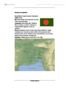
The Climate
The average annual rainfall varies from a maximum of 5,690 mm in the northeast of the country to a minimum of 1,110 mm in the west. The groundwater, however, provides adequate storage to compensate for annual variations in rainfall and streamflow. The average annual discharge from the three major rivers-at total of 35,000 cumec-is second only to the Amazon. They carry billions of tons of sediment load every year.
As it is situated in the tropic, the country is prone to cyclones associated with tidal surges, especially in the pre-monsoon and post-monsoon months. Because of high density of population in the flat deltaic coastal region, the loss of human lives in such cyclones has a time been very heavy. The country experiences a hot summer of high humidity from late March to late June, a somewhat cooler but still a hot and humid monsoon from late June through October and a coll dry winter from November to the end of February. Day temperature ranges from 7 to 12degree centigrade in the cool months and in the other month it varies between 23 to 30 degree centigrade.
A typical year in the climate of Bangladesh:
This sub-tropical monsoon climate has a maximum temperature in March to June of 34’c. From july to October it is the monsoon season and Bangladesh has an average rainfall of 1194mm to 3454mm. From November to February the maximum temperature is approximately 29’c.
Satellite image of the cyclone of April 1991
Where and Why People Live in Bangladesh
The local people of Bangladesh live mostly live on the coastline. The people there know of the risks of living there but when it isn’t being flooded there is a good living to be made from fishing, shrimp farming, salt farming. Tourists come as Bangladesh is considered as quite beautiful so a living can be made from this.
The Fact that Bangladesh is an LEDC
There is approximatly a population of 110million in the land area of 147,570 square kilometres. Bangladesh has a GNP of $240 compared to the UK, $18700, and the USA, $26980. only 49% of the population of males are literate whereas in the UK and the USA are 99%. In the UK and France there is 100% acess to sanitation where Bangladesh has only 83%.
Flood Prevention in the Past
While it is impossible to prevent flooding in bangladeshbcompletly, several measures have been introduced as part of the Flood Action Plan, a scheme financed by the world bank in 1990. this included a number of points for action:
-
Introducing flood warning systems – using weather satellites to warn people about cyclones and possible floods.
-
Improving urban flood protection – installing embankments and pumps in urban areas, protecting housing, hospitals and transport networks.
-
Building embankments alongside rivers – so as floodwaters rise they don’t flood adjacent land.
-
Constructing flood centres (killas) – concrete shelters build on stilts above the ground to provide safety against floodwaters and wind.
-
Protecting the costal areas – building a coastal barrier to protect lowlands from the effect of a storm surge.
Not all of the proposals are in place and, at £100 million a year, maintenance costs are very high for one of the worlds poorest countries.
Conclusion
Managing flooding in Bangladesh is difficult and expensive, and with a growing population and the possible rise in sea level due to global warming, the challenge is immense.