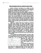
I will be focusing on two different case studies. The first of these two will be in Wales on a river called Afon Glaslyn. It rises near the centre of the Snowdon massif and flows in a general southerly direction towards Tremadog Bay. I will be considering the different locations when depositioning and erosion occurs. Here is a diagram illustrating the rivers course and the landforms that can be found throughout the river system.
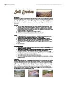
As can be seen, the source of the river starts in an area of reasonably high attitude of 400m. The river here is small and fast flowing, this resulting in a high velocity and thus some erosion occurs. At approximately 250m the river crosses slabs of metamorphic rocks, this gives the river turbulence. At site A which is at about 145m in height, there are high levels of transportation due to the high velocity levels, boulders and bedload and some suspended load are being transported, however there is little material souluted within the flow. At site A there can be found waterfalls, rapids, potholes and large boulders. When the river reaches site B there is major depositioning, small boulders, cobbles and pebbles are deposited first as the river enters Llyn Gwynant, the first lake on the rivers course. Between sites B and C different landforms occur. Here there are rapids and small meanders cased by this depositioning effect. As you can see the diagram below illustrates the rivers load, this can tell us the ways in which the river carries its material and how it will deposit this material if the river loses its velocity. As the water leaves the lake it picks up velocity again as the slope gradient increases. Transportation begins to occur again but only in the form of a small amount of bedload, there is however much suspension but little solution. This tells us that at this point of the rivers course the velocity is not great enough to transport great amounts of material. There are also signs of erosion, in the form of attrition and corrasion. There is a little amount of hydraulic action and corrosion. In the next three kilometres the river enters Llyn Dinas, where pebbles, gravel, sand and clay are deposited. This tells us that the river is losing velocity, as it follows its course. Several explanations of this are that the slope gradient is becoming lower and therefore is resulting in speed of the river decreasing, there could be a declining amount of precipitation or the river may be becoming shallower and wider. All these affects can reduce velocity so will increase depositioning and decrease erosion. Between sites D and E there are a range of landforms from floodplains and meanders to gorges and potholes. These gorges are created when a waterfall is eroded as in the picture. Here you can see the events that takes place before a gorge is formed. It starts with a waterfall eroding and undercutting the bank, this then weakens the land above and eventually this will crumble. This results in the waterfall moving backwards further and further. This is what will happen over thousands of years. The river will move so far back until it reaches a point where the rock is unusually hard and therefore can’t be further eroded. Thus the gorge is formed. At site D more depositing occurs pebbles and gravel is deposited on the outside of bends.
At site F the last lot of deposition occurs as the river enters the sea. At the beach the last particles are dropped as the river no longer has the velocity or capacity to accommodate them.
A major landform which involves both erosion and deposition is the meander. A meander is a loop or bend in the river. These tend to occur in the middle course, but they also do occur in the lower course. Most rivers tend to meander due to excessive energy. Below you can see a diagram showing the characteristics of a meander.
On the outside of the bend erosion occurs, this is where the water is deeper and faster flowing – therefore this section has a higher velocity. Deposition occurs on the inside of the bend where the water is shallower and slower. Meanders can migrate or move due to this erosion and deposition that occurs. You can measure the curving nature of these meanders using the formula below:
Actual channel length
Straight line distance
The higher the number the greater degree of meandering. If you came out with a ratio of 1:5 that would equal a high amount of meandering.
In conclusion, erosion and depositioning do take place at distinctive locations, however it is relative only to that specific river. For example you couldn’t say that because 20 meters downstream on one river you find a lake, on all rivers 20m downstream you will find lakes. Velocity has a major impact on the way all these features are made, is there is a great amount of velocity erosion is very likely to occur, if there is little velocity then deposition is likely to occur. Velocity can also be influenced by the amount of water and how it has entered the river. So erosion and deposition can be used to determine the locations of various land forms however only relative to a specific river.