Contents
GCSE Geography Coursework
Section 1 – Applied understanding
Why?
We are doing this study to test all the text book theories. It brings all the ideas that we read in a book to real life, we can see exactly what happens for ourselves we get the chance to record the results ourselves also this is a requirement for our geography GCSE and the study is worth 25% of our ultimate GCSE mark.
Aims
To describe and attempt to explain how the characteristics of the Glendun River vary from source to mouth. We plan to collect a number of samples at five different stages of the river and investigate how they vary.
Objectives
To compare the characteristics of an actual river with a textbook river and to collect primary data, this actually gives us the figures ourselves instead of copying out of the text book without actually truly knowing how the samples were collected or how they were analysed. Also we plan to look at all the different processes operating within the river from its source to mouth; this data will be presented in graphical form.
Hypotheses
- Width, depth and cross-sectional area will increase from source to mouth.
- The velocity and discharge of a river will increase from source to mouth.
- Bed load becomes smaller and more rounded from source to mouth.
Location
Our study is of the Glendun River. The map below shows part of Northern Ireland and where the river is positioned. It is in the Antrim hills.
The river runs from the source, west then turns and most of the river runs north until it reaches the North Channel. 6 grid reference of the source – 166277 and the mouth is 249247
Why this area?
We have chosen this river to study for the following reasons:
- It is not too far from school and easily accessible
- There is a road running parallel to the river which makes access easier as we were in a large group this was vital
- The school has been going to this site for many years and it has been successful in the past
- The river was not too deep and this allowed us to get into the river and make more accurate measurements.
The surrounding area of the Glendun River;
- There are 3 major roads which run across the river
- The upper course of the river is situated in between Silievenanee and the Trostan Hills; this is in the Antrim hills
- To the south of the source is the Glenariff Forest.
Glendun River
Theory
what does our theory tell us about what we should expect to find in our study?
Ideal Stream
We should expect to find at:
Upper course –
This part of the river will be the shortest in width due to virtually no lateral erosion. This is because it is at the source of the river. At this part of the river there is less water. The river is a lot shallower than the other courses and you would tend to find big angular boulders in this part of the course, these boulders are on the bed and in the river’s load. The river’s source is higher up than the mouth at the sea; this gives the river a lot of potential energy, but a lot of this energy is used overcoming friction. There should only be vertical erosion at this part, because the river is trying to cut down to its base level also it’s due to the large boulders and the high velocity. At this section you may also find potholes, they are formed by corrosion. Pebbles carried by the river are swirled around on the riverbed. This erodes the rock on the riverbed forming potholes.
Features include: Rapids, Waterfalls, Gorge and interlocking spurs

Middle course –
The river starts to widen at this stage of the course and due to vertical and lateral erosion the river also becomes deeper. Vertical and lateral erosion is the erosion of both the bed of the river and the sides of it. Also due to the velocity of the river it will erode edges of the river and start to meander. The river has a greater sediment load as the stones are continuing to get smaller. The river may also erode ...
This is a preview of the whole essay
Middle course –
The river starts to widen at this stage of the course and due to vertical and lateral erosion the river also becomes deeper. Vertical and lateral erosion is the erosion of both the bed of the river and the sides of it. Also due to the velocity of the river it will erode edges of the river and start to meander. The river has a greater sediment load as the stones are continuing to get smaller. The river may also erode away the bottom of the interlocking spurs causing a more flat land which looks more like a valley floor. Transporting materials and erosion should both be happening at this section of the river. The river erodes the outside bank of the river and undercuts it to form a river cliff. The gradient is not as high as it would be in the upper course of the river. On the inside of the bend, where the river flow is slower, material is deposited, slow flowing and shallow. This causes deposition to take place and a slip off slope is formed. Also at this part of the river the route is almost like a horse shoe and eventually, it can get cut off to form an ox-bow lake. At the middle course a flood plain begins to form on the valley floor. This is because there is more water in this section of the river and there is a greater chance of flood.
Features include: Meanders and oxbow lakes
Lower course of the river –
At this stage of the river it is nearing the sea and deposition is the most dominant process, there are many features of the lower course. It is at its widest and deepest with a more efficient shaped channel. It is lined with sand and mud so there is less friction. The river carries a large load of alluvium which can make the surrounding land very fertile when it floods. There is a wide, flat flood plain either side of the river. A floodplain is the area around a river that is covered in times of flood. A floodplain is a very fertile area due to the rich alluvium deposited by floodwaters. This makes floodplains a good place for agriculture. A build up of alluvium on the banks of a river can create levees which raise the river bank. There are features such as meanders, ox bow lakes and deltas. Some rivers reach the sea in deltas of which there are three types arcuate, cuspate and bird’s foot, which form where river mouths are overloaded with sediment, causing the main river channel to split into lots of smaller tributaries, but this can only happen when there are certain things e.g. The river must be carrying a lot of sediment.
Features include: alluvium deposited, levees and large discharge
Glossary
Alluvium - A deposit of sediment left by a stream on the stream's channel or floodplain.
Channel - A narrow strait of water between two land masses that connects two larger water bodies.
Deposition- the dropping of materials when there is low velocity or energy to carry them
Discharge – amount of water flowing in a river, measured in cubic meters per second (cumecs)
Distributaries - finger-like river channels which branch away from a main river channel in a delta.
Erosion – the wearing away of rock or material
Estuary- The wide end of a river when it meets the sea; salty tidal water mixes with the fresh water of the river here.
Floodplain - A flat, low-lying area near a river or stream which is subject to flooding.
Gradient- the steepness of the river
Interlocking spurs – spurs of high land which over lap in the upper part of the valley
Meander- bends in a river
Mouth- where river enters the sea or a lake
Ox Bow Lake – semi circular lake formed by a meander being sealed off from the main course of the river
Source- the beginning or start of a river
Transport- the carrying of materials in the river flow from one part of the river to another
Velocity- the speed of the river flow
Volume- the capacity of a river
Methodology
Aims
To describe and attempt to explain how the characteristics of The Glendun River vary from source to mouth.
Objectives
- To compare the characteristics of an actual river with a textbook river
- To collect first-hand data
- To identify and attempt to explain how the characteristics of and the processes operating in the stream change downstream from source
Hypotheses
- Width, depth and cross-sectional area will increase from source to mouth
- The velocity and discharge of a river will increase from source to mouth
- Bed load becomes smaller and more rounded from source to mouth
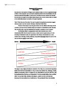
Sequence of Investigation
The morning of the investigation we visited the Glendun River. There were five sites to visit. We collected the same data at each stage of the river. We started at site one at the source; we were in groups of about 6, we all collected different bits of data and recorded it on are data collection sheets. We set out a certain area of the river for each group; we were able to get into the river for more accurate data. We used both primary and secondary data.
Primary data Secondary data
Stream width Texts books
Bank full width Class work book
Stream depth Maps
Mean depth Internet
Velocity
Gradient
Friction
Equipment used
Metre stick
Tape measure
Orange
Clinometers
Friction index card
Bed load card
Range pole
Stop watch
A comprehensive range of techniques
Stream width
To measure the stream width we got one person from the group to go at each side of the river, we gave each person an end of the measuring tape, they both got the end of the tape and reached down to the edge of the bank at the water’s edge and measured the stream width.
Bank full width
This is much the same as the stream width only you get the measuring tape and measure from the highest point of its maximum discharge e.g. floods.
Stream Depth
We measured the depth of the Glendun River at each of the five stages in the river. We would expect to find that the source the river was the narrowest so this meant the intervals between the measurements were small.
Velocity
To measure the velocity we used oranges, we set out a distance of 10 metres to get the velocity. The distance was set using two ranging poles and the orange was put in at the start of the 10 metres, at the upstream pole, and was timed to see how long it took to travel 10m past the downstream pole we would expect to find that the velocity increases as the river moves downstream. This was repeated three times each at the left bank, middle and right bank of the river and the measurements were averaged in metres/second.
Gradient
Again we set out a distance of 10m in a section of the river. We put a pole at either end of the 10m and used clinometers to measure the gradient of the river; we repeated this method at all 5 sites. This was probably one of are most inaccurate results as it was more of an estimate.
pH level
We used empty water bottles and collected water samples at each site and then analysed each sample for pH levels, to establish if pH changes over the course of the river.
Bed load
We collected a random sample of ten rocks from the bottom of the river at each site. We used a roundness index card to identify their shape. We also measured the longest axis and size of the rocks, to establish the size in mm, we would expect to find that the bed load got smaller and more rounded as you go towards to mouth.
Internal and external friction
This was also measured at each of the five sites. External friction was measured using a friction index card to access bank and bed friction, internal friction was used to measure turbulence. Each was rated on a scale of 1 to 5 depending on the level of friction.
Originality
For my originality I am going to deal with the pH levels of the water. To do this I am going to take the water samples we collected from each site and analyse them in the science department to test the pH levels.
How to test for pH:
Use Universal test paper
Dip the test paper into the water sample and remove
Compare colour change to colour chart to determine pH level
pH levels vary from pH 1 (very acidic) to pH 7 (neutral) to pH 11 (very alkaline)
My prediction
In up land areas there is more relief rainfall. Rainfall is slightly acidic therefore upland areas receive more acidic rain. In upland areas vegetation decomposition is limited due to cold conditions. Organic acids are released into the soil. Water passes through this soil on its way to the river, therefore it picks up acidic qualities. As the Glendun passes into sites4 and 5 it flows over bedrock of chalk. This chalk is slightly alkaline and will reduce acid levels in the river.
Many rivers have dead zones where there is no life due to too low a pH. If the pH is too high the same thing can occur. pH must be assessed because it affects the organisms living in it.
Results and analysis
Hypothesis 1
Stream Width
The ideal stream would get wider as it gets closer to the mouth.
This graph helps me to test my first hypothesis; I think the best fit line would be nearly perfect on this graph. These results are ideal and what I would expect, the stream getting wider from source to mouth. Site 5 is just over 5 times wider than site 1. I would expect this as site 1 is nearer the source and site 5 closer to the mouth. The graph shows positive correlation.
The width of the river increases from source to mouth because it has lots of energy and therefore erodes. Lateral erosion becomes more dominant in the lower course and this is why the width increases downstream. It is widened by hydraulic action and corrosion. The steep gradient and gravity causes this downward erosion as well.
What is bankfull width?
Lateral amount of water surface height at bankfull depth; bankfull depth is water surface elevation required to completely fill the channel to a point above which water would spill onto the floodplain.
By looking at this graph you can see that the bankfull width consistently gets larger as we go down stream until sight four, when there is a slight anomaly in the results, I don’t think this should be of much concern as this is only a slight blip in the results and the rest of the sites still follow a steady trend. I think the reason for this may have been an over estimation at site 4.
Like the previous graph site 5 is much larger than site 1 by 10.3 metres, the bankfull width should gradually get bigger as you go downstream due to erosion. This graph is closely linked to erosion, as it would increase so would bankfull width and vice-versa.
The hypothesis stated that the depth would increase from source to mouth. You would expect to find the river getting deeper as it gains momentum and cuts a wider and deeper channel as it increases efficiency moving downstream.
These results do not support the hypothesis, possibly due to inaccuracies in measurements taken or large boulders at the intervals resulting in uncharacteristic measurements at these points.
Site 4 had a very deep pool but large angular boulders as you can see on the following cross section diagrams.
These are my 5 cross sections for each site, as you can see each one is very different, as we went down stream I would expect the cross section to become wider and the height above sea level will drop.
As you can see the cross-sections support the hypothesis that the stream width will increase.
As I would have expected the cross sectional area from site 1 steadily increases to site 5. This proves that the river gets wider and deeper as you go further downstream. I think these readings were accurate as it gave the exact graph I was expecting.
Hypothesis 2
I would expect discharge to rise the further downstream we go as the channel gradually becomes wider therefore the water volume is bigger.
The graph shows that river discharge is fairly similar for sites 1, 2, 4 however sites 3 and 5 are a lot higher than the others, again I think this would probably be down to inaccurate readings.
Overall there is an increase and the drop at site 4 may have been due to the presence of debris from a recent rock fall and/or the material added to the river at the site to help ford the river. (Material had been added to help vehicles/people cross at a shallower point).
Surface velocity=distance/average time= m/s
We measured surface velocity over an area of 10m using an orange and timing how long it took it cover the 10m. In the ideal stream the orange would get quicker as we go further downstream as less energy is concentrated in overcoming large rocks and boulders. Therefore the water has more energy to take the orange downstream quicker
I realized that when I dropped the orange at the start of the 10 meter stretch, it took a few seconds to start moving at the same speed as the river. I think this may have been a flaw in my results; instead I think it would be a better idea to drop the orange before the start line and start the timer when it crosses the start line and so get a more accurate reading of the river speed.
As you can see from the graph, velocity fluctuated throughout the course of the river; site 2 and 4 showed slower velocities then might have been expected. Overall there was a slight increase from site 1 to 5.
Hypothesis 3
The bed load is evenly spread between the three types. The rocks at the stage have not been eroded and are mostly large and angular.
The sub rounded rock is quite dominant in site 2, as you can see going further downstream is setting the trend as the sub rounded rock becomes more popular, this is due to the increased erosion levels of the rocks making them more angular.
After making an appearance in site 3 there are now no rounded boulders. This may be due to debris from rock fall.
In site 5 there is a much larger variety of rocks, there is not one that is particularly dominant. The well rounded boulder was not found at any other of the four sites.
Conclusion
Due to processes of erosion at the mouth as the stream moves downwards towards the mouth hydraulic action, abrasion and attrition all happen in the middle and lower courses.
Conclusion
My aim was to analyse how the river bed load changed from source to mouth. The river bed load should become smaller and rounder due to various processes of erosion. During my study, I selected and measured 10 pebbles for their width and length. I put my hand in the river and pulled out the pebbles, trying to select the pebbles to cover all the sizes and shapes in the river. I wanted to measure the bed load to get objective data on the changes in the pebbles. The bed load will be linked to the velocity of the river as when the velocity is higher, the amount of energy the river has will increase
and there will be more attrition.
Originality
My prediction
In up land areas there is more relief rainfall. Rainfall is slightly acidic therefore upland areas receive more acidic rain. In upland areas vegetation decomposition is limited due to cold conditions. Organic acids are released into the soil. Water passes through this soil on its way to the river, therefore it picks up acidic qualities. As the Glendun passes into sites4 and 5 it flows over bedrock of chalk. This chalk is slightly alkaline and will reduce acid levels in the river.
pH is acidic becoming slightly less acidic from site 2 onwards. This is what I predicted, that the levels would get slightly less acidic however I expected a bigger change in the level of pH.
Glendun River
This demonstrates how the bed load varies as we go further down the course of the river.
Evaluation
Stream width
Reliabil would have be
en any more reliable. There were no problems measuring the stream width the only faults would be if the tape was not pulled taught then you would get an inaccurate reading, also if the tape was not at right angles to the bank this would measure the width, longer and also give a false reading. I think taking more than 1 measurement would be a good idea, I think we sity of method
I think the stream width was reliable, we used a tape measure to get the stream width, I do not think any other methodhould have taken three measurements and then taken an average to give more accurate results although the results were fine a lot of care needs to go into taking the measurements.
Accuracy of results
The results were highly accurate my results gave me the perfect graph, I do not think measuring it any other day or the weather would have affected the measurement the only thing that would have made it more accurate would have been taking 3 readings, I think at the first sites it was ok to take one but as we went further downstream and the stream got wider there would be more room for error.
Bankfull width
Reliability of method
This is much the same as stream width, again we used a tape measure, and there wouldn’t have been any other method as reliable. The only problem with this measurement may have been actually knowing where to measure from, as a result this measurement was in part an estimate.
Accuracy of results
Stream depth
Reliability of method
Stream depth was measured using a metre stick; I didn’t think this method was very reliable as when you went to measure the depth you may have not been measuring from the bottom of the river bed, instead from the top of a boulder which may have been on the bed, so this will have measured the depth shorter. To overcome this you could make sure that you are taking a reading from the bed or take a number of readings and take an average
Accuracy of results
The interval at which the depth was measured was changed according to how wide the river got. I would have expected the deepest part of the river to be at the mouth as this is where the river is at its most efficient. Looking at my graph I can see that from site 2 – site 5 this was the case, site 1 was slightly lower than site 2, this may be the case as the river is not perfect but neither were the readings.
Velocity
Reliability of method
I think this was one of the least reliable methods. When the orange was put in at the start of the 10m it took a period of time to get to the same velocity as the river so the first second or two were not actually the rivers velocity, the orange would need to have been started before the start of the 10m. By doing this is think this method of testing velocity would have become more reliable. Also the velocity was quicker in certain areas of the river e.g. the outside bank, so the orange would need to have done 3 runs on the left middle and right side.
Accuracy of results
Looking at my velocity graph I think it’s obvious that the results were poor. The results were not consistent in anyway, this shows that the velocity was not a good test and needs to be retested taking a more careful approach when testing. Using a flow meter would give accurate readings with no complication.
Gradient
Reliability of method
I think this was the most unreliable method as it was mainly just an estimate, we got the range poles and placed them a distance on 10m apart, using the clinometers we estimated the gradient of the river. I think this is a very unreliable method as it is only an estimate.
Accuracy of results
I think using a different method of measuring the gradient would give much more accurate results, an electronic device or something that was not an estimate
Friction
Reliability of method
Friction was a total estimate, we were given index cards on how to rate the river, it was purely down to opinion, I think this was the most unreliable method, again an electronic device would help measure the friction accurately
Accuracy of results
The results were much the same as it was a matter of opinion there was no way of telling if it was right. Depending on where across the stream width you looked I think it could have been perceived in many ways. E.g. Looking at the river after it smashes a large boulder is certainly going to look different then 1m across the river where it flows as normal
Bed load size and shape
Reliability of method
I think that this method was reliable although could have been improved, taking only 10 rocks from the river may have gave a slightly bias results, although time consuming I think taking around 20 would have given better results.
Accuracy of results
I don’t think the results for bed load I obtained were very accurate, looking at the graph you can seen that there were some sites which stood out from the rest. This may just have been the luck of picking the rocks but I think taking a bigger sample would have solved this problem.
Conclusion
Hypothesis 1, stream width, this was proved through my results as it gradually increased from mouth to source. Stream depth however it did not follow the hypothesis, the inaccurate results may be down to inaccurate readings or large boulders at the intervals. As you can see from the graph the Cross-sectional area also increased from mouth to source proving that part of the hypothesis. I think this hypothesis worked out well except stream depth which I think was just down to large boulders at intervals, I would like to take this reading again but I think in doing that all of the hypothesis would be proved.
Hypothesis 2, velocity and discharge will increase from mouth to source, neither of these things happened both results varied considerably and were not at all consistent I think poor measurement skills were to blame.
Hypothesis 3, bed load becomes smaller and more rounded from source to mouth. In the most part this was true; gradually the rocks did become more rounded and smaller proving this hypothesis.
Overall I think this study helped as it gave us a realistic idea of what it’s actually like to take and record measurements. Also how to present and interpret them this project also advances ICT and coursework skills
Bibliography
Websites
www.google.co.uk/images
www.bbc.co.uk/schools/gcsebitesize/
www.tiscali.co.uk/reference/encyclopaedia/hutchinson/m0007775.html
www.swgfl.org.uk/rivers/middle.htm
www.sln.org.uk/geography/schools/blythebridge/GCSERiversRevisionLC.htm
http://www.geographyalltheway.com/igcse_geography/igcse_coursework/igcse_coursework.htm#introduction
Books
Class text book
Bowen A. and pallister J. (2001)
Understanding gcse geography
Heinemann, Oxford
Appendix
DATA COLLECTION SHEET
- Stream width m
- Bankfull width m
- Stream depth (at equally spaced intervals):
- Mean depth cm
- Surface Velocity (time taken for float to cover 10m):
Surface vel
- Gradient of stream bed (over 10m) degrees
- Friction:
- visual estimation of external friction points
- visual estimation of internal friction points - Bed load size and shape
Chris Anderson Page