Landforms located along the River Tees, County Durham
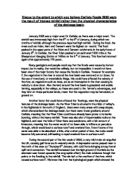
Landforms located along the River Tees, County Durham The River Tees is not necessarily one of the most famous rivers in the United Kingdom, but in its relatively short passage to its mouth from its source in the marshy moors of the Pennine Hills, the river produces a diverse array of landforms, which vary as it progresses downstream through its drainage basin. Beginning in a saturated moor as a mere trickle of water over 600m above sea level, it emerges progressively larger, producing waterfalls, gorges and V-shaped valleys with interlocking spurs in its upper course, meanders and oxbow lakes in the middle course and flood plains, levees and deltas as it reaches its mouth. In the upper course of the River Tees, the steep gradient of the land results in vertical erosion, mainly through abrasion and hydraulic action to be the dominant process occurring with the river at this stage. The Tees starts from its source in a saturated moor in the Pennine Hills. The abundant water trickles downwards, due to the high gravitational potential energy it possesses, which can be converted to kinetic energy due to the steep gradient. These mere trickles of water develop into the River Tees. Various tributaries add to the volume of water and the river uses its abundant kinetic energy to vertically erode away at the bed and banks, with its steep gradient encourages erosion vertically
If bed load size decreases downstream with distance downstream.
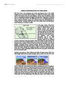
Avery Hill GCSE Unit 2: Water, Landforms And People Introduction (draft) The main idea of my investigation is to study if bed load size decreases downstream with distance downstream. I will be studying 3 areas of the River Usk. The River Usk is 5.5 km long but my investigation will only study 2km of the river. The river begins with many meanders but further downstream it straightens out and then meanders again. On the edge of the river side the land had been eroded (undercutting) and the land was soft clay. The weather on the day of study was sunny with a slight breeze. There was some vision of human activity in the drainage basin; there were quad bike skid marks and farmers. If the river basin is used for investigation as the discharge level can be studied better as we could enlighten whether discharge was more or less nearer tributaries. Discharge is the amount of water, which is added from tributaries, which makes the water energy faster. Further downstream more sources (tributaries) will add to the river. The river will get faster and attrition will occur which causes the bed load to become smaller and rounder. The largest size a river can carry is competence. The largest quantity is capacity. Upstream there are larger rocks but as discharge rises rocks decrease in size further downstream. I believe that the discharge is slowed down due to many rocks being

Hydrology and Fluvial geomorphology. (Q&A)
HYDROLOGY AND FLUVIAL GEOMORPHOLOGY Q: "Human activity, climate and landscape all affect a rivers regime". Discuss with reference to rivers from around the world. Suggested Answer The river regime is the expected seasonal pattern of discharge at a given point, over a year. The discharge is the amount of water flowing in the river channel. It is calculated by multiplying the cross-sectional area by the mean velocity (speed). A river's regime is based on average monthly discharge figures. These are collected over at least 20 years to try to eliminate minor year-to-year variations. There are several factors which will affect the river's regime, including rainfall, temperature, human use of the land and the landscape. For a better answer it is suggested that each of the factors has to be explained with examples using named rivers how each one may affect the regime of the river. Factors affect the regime Human activity means 'how people use the river and the surrounding land'. For example, if vast amounts of water are taken out of the river by industry, this may affect the regime as it will artificially decrease the amount of water in the river (although most industries do return the 'used' water to the river channel). In a similar way, if large amounts of water are used for agricultural irrigation, or water is removed from the river and directed somewhere else, the

Explain how the physical environment of the lower Tees and its estuary may have influenced land use up until 1994.The Rivers Tees's estuary has a large area of low-lying mud flats so wildlife and birds mainly used the area before 1994
b.) Explain how the physical environment of the lower Tees and its estuary may have influenced land use up until 1994. The Rivers Tees's estuary has a large area of low-lying mud flats so wildlife and birds mainly used the area before 1994. Over time since 1906 inter-tidal land has been reclaimed, this adds to the overall area of the estuary. There are several sites of scientific interest in the estuary including seal sands, up to 200,000 migrant birds visit the sites of scientific interest in the autumn. With all the land that has been reclaimed the estuary has an area of around 8km squared in total, this provided a perfect area for building in the lower section. c.) Comment on the extent to which the Tees Barrage has modified: i.) The physical environment; The Tees Barrage has changed the level of water upstream which may distress the fish living there. The speed of the river upstream may change so the erosion rates and the amount of sediment the river deposits may alter. Bellow the Barrage the water level has raised which has submerged the shallow areas and the inter-tidal sites of scientific interest. The water quality and salinity have been improved with the level of dissolved oxygen increasing rapidly upstream at the Tees Barrage the level has doubled since 1992/1993, downstream the levels have increased slightly since the Barrage was in place. Also the ammonia
Assess the different ways in which we can use river environments and identify the different conflicts that occur
Elizabeth Wood Assess the different ways in which we can use river environments and identify the different conflicts that occur. Humans use all river environments other than those, which are remote and in inaccessible areas. We alter the landscape both directly and indirectly, altering the processes that shape the environment. The different ways in which we, as humans, change the environments is often at odds with another and conflicts with the physical processes at work will result. As human populations within river environments enlarge, so do the conflicts. The River Tees, in North East England, has an environment much used by humans. The source of the river in the Pennies is 893 metres above sea level, with a high rainfall of over 2000mm a year. It is in an area of impermeable rock so surface runoff is greater; precipitation reaches the river channel quickly. The river Tees is clear and turbulent, with a waterfall, gorge and rapids. In the upper course of the river communication and the building of settlements is difficult on the steep valley sides. There also are harsh weather conditions in the Pennies. There is tourism such as walking or hiking to visit the High Force waterfall and the scenic landscape. Also recreational activities take place as such as water sports take place consisting of white water rafting, sailing canoeing and also fishing.
Lougton Brook Epping Forest - river study.
Vikki Hatch INTRODUCTION Aim We will be going to Lougton Brook which is a small stream which flows through Epping Forest and the town of Loughton, in Essex this make it an ideal case study through which to explore river and how they change as you move down stream. Epping Forest it self is 12 mile long.. The main reason is that we wanted to see river processes and landforms in real life that you had only seen in class and it it experience it see to make a better knowledge. Also because it helpful find out more about a natural feature of the landscape in this investigation. We will be study three sites Site A: upstream Site B: midstream and Site C: downstream Characteristics of the river cross sectin area channel dept channel width friction between water bed bank channnel roughtness velocity of water in channel turbelence with the channel cross sectional area discharge of river size particualar making load channel gradient chanel effictiently angularity of bedload Location Lougton Brook High Beach London Essex United Kingdom Loughton Brook is a tributary of the River Roding which then flows into the River Thames. Epping Forest is near Greater London which stands on the River Thames. This is one of the largest rivers in London. Date ane weather We shall be going to Epping forest on Wednesday 18th November One of the reason that will affect

Velocity of the water will increase steadily as down stream
River Velocity Hypothesis I think that the velocity of the water will increase steadily as we go down stream. This is because at site one the river shouldn't be very wide and deep, so the velocity will be slow as there will be more friction, as you go down stream the river should get wider and deeper so there will be less friction increasing therefore increasing the speed of the river. Method To measure the velocity of a river I will need to: a. Measure out a 10m stretch of river, b. At the beginning of the 10cm I will drop the cork into the river and start the stopwatch, c. When the cork reaches the end of the 10cm stretch I will stop the stopwatch and collect the cork. d. I will then repeat steps b and c a further, two times. e. I will then average out the three speeds. f. Once I have the results I will use the following equation to work out the speed of the river: Stretch of river = speed in metres per second Average time in cork I will repeat the steps a to f at each site. Results Velocity Site one Site two Site three st cork 75.92 secs 8.98 secs 33.90 secs 2nd Cork 82.26 secs 21.46 secs 31.90 secs 3rd cork 50. 30 secs 22.93 secs 32.83 secs Average Cork 69.49 secs 21.12 secs 32.54 secs Speed of river 0.14 m/s 0.47 m/s 0.31 m/s Conclusion From the results, you can see that a site one the river was
How and why do glaciers erode?
How and why do glaciers erode? Glaciers are found where temperatures have stayed below 0?C for a period of time long enough that the snow from one winter survives the following summer. Then it will be covered with fresh snow in the winter. As the amount of snow falls it is compacted, and through partially melting and refreezing air is removed. Over time a glacier will form. Before an area is glaciated it will be affected by tundra conditions. These are extremely important, with regard to the later erosion processes, because they determine the amount of debris available for use in abrasion. The more joints in rocks that are exploited by freeze-thaw weathering then there will be an increase in the tools available for erosion when the glacier forms. If the area is tectonically active or the rocks are well jointed then the amount of glacial erosion may be increased (or continued) due to the increase in (or constant supply of) debris and weathered rock. However, though debris is required at the base of the glacier so that erosion can occur, if there is too much debris then the speed of movement will be reduced by the 'load' and with it the rate of erosion will fall also. This is also true with the amounts of water at the base of the glacier; 'Just a few millimetres of water at the base of a glacier to in crease the speed of the glacier by 40% to 60%' (Weertman). This is why
Loughton Brook River Studies - Epping Forest
GCSE Geography Coursework (2003) Loughton Brook River Studies - Epping Forest Shah Azizur Rahman 11Q/3850 Ms Begum Stepney Green School (10548) Contents . Introduction 2. Method 3. Results 4. Description of results 5. Analysis of results 6. Conclusion 7. Limitations 8. Bibliography 9. Appendix GCSE Geography Coursework For my GCSE Geography Coursework I will be studying a river. My objective will be to see the river processes, natural features and the river landform through my investigation. The aim of my fieldwork is to investigate the characteristics of the Loughton Brook as the river goes downstream. We did this investigation on the 15th January in the winter season. The weather was very windy and it started to rain in the middle of the process of recording the results. The Loughton Brook, a small stream that flows through Epping Forest (Northeast of London) and the town of Loughton, Essex. The Loughton Brook is one of the many tributaries of the River Roding that eventually runs down to the River Thames. The Loughton Brook catchment (drainage basin) covers an area of 5.8km². 60% is within Epping Forest. The remaining 40% is in Loughton. A drainage basin is......................... The Loughton Brook and its tributaries rise in dense vegetation mostly different kinds of trees flowing over impermeable Clay gate beds and London Clay drift material.
Define the term permafrost
A) Define the term permafrost and distinguish between the three types. Permafrost is defined as frozen ground that has been frozen for at least two consecutive summers. For permafrost to develop the mean annual temperatures needs to be at most -4°C and it exists of three types. The first of these is continuous permafrost, which occurs where the upper limit of the permafrost remains at ground surface throughout the year and there are no unfrozen patches. Continuous permafrost is only found in the Arctic circle and is commonly over 300m in depth. Discontinuous contains noticeable unfrozen ground called talik within the permafrost. It also tend to be less deep, between 10 and 50 meters deep. The surface shows a significant depth of melting in the summer, forming an active layer. The last type is sporadic permafrost which occurs where there is more talik than permafrost. The mean annual temperature in these areas may be around 0°C B) Describe and explain the variety and location of periglacial landforms. There are a number of periglacial landforms caused by permafrost. One of the largest, as a single object, would be pingos. These are rounded ice-cored hills that can reach up to 90 meters high. They are formed by ground ice which develops in the winter months as temperatures fall. There are two types of pingos open and closed system. Open pingos are formed in valley