
An experiment to study flow banding lava
An experiment to study flow banding lava Apparatus Syrup - To simulate the flow of lava Sugar strands - To simulate logs, tree branches, rocks etc Board - To simulate the volcano slope Clamp - To hold the board Spoon - To transport the syrup from the pot to the board Stand - To hold up the clamp Protractor - To measure the angle of the board Pencil - To mark where the syrup reached Hot water - To clean the syrup Paper towel - To wipe up the syrup Newspaper - To cover up tables in case syrup gets onto the table Stop Clock - To measure the time Diagram Plan . Set up the apparatus as shown in the above diagram with the board at 35 degrees. 2. Put syrup into the beaker using a spoon to transport the syrup from the jar to the beaker. 3. Mix sugar strands into syrup using a spoon. 4. Put mixture of syrup and sugar strands onto the spoon. 5. Transport the mixture from the beaker onto the board by pouring the mixture onto the top of the board from the spoon. 6. Start the stop clock when all the syrup is on the board and mark where the syrup started. 7. Let the syrup descend down the board for four minutes 8. Take a photograph or sketch a picture of the finished experiment. Fair Test I will make this experiment fair by using a stop clock to measure the time. I will keep the board at the same angle. The board will be cleaned before it is used for the
Geological changes - revision notes
* Weathering * Rocks * Earth's Structure Tina Doyle Weathering There are 3 main types of weathering: Physical, Chemical and Biological. * Freeze-thaw weathering - this occurs when rain water seeps into cracks in rocks and if the temperature drops below freezing, the water turns to ice and expansion pushes the rocks apart. This keeps happening each time the water thaws and refreezes. Eventually bits of the rock break off. * Acid rain - this is caused by pollution from the burning of fossil fuels being dissolved in it. Limestone is a very alkaline rock so it is quickly attacked by any acid. It also contains a lot of calcium carbonate. This dissolves in cold rain water to make calcium hydrogen carbonate solution. This reaction is shown in the equation below: Calcium carbonate + Carbonic acid Calcium hydrogen carbonate solution As rain water trickles through cracks in the limestone over many years it can dissolves millions of tonnes of rocks to make huge caves. The calcium hydrogen carbonate solution in the underground water is not a very stable substance. Often a steady drip from the ceiling of a cavern will allow the solution to decompose back into solid calcium carbonate. This solid slowly forms stalactites. They grow at a rate of 1cm every 100years. * Biological weathering - this is caused by plant roots in cracks. Plants push their roots
A Geological Report on the Permo-Triassic of Chester.
A Geological Report on the Permo-Triassic of Chester. Hypothesis: * The geology of Chester is dominated by sediments of desert origin and of permo-triassic age. Aims: * Investigate the rocks of the South Chester area; * Determine the depositional environment in which these rocks accumulated; * Determine whether or not the area was dominated by a desert environment in the geological past. Background Chester is located in the North West of England. It is not just a world-famous heritage city with 2,000 years of history dating from the Roman invasion of Britain; it's also the gateway to some of the finest countryside in England and neighbouring north Wales. The district of Chester stretches from the Dee estuary in the north to Shropshire's rolling hills in the south. To the west of the city are the stunning Welsh borderlands. East of this county town are the immense flatlands of the Cheshire Plain, carved out of the landscape by Ice Age glaciers with a history older than Chester itself. Here a host of timeless towns and villages with their traditional black and white, half-timbered architecture set amid green meadows and scenery - a vision of England as it was and still is. Introduction. The investigation will involve the reviewing of the depositional environments of sedimentary rocks and in particular the characteristics of desert sandstones. To determine the

Outline the major landforms associated with Periglacial landscapes and discuss their formation.
Outline the major landforms associated with Periglacial landscapes and discuss their formation. Periglacial (peri=near) are landforms that are close to cold and arid environments geographically and physically. Usually surrounding glaciers they are earth environments which are non-glacial experiencing huge shifts and changes to their temperature throughout the year. The term also states that the process of freezing water (ground ice) must occur in these environments creating ice and permafrost to form. As the "zone peripheral to glaciers" the ground temperature for these arid environments share the same conditions and temperature as their neighbour, with the ground temperature being below 0 o C for six months of the year with the temperature increasing enough to melt away only some of the ice or permafrost from the Earth's surface (1metre). As these freezing cycles happen throughout the year there are a number of processes that occur resulting in the creation of different landforms which can be seen in Periglacial environments today e.g. Tundra. There are five different processes that affect the formation of the land and characterise its appearance leading to ten forms of landscape, featuring in these Earth environments. The first process or cycle that affects the formation of the land is that of frost action or cryofacturing. Frost action is a broad term to describe
Pre-modern causes of erosion theories.
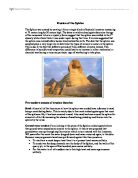
Erosion of the Sphinx The Sphinx was created by carving it from a single block of bedrock limestone measuring at 73 meters long by 20 meters high. The dates to witch archeologists determine the age of the monument to be is a mystery. Some suggest that the sphinx was crafted in the 4th dynasty while others think it was under repair during that time. It is even suggested that the sphinx was created before human kind walked the earth. The date that the sphinx was sculpted plays a very large role to determine the types of erosion to occur on the sphinx. This is due to the fact that different periods of time, different climates existed. This difference in humidity and temperature could lead to an increase in either mechanical or chemical weathering or any one particular type of weathering to take place. Pre-modern causes of erosion theories Sand: Almost all of the theories as to how the sphinx was eroded have reference to sand being a contributing factor. This is mainly due to that most archeologists agree that most of the sphinxes life, it has been covered in sand. Also sand has been around the sphinx for almost all of its life increasing the chance of sand being picked up and thrown into the sphinx by the wind. Ground water erosion: From looking at the paws of the Sphinx archeologists believe that ground water caused some erosion to the sphinx. A theory was proposed that
Porosity and permeability.
Porosity and permeability coursework The vast majority of geological materials can hold water to a greater or lesser extent, the amount of water if affected by the materials porosity and permeability. Porosity is a parameter that describes the amount of open space in geologic material, it can be stated as either a fractional value or percentage of the material that is open space. This open space is not however a void like the interior of a balloon it is more like a sponge with small air bubbles and interconnecting pores. These open pore spaces occur between sediment grains, in cracks or fractures and also on a larger scale in cavernous openings formed by dissolution of rock. The porosity values of rock typically range from 0-50%, this space is often filled with water or air or mixture of both. Permeability is closely linked to porosity as permeability is a parameter that describes the ability of geological material to transmit water. Permeability is measured in Millidarcy (MD) or Darcies (D). A Millidarcy is 1/1000 of a Darcy. A Darcy is the permeability that will allow a flow of 1 cubic centimetre per second of a fluid with 1 centipoise viscosity through a distance of 1 centimetre through an area of 1 square centimetre under a differential pressure of 1 atmosphere. The greater the permeability of a rock, the easier it is for fluids to flow through it. Typical permeability

James Hutton (1727-1797), the eminent 18th century gentleman farmer and founder of modern geoscience, authored the concept of the rock cycle, which depicts the interrelationships between igneous, sedimentary, and metamorphic rocks.
James Hutton (1727-1797), the eminent 18th century gentleman farmer and founder of modern geoscience, authored the concept of the rock cycle, which depicts the interrelationships between igneous, sedimentary, and metamorphic rocks. The upper part of the earth (mantle, crust and surface) can be envisioned as a giant recycling machine; matter that makes up rocks is neither created nor destroyed, but is redistributed and transformed from one rock type to another. PETROLOGY, the study of rocks and their origins, is essentially the formal process by which we resolve the interrelationships expressed in the rock cycle. Liquid (molten) rock material solidifies at depth or at the earth's surface to form IGNEOUS ROCKS . Uplift and exposure of rocks at the Earth's surface destabilizes these mineral structures (c.f. Bowen's Reaction Series). The minerals break down into smaller grains which are transported and deposited (either from solution or by lowering the hydraulic energy regime) as sediments. The sediments are lithified (compacted and cemented), and SEDIMENTARY ROCKS are formed. Changes in temperature, pressure, and/or rock or fluid chemistry can allow igneous and sedimentary rocks to change physically or chemically to form METAMORPHIC ROCKS. At higher temperatures, metamorphic (or any other rock type) rocks may be partially melted, and crystallization of this melt will create
Geological Unconformities.
Guided study 1: Unconformities. According to Collins dictionary of geology an unconformity is defined as a break in the sequence of strata in an area that represents a period of time during which no sediment was deposited. It indicates a change in the conditions prevailing in the area. An unconformity may be the result of uplift and erosion, an interruption in sedimentation, or non - depositional of sedimentary material. The absence of rocks normally present in a sequence indicates a break in the geological record. The De La Beche unconformity is situated in Frome, Somerset, and it gives an opportunity to investigate unconformities and to compare and contrast a number of different positions in the area to create a better understanding. The first place visited was Black Rock Quarry. The lower bed seemed to be a horizontal bed of carboniferous limestone, but at this point it was a possibility that it could have been a strike. There were a number of fragmented fossils visible in this section of rocks; these were small circular "polo" shaped fossils. Along the top of the beds was vegetation, a number of small trees and grass. There were a number of deep cracks and at the bottom was some debris and fallen rocks. At one side of the quarry there was a dipping bed. The angle recorded was approximately 15º. There were a few trees and some plants growing on the rocks. As

In this Essay I will inform you of the social, economic and environmental advantages/ disadvantages which relate to the activity and outcomes of the Limestone Industry.
5th Oct 03 Science Essay-The Limestone Industry In this Essay I will inform you of the social, economic and environmental advantages/ disadvantages which relate to the activity and outcomes of the Limestone Industry. Firstly is shall answer the highly common and simple question; 'Why bother Having this industry?' Look around you. The house your siting in, warm and cosy wouldn't be standing if it wasn't for the limestone industry, in fact buildings as strong and durable as these are wouldn't exist. Finding it hard to read this essay? A little bit short sighted perhaps? Then get out you reading specs that they themselves, wouldn't exist if the limestone industry didn't. I like the new car you've got out side, im sure that if the limestone industry didn't exist neither would your car because steel manufacturing to make the car would be too expensive. Hungry? Then swipe some of the millions of fresh and delicious vegetables from the local supermarket that wouldn't be so cheap let alone delicious if the limestone industry didn't exist. In fact without this industry there would be no fertile farming land, so farming wouldn't exist. Foundations and cement for buildings, statues, pavements and roads couldn't be made to the cheapest and highest standard and strengths they are now, the sea wave barriers couldn't be produced to prevent erosion against the coasts. Glass

Describe and account for the different types of weathering that effect two types of rock
Cristina Clark 12A Describe and account for the different types of weathering that effect two types of rock Weathering is the atmospheric action on rocks by physical, chemical or biological processes; there is no movement of the rock involved. Lithology refers to the physical characteristics of a rock, as each rock is different, such as its vulnerability to weathering, its permeability and its structure, they greatly influence the landforms that can be produced by weathering. Carboniferous limestone and granite can show how characteristics affect different rocks, as they are two of the main types of rock that produce distinctive types of landform and scenery. Both granite and carboniferous limestone are vulnerable to weathering, as they have air gaps, which water can penetrate into. Carboniferous limestone (sedimentary) contains horizontal bedding planes, which separates different layers in a sedimentary rock and also vertical joints at right angles to the bedding planes. Whereas granite has cracks which has resulted from high-pressure release or contraction on cooling within it. The subsequent freezing and thawing along these lines of weakness (in both rock types) cause frost shattering. Permeability is the rate at which water maybe stored within a rock, allowing the free passage and the interfusion of fluids. The primary permeability depends upon the size, shape, and