River Processes - What are the physical characteristics of a river?
Jack Chen 11KM
Chinese International School IGCSE Geography Coursework
River Processes - What are the physical characteristics of a river?
Introduction:
River Features are elements of the landscape produced by fluvial processes-that is, the action of running water as it flows through the channels forming the drainage network of a river basin, eroding, transporting, and depositing sediment. (Source from Microsoft Encarta Encyclopedia 2001)
A useful way to study a river is to look at its long profile and its cross sectional profile. The long profile of a river is a section drawn along the length of a river from its source to its mouth. Usually, a long profile has three parts:
? Upper course or mountain tract
? Middle course or valley tract
? Lower course or plain tract
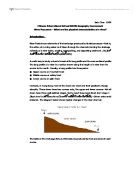
However, in Hong Kong most of the rivers are short and their gradients change abruptly. These rivers have two courses only, the upper and lower courses. Not all rivers have three well-defined stages. Some reach base level direct from stage 1 (Base level is the lowest level down to where a river can erode). Others arise amid lowlands. The diagram below shows typical changes in the river channel:
The table on the next page lists out the features produced by river processes in each course.
The Long Profile of a River
Upper Course
Middle Course
Lower Course
* V shaped valley
* Steep gradient
* Vertical erosion
* Flows between interlocking spurs
* Flood water rises high in valley
* In flood, river moves boulders
* Small discharge
* Small boulders help to wear bed and banks
* Load more angular and larger
* Pebbels wear potholes in bed
* Uneven bed; water flow turbulent. Much energy used overcoming friction
* Waterfalls and rapids
* Valley wider and straighter; spurs have becomebluffs
* Lower gradient
* Lateral erosion and transport dominant
* Floodplain beginning to develop
* River cliffs and slip-off slopes
* Extra water from tributaries (more load carried)
* Decrease in particle size of load; becoming rounder
* Bed smoother; still turbulent; friction still high
* Water flows freely in centre of channel
* Balance between deposition and erosion depends on load and speed of flow
* Valley wide and flat
* Very gentle gradient
* Much of the load deposited
* River meanders over valley floor
* Floods spread alluvium over flood plain
* Divides into shallow channels about gravely deposits (braiding)
* Discharge increases further
* Loops work way across valley and downstream
* Load small and rounded grains
* Less turbulent; lower friction
* Old channels cut-off leaving ox-bows
Aim:
The aim of this study is to investigate the physical features of the Hoi Ha Wan. I am aiming to see if the river does conform to the expected changes as a typical river profile based on both map and site evidence. In additional, we will find whether there is any evidence of man's influence on the river and if so, how it might have altered the river's natural state.
Hoi Ha Wan is located in the northeastern part of Hong Kong near Sai Kung, and is a sheltered bay of 260ha. It is unique in its coral diversity (i.e. more than 30 species are found there out of the 50 identified in Hong Kong's waters) and possesses a dynamic sand beach. It is also important for its diverse coastal habitats such as mangrove and rocky shores.
What I find will be brought together and diagrams of the channels will be drawn using the results I acquire from each varying site. I also have to find ...
This is a preview of the whole essay
Hoi Ha Wan is located in the northeastern part of Hong Kong near Sai Kung, and is a sheltered bay of 260ha. It is unique in its coral diversity (i.e. more than 30 species are found there out of the 50 identified in Hong Kong's waters) and possesses a dynamic sand beach. It is also important for its diverse coastal habitats such as mangrove and rocky shores.
What I find will be brought together and diagrams of the channels will be drawn using the results I acquire from each varying site. I also have to find out if there is there any evidence of man influence on the river? If yes, how might it alter the rivers natural state?
A series of hypothesis have been produced in order to see how the hydraulic radius/efficiency of the channel is affected.
Hypothesis:
. The channel shape of the river gets wider and shallower as the river travels downstream from site 1 to site 3
River discharge usually increases with distance downstream because the drainage area of the basin is greater, and hence so too is the volume of water reaching the channel via tributaries, surface flow, through flow, and groundwater flow. This also holds true for the sediment load, which increases with drainage area even more markedly. The increases in discharge and sediment load dictate that the size of the channel grows in the downstream direction; this is achieved through increases in both width and depth.
2. The gradient decreases as the river travels downstream from site 1 to site 3
The gradient at the upper course is steeper than the gradient at the middle and lower course. This is because as the river travels downstream, it begins to flatten out into the sea. As the river flatten out, the slope of the river starts to change from steep to flatter and flatter. Also, there are many rapids and waterfalls at the upper course that cause erosion, and this makes the slope of the upper course very steep and uneven.
3. The speed of water increase as the river travels downstream from site 1 to site 3
The speed of water increases as the river travels down stream. This is because as the river travels along, it confluences with many other tributaries. When this happens, the river energy will increase, hence the speed will increase. Although the upper course has steeper gradient and the lower course has gentle gradient, there are small bedloads in the lower course. The upper course has a very shallow, narrow, rock filled channel which it increase the friction. Therefore the velocity will be greater in the lower course.
Methodology:
In order to prove that the hypotheses are correct, we have gone to three different sites, which include an upper course, a middle course, and a lower course. At each of the three different sites, I took down the rate of water flow, the channel shape, and the gradient.
Before going to the river, there were some classroom preperation which we need to complete. We had to draw a llong profile fo the river and a valley cross section from one of the upper, middle or lower course of the river. The reason of doing this is because we have to generate at lesast three hypothesis before going out to investigate. The river investigation was taken place from November 13 to November 14 at Hoi Ha Wan . All the IGCSE Geography students were divided into 17 groups. The size of each group varied from 3 to 5 students. Each member had a specific job (measuring, recording data, etc). The 17 different river investigation groups were assigned to 3 different geography teachers. With three main stations being investigated, there were 7 groups at each station. Each river group had to carry out data collection at each of the stations.
Equipments:
? Range poles
? Weight corks
? Meter ruler
? Clinometer
? Measuring tape
? Safety rope
? Field diary
? Stop watch
? Camera
? Field guide book
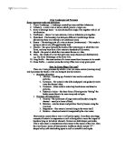
Site 1 - Upper Course
The map above shows the location of site 1B and it also shows the Pak Sha O Youth Hostel.
The reason that site 1B is chosen between site 1A and 1C was because that the teacher found site 1B is has less obstacles and less rock on the riverbed. Therefore, it will be safer and more efficient to carry out the investigation there.
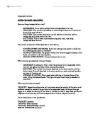
Site 2 - Middle Course
The map above shows the location of site 2 and there is a pumping station beside it.
Site 3 - Lower Course
The map above shows the location of site 3. Also, we can see from the map that there is a village near it.
.Channel shape: First, place a tape measure across the stream. Keep it taught. If it is a shallow stream, use a ruler to measure the water depth. If it is a deeper stream, then use the range pole, mark the depth of the water and measure it.
The measurements can be recorded in the following way:
Measuring point (every 50cm from left
2
3
4
5
6
7
Etc
Depth (cm)
0
5
7.2
8
Etc
(http://downloads.members.tripod.com/fhsgeography/Yr11/Bowland_coursework/River_Channel_Fieldwork.pdf)
2.Transect of the river valley (gradient): Slight the clinometer from the top/bottom of a color band on pole one to the top/bottom of the same color band on pole two. Record the number of degrees, and whether it is up or down. Take the measurement more than once to make sure that it is accurate. Measure the distance between the poles and record that. Keep pole 2 in position and move pole 1 to the next position, and then record the next set of data.
The data could be recorded in the following way:
Site Number: 1
Pole positions
-2
2-3
3-4
4-5
5-6
6-7
Etc
Degrees
3
2
0
N/A
24
9
Etc
Distance (m)
2.54
3.22
2.16
.42
0.95
2.11
Etc
Diagram shows positions of surveying poles and clinometer when measuring the river gradient.
3.Water speed: Drop the float in upstream, opposite pole 1. Record the time it takes to travel to pole two. Repeat the timing at least six times, then work out an average time. Then use the formula to calculate the speed:
Speed = distance traveled (d) / time taken (t)
Data description and analysis:
At the upper course, the deepest point has a depth of 27 cm. This occurs when it is 90cm away from the left bank. After this lowest point, the depth starts to become shallower, moving back up to the top of the water. We can obviously see that this is a upper course feature as it has a narrow and shallow channel shape and these features are created by the V-shaped valleys and the interlocking spurs.
At the middle course, the deepest point has a depth of 69 cm. This occurs when it is 160cm away from the left bank. This channel shape is steeper comparing to site 1. This is because site 2 is closer to the mouth and the water is going into the sea.
At the lower course, the deepest point has a depth of 90 cm. This occurs when it is 60cm away from the bank. This channel has the steepest channel among the others. This is because the water is flattening into the sea.
Description: The graph above shows the long profile of Hoi Ha River. The total length of the river is about 2080m. It's height is about 85m. The graph above shows the long profile of a section of the Hoi Ha River. The total length of the section is about 2080m long. It has a height of around 65m high. From the graph, you may see that the Hoi Ha River is a very young river, therefore backward erosion has not come yet.
Analysis: The hypothesis "The gradient decreases as the river travels downstream from site 1 to site 3" is rejected. Site 3 has the steepest gradient while site 1 has the smallest gradient. These shows that
The hypothesis - The speed of water will decrease as it goes down stream is accepted. From the graph, we can clearly see that the average water speed for site one is the greatest, which is about 0.758 m/s, while site two is 0.657 m/s and site three is 0.117. The reason for this is because site one has steep gradient and site 2 and 3 have lower gradient compare to site one. The steeper the gradient, the faster the water speed.
These two photos proved that there is evidence of man's influence in the river. The photo shown on the left is a pumping station. The photo shown on the right is a valley. Also, if we look carefully at the each site map, we can see some buildings. These facts show that there is man's influence in the river. The people living in the valley might influence the water by polluting it. For example: Washing, cooking...etc. This can also decrease the amount of water around the village. The pumping station might affect the speed and the amount of water near the pumping station. The water volume may slightly decrease as the water are being pumped away from the river.
Conclusion:
As a conclusion, I think Hoi Ha Wan does not conform to the expected changes as outlined in the textbook about a typical river profile. e can see that the Hoi Ha River does not have a shape of typical river. The features of Hoi Ha River are different from that of a typical river because it is a very young river.
Overall, from the data that I had collected, they only agree to my hypothesis 1. Hypothesis 2 was rejected because abnormal river profile of Hoi Ha River affects the gradient of the river; therefore the velocity of the water is also being affected. However, if after a very long period of time, when erosion had change the abnormal river profile it now has into the typical river profile, this hypothesis would be correct. Hypothesis 3 was rejected because the velocity of the water at site 1B is quite slow, and the gradient is very gentle as well, so the flow speed is not fast enough to erode the rocks on the riverbed. The vertical erosion is less than anticipated, therefore creating a shallower river channel than expected.
Evaluation:
There were some limitations to the method when measuring the gradient.
The readings we recorded on the surface of the water might be inaccurate as the velocity of the stream is less at the sides and surface than in the centre where the velocity is highest. The results also could be affected by the wind over 1/2the surface, which could make the floats faster.
Another adaptation we had to make was shortening the travelling distance of the float from 10 metres to 1 metre at the first site as the water was too sallow and there were too many obstacles for the piece of float to overcome. This might make our results a bit less accurate as a longer distance will enable a more accurate result to a shorter distance because the longer distance gives the float peel a good distance in which to adjust to the average flow of the river. Whereas a shorter distance will only give the orange peel a small amount of velocity. There is more chance of the reading of velocity to be affected if it is taken in shorter distance as a tributary could effect the amount of water flowing at that particular place whereas the flow of the river is averaged out more over a longer distance.
Bibliography:
Chinese International School Geography Department Website:
http://www.cis.edu.hk/sec/ss/Geography/IGCSE/INDEX.html
World Wild Fund for Nature Hong Kong:
http://www.wwf.org.hk/eng/conservation/hab_protect/green_dragon/hoi_ha_wan.html
Text Book - New Geography 4A
Text Book - The New Wider World by David Waugh
Microsoft Encyclopedia Standard 2001 - WE
IGCSE River Investigation Field Guide 2001