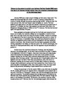
Other types of condensation come in the form of orographic and frontal uplift. In this process warm, moist air is forced to rise as it crosses a mountain barrier or when it meets a colder and denser mass of air at what is called a front. This is a far more effective method of creating condensation as it has a vertical movement rather than a horizontal movement. Along with the orographic condensation there is also convective condensation that occurs when air gets warmed during the daytime and rises in certain pockets as thermals. When the air expands it uses energy and so loses heat and so the temperature drops. As the air is being cooled by the reduction in pressure with height rather than due to a loss of heat to the adjacent air it is said to be adiabatically cooled. This process is demonstrated in the diagram below.
The diagram shown above is the process of adiabatic cooling in the condensation process. For condensation to occur the air must be saturated (cooled to dew point). Dew point is the certain temperature to which air must be cooled in order to reach saturation. Also there must be a surface to condense on, for example the condensation nuclei (dust/smoke). Rising air cools adiabatically due to the expansion adiabatic process. This is a temperature change without a heat transfer involved, and so once the condensation level is reached and clouds will form.
Once the process of condensation has started the formation of the actual rain droplets is very important. As the air has now become too unstable to support the water as a vapour and is turning it into its liquid state the water does not just fall from the sky in one great mass. The water is in minute droplet sizes and are so small that they cannot fall straight to the ground because they cannot overcome the updrafts that support clouds simply because their falling velocity is not high enough. Therefore most of the condensed water in clouds cannot just fall as precipitation, it must fall as a large raindrop sized droplets of water.
The air in our atmosphere is never pure. There is always some particles of dust, pollution, smoke or salt in the air. Therefore this comes into play when the raindrops are actually forming. These tiny, minute water droplets must first condense onto these even tinier dust particles, which act as a nucleus for the raindrop. Water droplets may grow as a result of additional condensation of water vapor when the particles collide together. If enough collisions occur to produce a droplet with a falling velocity which can exceed the cloud updraft speed, then it will fall out of the cloud as precipitation.
However there is a more efficient mechanism for the creation of precipitation siezed droplets of water which leads to the growth of ice crystals at the expense of the water vapor present in a cloud. These crystals may fall as snow, or melt and fall as rain. The likely thing that happens is that they may start to fall as slow ut mostly end up melting into raindrops. They can fall in many different sizes but are normally under or about 2-3mm in size. They also have different shapes and the sizes are shown below in the small diagram.
As the raindrops fall, they can be distinguished by the mechanisms that cause the initial uplift of the air. There are three main types of mechanism the first of which is the convergent and cyclonic rainfall. This can also be described as frontal rainfall. This process results from the meeting of two air streams in the areas of low pressure. Within the tropic areas of the earth winds blowing towards the equator meet at the inter-tropical convergence zone where the air is forced to rise, and along with the convection currents, produce heavy thunderstorms associated with a more equatorial climate. In more temperate latitudes depressions form at the boundary of tow air masses. At the fronts warm, moist and less dense air is forced to rise over cool, dryer, denser air, which creates long periods of rainfall.
Orographic or relief rainfall is the second mechanism of precipitation. As in the name of the process, the word relief associates itself with the shape of the land. Frontal rainfall can sometimes be affected due to the relief of the land and so links can be made with orographic and cyclonic precipitation. Orographic rainfall occurs when warm, near saturated maritime air (come from the sea) gets forced to rise when it is faced with a coastal mountain barrier range. These mountains reduce the water holding capacity of rising air by enforced cooling of altitude and can then increase the amount of cyclonic rainfall by slowing the speed of depression movement. However as the air descends on the other side of the mountain range it gets warmer and compressed, creating an area where little rain will fall. This is often called the rain shadow area as it is in the diagram of relief rainfall below.
These three main mechanisms rarely work separately which is why the process of cyclonic rainfall was mentioned again when talking about the relief rainfall above. The third mechanism in this group of precipitation processes is convectional rainfall. This occurs when the ground surface on a localised scale gets heated and through the process of conduction and convection the air heats up, expands and rises. As the mass of air rises it is surrounded by air which is much cooler than itself and so is likely to become unstable with immense cumulonimbus clouds forming. These unstable conditions caused by frontal or orographic uplift force the air to rise up in a large chimney shape. This updraft is then maintained by energy released by latent heat at both the condensation and freezing levels. The top level of the cloud is characterised into an anvil shape of ice crystals caused by upper air movements flattening the top of the cloud. Once these ice crystals and water droplets have become large enough they will fall in a downward draft. The air they pass on the way down is cool as heat gets absorbed by evaporation. The downdraught causes the warm air supply to the chimney to reduce and so limits the duration of the storm.
These storms usually have thunder and lightning. Lightning is thought to occur because as these ice crystals rise they crack due to compression of water on the inside of the ice shells. This gives a positive charge to the water inside and the heavier ice shells fall negatively charged down the cloud inducing a positive charge on the earth’s surface. This may be the reason for the lightning to occur but thunder is certainly the sound of pressure waves created by the heating of air along the lightning flash.
The diagram above shows the simple version of convection precipitation. However we would expect to see the lightning at the base of the cloud and the charges going from positive to negative down the cloud from top to bottom as the ice crystals fall to induce a positive charge on the earth.
We can see that the processes of rainfall are very in depth. The start of the progression of evaporation to condensation, raindrop formation and precipitation is a long line of chemical and physical processes that in everyday life we do not usually think about. The different types of rainfall and the origins behind the creation of thunder and lightning are all very complex and are all due to the convection currents of warm and cool air that circulates the earth everyday. As demonstrated when talking about the mechanisms of precipitation we notice that everything is interconnected. One system of precipitation never works alone as there is always a contribution from warm and cool currents, relief and even the terrestrial heat of humans affects the way that rain eventually falls. This shows just how composite the earth’s climate system is and explains why some areas of the world have high rainfall and why some areas are so dry and unaffected.