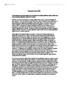
Snowdon
Snowdon is a pyramidal peak which means that three or more cwms have eroded backwards into the same mountain (Snowdon). Aretes radiate from this central peak.
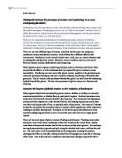
Uses of the glacial features of Snowdonia
Recreation
Snowdon itself can be used to do an number of things Cycling, camping, walking, climbing. Cwm Idwal could be used as a place water sports such as canoeing, windsurfing, sailing etc. The U-shaped valley of Nant Ffrancon could be a great photo or painting opportunity. Many of the attractions are related to the natural landscape, such as walking, rambling, rock climbing and absailing plus places of historic interest and nearby beaches. Snowdon is climbed by over 2500 people a day in the summer while the Snowdon Mountain Railway takes a further 100000 people to the summit every year.
Sheep farming
Snowdonia has a very harsh upland climate with steep slopes and poor soils, this means that most of the land is only suitable for sheep farming although this is not a very profitable business anymore, I will explain the problems in more detail later on.
Forestry
While the sheep farming business has declined profitably in Snowdonia, the Forestry business has grown and grown and has become increasingly important (and profitable) in the last 40 years. Over 20% of the upland area of Snowdon is covered by Conifers such as Sitka Spruce which can cope with the harsh conditions of the region. Many jobs have been created, both in the forests and in wood using industries although there are some bad points about the forestry industry.
Water supply
This area has a high rainfall but it has a low population, which means that there is more water than it needs (a surplus) and so for many years the water has been put to good uses by supplying other parts of the country with water. Valleys with land that was of little value to farmers in Snowdonia has been dammed to create reservoirs, although large areas of land has been lost, relatively few people have had to move out of their homes. Also the reservoirs have created opportunities for leisure and recreation.
Electricity
Dinorwic hydroelectric plant in Snowdonia, it is the largest pumped storage scheme in the U.K with a generating capacity of 1.5 giga wattes. This has been made possible because of the steep slopes and lakes to generate hydroelectric power (HEP). Water drops from Marchlyn Mawr which is a tarn, through tunnels inside the mountain, to the power station on the shores of Llyn Peris (a ribbon lake formed as a result of erosion when a glacial over deepens part of the valley). The at night-time the water is simply pumped back to the top again using cheap electricity which would otherwise have been wasted. This is good as it does not produce any greenhouse gases and it provides cheap electricity.
Problems
Those are all the uses of the Snowdonia National Park although they are all positive factors they do have problems and where there are problems they are usually big problems.
Problems in tourism
Tourism brings many jobs to the area, these include shop keeping, train driving, guides etc. But most of these jobs are seasonal and so while it does bring jobs area they may only be for the Spring/Summer months and after that most of the trade goes away. This leaves many people in the area jobless and penniless. A great natural landscape like Snowdonia brings tourists and with tourists brings cars and lots of them, this makes the narrow roads very congested and poor parking can damage verges. Also it’s not the prettiest feature seeing 100’s cars amongst the landscape. Huge numbers of walkers means the footpath is eroded away. Ramblers and walkers also stray off footpaths which leads to trampling, this may not seem like much but in the 1980’s over £1.5 million was spent on repairing the damage which is a huge sum (although footpaths are not always clearly marked). Also the walkers damage fencing when they stray of the paths and climb over them and not only that, the ramblers do stupid things such as leaving gates open which lets sheep stray off the land.
Problems in management
There are so many different types of land use within Snowdonia because it’s a National park, but sometimes these uses conflict with each other and so it faces difficult management decisions.
Problems in Farming
Snowdonia’s harsh upland climate, steep slopes and poor soils mean that most of the land is only suitable for sheep farming. This means that if you’re a sheep farmer living in this region and this type of farming becomes unprofitable then your stuck as you there are no other types of farming you can do in this area. Also many disused farmhouses have been bought by outsiders as second homes for use at the weekend and in the holidays. But this contributes to the break up of the community and instead of bringing people together it is breaking people apart. Plus the purchase of farmhouses as holiday homes increases house prices and makes it more difficult for local people to continue living in the area, especially the farmers themselves.
Problems in forestry
I have noticed whenever I have been to the Snowdonia National Park that there appear to be long, straight rows of identical trees which stand out from the rest of the scenery. This is the trees that the foresters have re-planted after cutting the other trees down. But they look very place and not natural at all although they have introduced some methods of rectifying this, I do not feel the foresters have done as much as they could do.
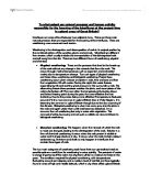
Solutions to the problems
I think that things not carry on as they are because leaving it like it is, is just going to cause more problems and is not going to solve anything although I don’t think Snowdonia’s got as much problems as it could have. I think that more warning signs should be put up as so to encourage visitors to be more careful and to respect the environment. I also think that “on the spot” fines should be introduced, so those visitors who are caught doing excessive damage to the environment would be punished. I also think that footpaths should be clearly marked because through my own experience the footpath is not always clearly marked and so I sympathise with the visitors who wonder off by mistake. But anyone who strays off the footpath deliberately and causes damage to the surroundings should be fined. I definitely don’t think people should have to pay to climb the national wonder that is Snowdon because it’s a natural beauty and no person should be allowed to charge money to climb up it, everyone should have a chance to climb it after all it’s a natural park. Also it will bring less tourism as visitors might be put off climbing Snowdon and it won’t solve any problems, there may be less people causing them but people will still wonder off the path and damage fences etc. Limiting the number of walkers by operating a permit system is a better idea than charging people to climb up the mountain but I still think it will put some people off thus bringing less trade to the region. Again it won’t solve any of the problems just reduce the number of people causing them.
Solution to problems encountered in management
I think that everything should be organised better so that land which is being used for one thing does not conflict with land which is being used for something else
Solutions to problems encountered in Farming and forestry
There is nothing much we can do about the problems with farming although I think the number of farmhouses being converted into holiday homes should be restricted. Concerning the forestry I think that the foresters should make sure that they always introduce different kinds of species and plant them in a more random way instead of identical row after identical row.
Conclusion
In conclusion I think that Snowdonia is a beautiful National park but has various problems which need to be addressed to and quickly fixed before it is too late.
Sion Brooks 10N