
Plantation agriculture
Geog Summer Assignment- Essay Question 3 Stella Kwok (7) Plantation agriculture is a kind of commercial arable farming in the world. It is especially important in humid tropics with luxuriant growth of vegetation. Its economic effectiveness is always emphasized, bringing both positive and negative impacts. In recent decades, crop diversification is introduced and the ecological balance of the natural environment is greatly conserved. Plantation agriculture refers to the growing of cash crops on large foreign owned estates in countries of tropical environment. It is usually practiced in a large scale with monoculture, in which only a certain type of plant is dominant. Take Papua New Guinea as an example, in the area, cacao, coffee and rubber are mainly grown in the region for export to other countries. Under this kind of farming, there are positive impacts to the economy. Firstly, due to its large scale of operation and being export-oriented in Papua New Guinea, the supply of products is regular and of uniformly high quality. With high demand for the products, this attracts large amount of investment of capital from the foreign countries, such as Europe and North America, thus allowing the farmers being financially able to provide the expensive machinery capable of turning out a high grade product. Benefiting from economies of scale, this enables both the

Park Design Issues.
Ritchison, Derek Facilities Management, RPLS 379 February 4, 2004 Park Design Issues, Assignment #1 I always knew Minneapolis had a quality park system, but I had no idea it was renowned throughout the country. Also, I had no idea there was such a large number of parks, lakes, trails and just plain "open space" in Minneapolis. There are over 150 parks, 30 lakes and 50 miles of parkways in Minneapolis. It is obvious much credit is due to Frederick Law Olmsted and his park design principles, which are heavily included in the Minneapolis park system. I believe all of Olmsted's basic principles are apparent in the Minneapolis parks, and have been since the very beginnings of the city. One of the first things city officials did was set aside different areas of land specifically for parks. There were many benefits of doing this. First, it allowed the city to build houses around all the parks, making them all easily accessible. Also, it placed many different parks throughout the city, scattered but connected. This way, no matter where you live, there will be open space and "green relief" somewhere nearby. Most of the parks in Minneapolis, especially the larger, more frequented ones, are connected by parkways. The Ground Rounds, as it is called in Minneapolis, consists of over 50 miles of parkways and open space. This is broken up into seven districts scattered

Creative writing - I, David Vivian-Currie, had been used to the upper-class life until I was forced to join the war through National Service.
I, David Vivian-Currie, had been used to the upper-class life until I was forced to join the war through National Service. I had received the dreaded letter on 29th May 1944, a week before it detailed me to leave. I was to help recapture France from the German's. Until I had received the letter, I felt that I had lived quite a pleasant life: I had attended Dunce Hall in North London and, at the age of thirteen, had moved onto Eton, where I became a school prefect in my final year. My father, John Vivian-Currie, was a well-established banker who had always tried to give me the best opportunities in life. After realising his success in banking, I decided to give it a try after I left Eton, and by the age of twenty-five, I had risen to the position of my father's assistant. He had avoided National Service due to age reasons. I however, had not. Due to my schooling I entered the army as captain, so I was in a better position that most of the soldiers. However, I still knew that I had virtually no chance of surviving. Today, 5th June 1944, I was sitting in the tiny transport boat with the remainder of my platoon, preparing ourselves for the journey to France, that would decide the rest of our lives. There was not a cloud in the sky, however, it was still quite brisk, I was glad that I had decided to put an extra pair of breeches on, but it didn't really matter, for I would
The Indutries and Energy Resousces of Brazil.
By Alison Taylor Contents Energy Page three Industry Page four The Future Page six Energy resources in Brazil H.E.P The main energy resource in Brazil is hydroelectric power (H.E.P). There are problems with this cheap efficient energy. H.E.P needs a lot of land and a big river, and a lot of natural vegetation is flooded when a dam is built, which mean that the local people haven't got that land to grow their crops on which means that there will be less food for the community. Flooding this land also means that the local people are forced to move and there don't have a say in this. When there built the Itaupu Dam, which is the largest H.E.P dam in the world they talked to, the local people to decided what to do about their houses and land. There are also thinking about were the people will live after wards and there are also thinking about the environment more, which is a very new thing. In 1997 Brazil was the 3rd largest H.E.P produces in the world. Most of the H.E.P dam's are in the south but there are one or two in the rest of the country. Here is a map of were they are situated. Oil Oil is important in Brazil because the other types of energy only contribute a very little bit. H.E.P is the only one, which has really made a difference. But oil does help a lot like in 1974 a hugh oil field was found about 50 to 130 km offshore but even since that
Built Environment
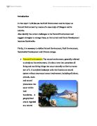
Introduction In this report I will discuss the Built Environment and its impact on Natural Environment by means of a case study of Glasgow and its suburbs. Also identify the current challenges to the Natural Environment and suggest strategies to manage these, so that current and future Development becomes Sustainable. Firstly, it is necessary to define Natural Environment, Built Environment, Sustainable Development and Climate change. * Natural Environment: The natural environment, generally referred to simply as the environment, it is also a term that comprises all living and non-living things that occur naturally on Earth or some part of it. A complete landscape units that function as natural system without enormous human involvement, including all plants, animals, rocks and natural phenomena that occur within their boundaries. A geographical area is regarded as a natural environment if the human impact on it is kept under a certain limited level. This level depends on specific context. General natural resources and physical phenomena that lack clear boundaries such as air, water, climate , energy, radiation, electric charge and magnetism not originating from human activity. * Built Environment: The phrase built environment refers to the manmade surroundings that provide the setting for humane activity, ranging from the large scale civic surroundings to the

The Ozone a Hole in the TheoryThe protective ozone layer around our world undergoes much thought and debate. The "Hole", however, only exists in the minds of environmental
The Ozone a Hole in the Theory The protective ozone layer around our world undergoes much thought and debate. The "Hole", however, only exists in the minds of environmental, self-serving scientists and politicians. It interests many to find all the faults in the publics consensus of the "ozone depletion." Most scientists do not believe in this "depletion", they think it is a natural phenomenon. Ozone gasses come into view as consideration over what gasses are actually accused for this awful crime of destroying the ozone. But what do these invisible murderers really do (or don't do)? Some actually think that these cursed elements of air help rather than hinder the earth! Volcanoes put yet another damper on the ozone theory. Can humans actually over power volcanoes and other natural causes? The most debated of the gasses, Fluorocarbons (CFCs), now come into view. What of the controversy of 1947? The flaws in the CFC theory overshadow its relevance. Even though no decisive proof exists major coun! tries in the world will ban CFCs in the year 2000 due to the Montreal Protocol. What exactly does this banning entail, and how will it affect us? Environmentalists insist that because of the "depleting ozone" harmful ultra-violet (UV) rays seep through the ozone causing UV and cancer levels to soar. How seriously can the populous take these claims? One alleged problem that goes hand

glacial eroded landforms
June 2002 - past paper (1) . Distinguish between the processes of erosion and weathering in an area undergoing glaciation. Erosion is the wearing away and removal of material by a moving force. In an area undergoing glaciation the moving force is the ice. The processes of erosion include plucking and abrasion. On the other hand weathering is the breakdown and decay of rock in situ, with no movement involved. The processes of weathering include freeze-thaw and dilatation. Erosion moves rocks from one place to another, whereas weathering simply breaks rock particles down. So the difference between the processes of erosion and weathering it that the processes of erosion involve movement, whereas the processes of weathering do not. 2. Examine the impact of glacially eroded landforms on human activity Glacially eroded landforms have many different impacts on human activity, some positive and some negative. These impacts range from transport to industry in both rural and urban areas. Transport is an aspect of human activity affected by glacially eroded landforms. U shaped valleys are glacially eroded landforms which have great advantages for transport as they provide natural routeways for through upland areas. So roads and railway lines can be constructed, linking major towns together. For example the A591, which is the main road through the Lake District, follows a glacial
Examine the components of a 24-hour city
CHAPTER 1: THE THEORTICAL CONTEXT .1 OBJECTIVES AND RATIONALE London has an arguable case to suggest whether or not it is a 24-hour city. At the moment, there are many issues that need to be resolved and implemented before it can be crowned with the rest of the leading world cities like New York, Berlin, Amsterdam, Japan, etc as a 24-hour destination. But more to the point objectively, does London have the capabilities to becoming more than it is now? Hence, more of a city that is generalized like such destinations mentioned. A predicted difficult aim to achieve, however, more challenging in knowing that no dissertation has been written on such a topic. The following objectives for this dissertation are as follows: Objective 1: To examine the components of a 24-hour city (What makes a 24-hour city is the aim of this objective. It will also focus on infrastructure in sustaining a 24-hour city) Objective 2: To investigate the West End as an entertainment district. (Assessing a S.W.O.T analysis on the district will carry this out. It will aim to establish the extent of the late-night economy within the district.) Objective 3: To investigate on the development opportunities to create the area of London Bridge as a 24 hour district. (The aim of this objective is to recognize opportunity development, and to see whether or not by creating the district will help relive
Extreme Weather Investigation
Extreme Weather Investigation Location of Investigation Castle Head Field Centre lies between the fells of the Lake District and the shores of Morecambe Bay, in a secluded corner of northwest England in a small rural town of grange over sands. Aim of Investigation In this report I shall be investigating how land-use in a drainage basin affects the rivers response to a rainfall event. I shall be describing the various methods of research, deeply analysing my findings and concluding the results I have found the my hypothesis. Hypothesis My hypothesis for the outcome for the investigation is that impermeable surfaces will result in a flash flood river response. The hydrograph will show a high magnitude, short duration response and a short lag time. I believe this to be true due to the surface run off on impermeable surfaces which because it can't infiltrate it runs down faster and in a higher quantity. Impermeable surfaces give a higher risk of flooding as the run off duration is a lot quicker and the peak is a lot higher than permeable surfaces where infiltration occurs causing a slower response and a longer duration. Method Part 1: Simulating Drainage Basins The investigation was based around four different surface types representing drainage basins, to test the response of each surface. The first surface was bare earth witch consisted of various materials including

Rwanda Case Study
Blood, dead bodies, war, starvation and overall tragicness were a few aspects of the terrible genocide that occurred in Rwanda in 1994. These things caused the majority of the population to leave Rwanda and seek refuge in the neighboring countries such as Zaire, Burundi, Tanzania and Uganda. The genocide in the tiny Central African country of Rwanda was one of the most intensive killing campaigns in human history. It all began due to the rivalry between two groups called the Hutus which 90% of the population belonged to and the Tutsis, occupying the remainder 10%. In the past, the Tutsi minority was considered the upper class of Rwanda and dominated Hutu peasants for decades, especially while Rwanda was under Belgian colonial rule. However on April 6, 1994 the Rwandan President Habyarimana was killed when his plane was shot down. The Rwandan press immediately blamed the Tutsis and this was the spark that led to the Rwandan Genocide. Within hours of the attack, a campaign of violence spread from the capital throughout the country, and did not subside until three months later. The Rwandan army (FAR) and the Hutu Militia went from house to house cruelly killing Tutsis, as they wanted to seize power, revenge and also wanted to reverse the roles. A young Tutsi girl remembers, "Then there was a knock at the door and before we could even respond, the door fell in and about four or


