Once the signal has been returned the computer, or a very clever person can calculate the distance and size of the object using the following equation:
[2]
X) The distance you are calculating.
V) The velocity of the wave which can be calculated by: [2]
T) The time for the signal to return.
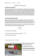
An image showing GRP in use to find a pipe [3]
Once the computer has gathered all the distances of an object it can product an image that might look a bit like this one:
An image showing the computer generated image of the GPR scans [4]
-EM (Electromagnetic induction)
Electromagnetic induction, measures the impedance change between a pair of magnetic coils, on or above the surface of the earth. The EM instrument comprises of two coils, primary or transmitter and secondary or receiver.
An image showing the Equipment used to collect the data for a EM scan [5]
The transmitter coil generates an electromagnetic flied at a specific frequency. The primary field then causes electrical currents to flow in conductive material at and in the subsurface. This flow of currents, called eddy currents, and then generates another magnetic field, or the secondary field, which is then detected by the secondary or receiver coil. The magnitude of the signal on the second coil depends on the type and disruption of the material in the sub surface. [6][7] Once this process is over the computer can generate an image looking like this:
An image showing the computer generated image of a EM scan [7]
-Social and environmental impacts
Using radar for looking underground at mines, or pipes doesn’t have a significant impact of the environment or social aspects, because the signal used is very weak. But one factor to think about is that to look underground without using radar will mean you have to dig up the surface you are trying to look at, and if you are looking at pipes under a road, radar will save a significant amount of money and time.
-Benefit and risks
So far, no conclusive evidence has been show that radar causes cancer or other illness, if you were to stand within a meter of a ship radar, there will be a good chance of you being ‘cooked’ by the radio waves. This could also apply to the workers using GPR, on a regular basis to find defect in the ground. But precautions can be taken to prevent it like wearing lead shielding. But the benefits of Radar and EM outweigh the risks.
-Conclusion
To further investigate geophysics I will conduct and practical experiment composing of a plan, a write up and an experiment to ‘indentify a metallic material using its resistivity’. Once I have gathered the resistivity of the chosen material I shall compare it to a given list of resistivity’s to determine the material.
Bibliography
Books
[2] - Edexcel AS Physics Student’s Book, Miles Hudson, 2008, Pearson Education Limited, pg. 109 – Pulse-echo detection equation.
Websites
[1] - -information about how radar works (accessed 09/03/2010)
[3] - - image of GPR equipment in use (accessed 09/03/2010)
[4] - - image of GPR in use and the computer generated image (accessed 09/03/2010)
[5] - - image about EM induction equipment (accessed 09/03/2010)
[6] - - information about EM induction (accessed 09/03/2010)
[8] - - image of them EM induction scan (accessed 09/03/2010)
Interviews
[7] – Donald, Joseph. Retired university Physics lecture. (23/03/12) – explained how EM induction works.
Glossary
Eddy currents- are electric currents induced in conductors when a conductor is exposed to a changing magnetic field.
EM- is the production of an electric current across a conductor moving through a magnetic field. It underlies the operation of generators, transformers, induction motors, and electric motors
GPR- is a geophysical method that uses radar pulses to image the subsurface. This non-destructive method uses electromagnetic radiation in the microwave band (UHF/VHF frequencies) of the radio spectrum, and detects the reflected signals from subsurface structures.
Radar- is an object-detection system which uses radio waves to determine the range, altitude, direction, or speed of objects. It can be used to detect aircraft, ships, spacecraft, guided missiles, motor vehicles, weather formations, and terrain.
Page of