Small pioneer plants will begin to colonise the surface of the mud. The halosere will have entered the first stage proper of primary succession which can be called colonisation.
The presence of a fledgling community on the site will affect the physical conditions. The roots of pioneer plants will help consolidate the mud that has already built up by binding it together. Their upper parts will help trap more sediment. (It's been estimated that Spartina can add 8-10cm of mud a year to a salt marsh). Primary producers will provide a source of food and places of refuge for animals. When individuals die their roots will remain in the mud helping to hold it together. Some parts of them will be resistant to decomposition and they will add humus to the mud.
Conditions become suitable for more species and they migrate to the area and begin to grow as well. All species (including the pioneers) start to do better. The community has entered the next stage of succession: Establishment.
There will be a general increase in number of species at this stage. Seeds of flowering plants from all over the salt marsh will be dispersed by water currents all over the marsh. Some of them will germinate and be found as seedlings at the establishment stage but will not survive to maturity. As time passes the height of the mud increases. There are more species taking up more space and less bare ground and the community enters the next stage of development.
The species present will compete for space, light, water minerals etc. until those best suited to the environment remain. At this stage there will not be many changes in population type. The height of the ground has increased to such an extent that it gets immersed much less frequently. The rate of height increase of the shore is reduced. Few if any new species will be added to the community at this stage of stabilisation. This will eventually lead to the climax community.
Measuring Periwinkle population-
Capture-recapture-
- Quadrats placed on the ground to mark 1m2 area
- Marked the area distinctly with rocks at corners and bamboo cane at centre so it could be located later
- Systematically check each square for periwinkles
- As each periwinkle is identified record number and mark it so you later identify it as marked but not so it will draw the attention of predators unnaturally altering the periwinkle population
- Return each periwinkle to the location it was found in
- Remove quadrats and leave area for an appropriate length of time (periwinkles move slowly therefore hours)
- Return to site and lay quadrats
- Once again systematically check each square
- Record each periwinkle found and number that are marked
- Return each periwinkle to their original location
- Perform equation to gain an estimate for the population of periwinkles per m2
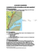
East Head
Sand dune
East head is a sand dune spit at the eastern side of the entrance to Chichester harbour. It is an SSSI and a Ramsar site. It was formed by the process of longshore drift, but its present shape and direction have been affected by sea defences that have been interrupting this process for nearly 200 years. During the 1960’s and 1970’s the sea breached the narrow Hinge. A large part of the spit was submerged in seawater that destroyed much of the vegetation. The sand dunes had to be replenished with the planting of Marram Grass and other dune plants. Since the 1980’s, there has been severe erosion to the west/sea facing side of the spit In 2005 a ‘rock berm’ was put on the inside of the narrow Hinge area to try and secure the spit to the mainland and to prevent a channel forming if the sea should break through again. In October 2004 the narrowest section linking the spit to the mainland was completely eroded away by the sea. During the summer of 2005 a huge quantity of sand was transported from the northern tip and a huge bank built over the top of the surviving rock berm. This has been planted with Marram Grass and it is hoped it will remain in place until a long-term solution has been agreed on.
Sand dune vegetation- Ammophila arenaria (Marram Grass), Atriplex spp. (Orache), Cakile maritima (Sea Rocket), Calystegia soldanella (Sea Bindweed), Carex arenaria (Sand Sedge), Carex spp. (Sedges), Elytrigia juncea (Sand Couch), Eryngium maritimum (Sea Holly), Euphorbia paralias (Sea Spurge), euphorbia portlandica (Portland Spurge), Festuca rubra (Red Fescue Grass), Honckenya peploides (Sea sandwort), Juncus articulatus (Articulated Rush), Ononis repens (Restharrow), Ranunculus flammula (Lesser Spearwort), Salsola kali (Prickly Saltwort), Tortula ruralis ssp ruraliformis (Twisted Moss). There are others.
Sand dune formation- If the shore faces into the prevailing wind the sand grains will be blown inland. The sand grains blow inland until they meet some form of obstruction. This might be a pile of seaweed dumped high up the shore by the sea, a lump of driftwood, a fence, a pool or muddy, sticky ground. Alternatively, sand might settle in the still air behind a small hillock or similar. The sand piles up against the obstruction and we have the first stage in formation of a sand dune sometimes called an embryo dune.
Embryo dunes are characterised by pioneer species such as, sand couch (Elytrigia juncea) and/or lyme grass (Leymus arenarius). Plants stabilise the embryo dune with their roots and encourage accretion (sediment build-up) with their aerial parts (the bodies of the plants act like barriers to the movement of sand). In time the sand will build up and a mobile dune, dominated by marram will take the embryo dune’s place. When sand has built up above the height of the highest spring tides, marram grass (Ammophila arenaria) dominates; it quickly encourages substantial accretion and this overwhelms the typical embryo dune species.
This marram-dominated stage of sand dune succession is the most widespread, extensive colonising community on mobile coastal sands all around the British coast.
This leads to a stable or fixed dune community and the biodiversity increases as the abiotic factors that were so extreme in the mobile dunes improve. Nutrient status of the ‘soil’ improves and the impact of salt spray and wind scour decrease. The nature of the fixed dune community is extremely variable depending on the pH of the substrate and activities of grazing animals, especially rabbits.
A dune slack may be created when a blow-out (a damaged area of dune knocked back to bare sand by a combination of erosion and strong wind) takes the sand below the level of the water table. If the dune slack is old enough then the community may develop to scrub, there is some evidence for this at East head as small trees and brambles are growing, usually willow (Salix spp.), with moisture loving associates such as marsh pennywort (Hydrocotyle vulgaris), marsh orchids and various rushes and sedges.
Experiment-
At east head we took a dune profile and at each site, very 10m apart measured the abiotic factors, air and soil temp, wind speed at ground level, light intensity and moisture at each site. Biotic factors, the percentage of ground coverage by different plants.