"Functions in Belfast central business district display patterns of location- clustered, random, and uniform and these can be explained".
Geography Course Work. "Functions in Belfast central business district display patterns of location- clustered, random, and uniform and these can be explained". *In a statistical sense, a random pattern results when any point can occur at any location and the positions of points have no effect on other points. Uniform patterns are characterized by each point being as far away as possible from other points. Clustered patterns indicate point patterns with various degrees of concentration. Random functions are usually specialised and are generally not as common (pet shops or jewellers). Uniform functions tend to be more common (newsagents) and as a result they tend to be spread out evenly to allow for a fair share of customers and prevent competition. Clustered functions are found close together (banks, department store), this may be for; *Convenience- less travel to select goods. *Information- swapped between businesses. *Contact- between businesses. *Comparison-customer wants to compare goods and prices. Bid rent- Given total space available in the city, the central sites are relatively few, so competition for them will be intense, and prices higher. The most central sites will be the most attractive. In our class discussion concerning or field trip in the Belfast C.B.D we chose six functions of concern to us. This would give us a mixture of Orders to allow us to

So what is it like to live in Hungary?
So what is it like to live in Hungary? Hungary is located in Central Europe and it is one of the few landlocked countries. Hungary is a fairly small country; it covers an area of 35,934 square miles, and is surrounded by the Carpathian Mountains, the Alps, and the Dinaric Alps. The Danube River divides Hungary and bisects the capital, Budapest into Buda, and Pest. The culture of Hungary is very rich and varied; it has great folk traditions producing embroideries, pottery, decorated buildings, and carvings. The religion in Hungary is Christianity, and the majority (70%) are Roman Catholic. Special traditions include believing that Santa (St. Nicolas) gives gifts on the 6th December and Jesus gives the Christmas gifts on the 24th - So I open my Christmas gifts a day early! Hungarian people also celebrate name days, each day of the calendar is dedicated to 2 or 3 names, and small gifts are given. I play the piano and am a cellist in the school orchestra; music is a very strong part in my life, and runs in the veins of the country. Hungarian music ranges from the rhapsodies of Franz Liszt to Roma and folk music. Although today's Hungary is rife with newly developed pop-bands, and modern groups, Kodály Zoltán and Bartok Béla are among the most famous Hungarian musicians who displayed the best of the Country's folk culture in their music. The characteristics of Hungarian
Overstrand report
In the past few years, Overstrand has been eroded, and people's lives, houses, schools, hotels, farmlands and the rest of the town is at risk. So we need to protect the coast from the waves, eroding the area. Action should be taken as soon as possible. Overstrand is in Norfolk close to Norwich. It is situated on the coastline, where the waves are causing lots of problems. (On the right is an image of where Overstrand is located.) Overstrand is made out of soft clay. If it was made out of hard rock or something on the lines of that, Overstrand would not have been eroded as quickly as the land has now. Overstrand has been eroded mostly by long shore drift, because the energy from the waves rushes on to the beach in the directions the wind is blowing. The waves then hit the cliff and come back down in to the sea with bits of sand and pebbles. The reason why the waves came back down in to the sea is because of gravity. This happens along the beach when it comes to a curve. Over the years the waves wash the beach away. When the beach has been washed away, the waves then start hitting the cliffs. Later on a crack will be formed, then a notch, a cave and next an arch. After the arch has been formed, it falls down in to the sea, this is called a stack. The stack will then topple over in the sea and a stump is produced. Then the stump erodes away until you
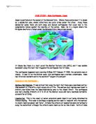
Kobe Earthquake, Japan
CASE STUDY - Kobe Earthquake, Japan Japan is positioned on the margin of the Eurasian Plate. Where these plates meet it is known as a subduction zone, where effectively one plate slides under the other. Along these subduction zones there are both deep and shallow earthquakes that occur due to the compressive forces against the meeting of the plates. Kobe lies in a region where the Philippine Sea Plate is thrust under the Eurasian Plate (See picture below) At Osaka Bay there is a fault called the Median Tectonic Line (MTL), and it was sudden movement along this fault that triggered the earthquake that hit Kobe. The earthquake happened early morning 5:45am JST January 17 1995, the epicentre was at Akachi. It was 7.2 on the Richter scale; this earthquake was a national catastrophe. Kobe has 1.5 million residents and is the worlds 6th largest city and port. Impacts of the Earthquake : Surface Fault Rupture: It was noticed that along the fault that there was a maximum vertical displacement of 1.2m with a right-lateral slip of 2.1m. The surface fault rupture was found to stretch over 60km from the Kobe-Nishinomiya area to the Akashi Strait. The earthquake also had a shaking intensity of X to XI on the Mercalli scale and had a maximum horizontal acceleration of 0.84g. Liquefaction: This is the result of water saturated sands found in soil being disturbed by intense

The Amazon River
Amazon The Amazon River is the second longest river in world. The headwaters begin high in the soaring Andes Mountains and stretches 6,400 km across the South American continent to the Atlantic Ocean. It discharges between 34 to 121 million liters of water per second, and depositing an average of 3 million tons of sediments near its mouth. The outpouring of water and residue is so vast that the salt content and the color of the Atlantic Ocean are altered for a distance of about 320km from the mouth of the river. Also, unlike many other rivers it¡¯s wide and straight from the headwaters to the mouth. During a new or full moon, a wave front from the ocean sweeps 650km upstream at speeds of 65km/h and this causes waves as high as 5m. Because of its vastness, annual floods, and navigability, the Amazon River is often called the Ocean River. The Amazon River is the largest and wettest tropical plain on Earth with heavy rains. Europeans were not the original keepers of this vast rainforest. The Amazonians are trapped between the old and new customs, and since they have traditions, their technology isn¡¯t as modern as the rest of the worlds¡¯. They live on the richest land with a wide variety of flora and fauna. With such great resources, including the river as transportation, almost anybody would want to seize the land and gain profits easily. The Amazonians have little
To What Extent Does the Seaside Resort of Bridlington Cater For the Needs of the Elderly People Who Have Retired To the Peaceful Seaside Resort, Also Do the Facilities Cater For Tourism That Can Be Expected?
Bridlington GCSE Coursework TO WHAT EXTENT DOES THE SEASIDE RESORT OF BRIDLINGTON CATER FOR THE NEEDS OF THE ELDERLY PEOPLE WHO HAVE RETIRED TO THE PEACEFUL SEASIDE RESORT, ALSO DO THE FACILITIES CATER FOR TOURISM THAT CAN BE EXPECTED? Introduction Site and situation, Bridlington is situated on the East coast. It is in the north of Britain. There are many neighbouring resorts offering the same features. This will mean that the resorts are always in competition. Seaside resorts have to have a wide thresh hold otherwise; most of the businesses, which are tourist orientated, will shut down. Bridlington is one of the better-situated resorts. It is in near the centre of England so it will never be too far from tourists. The main areas from which the tourists will come from are Yorkshire, Derbyshire, Leicestershire, Nottinghamshire and Humberside. Many will come from further. Bridlington is in direct competition with Scarborough and Whitby. Both are big tourist resorts. History The town of Bridlington dates back to the 11th century when it was mentioned in the 'Doomsday' Book, except then it was known as 'Bredlington'. During the last 1000 years Bridlington has been visited by several monarchs, starting with Edward II in 1319. But it is within the last century that Bridlington has become recognised as a beautiful seaside resort. Bridlington was an ideal site,
How Do the Land Use Patterns in Hebburn Compare with the Urban Models of Burgess and Hoyt?
How Do the Land Use Patterns in Hebburn Compare with the Urban Models of Burgess and Hoyt? In my coursework I will be trying to answer the question above. I will identify what the models of Burgess and Hoyt are and how useful they are in showing how towns develop. Burgess and Hoyt are land use models, which demonstrate that towns develop and grow in a pattern, with the CBD (Central Business District) as the main focal point and that towns develop and outwards from this area. Both models show land use patterns and are based on concentric circles. Burgess is the simpler of the two models; Hoyt's model is more complicated because the concentric circles intersect one another. I want to ascertain if my hometown of Hebburn fits into either of these models, to establish this I came up with a series of hypothesis, which I thought might help me to understand whether Hebburn fits into these models. Hypothesis One of the aims of my coursework is to try and answer the hypotheses that we came up with in a class discussion. * Housing density increases as you move towards the town centre * Housing age increases as you move towards the town centre * Quality of housing declines as you move towards the town centre * Quality of environment declines as you move towards the town centre * The price of housing decreases as you move towards the town centre * Traditional heavy industry
Moneyless in Madras: Millionaires in Manhattan
Moneyless in Madras: Millionaires in Manhattan Warm droplets of rainwater bombarded the tin roof of the extremely modest dwelling that had a greater resemblance to a dog's kennel than the home of two men. The house was empty as the rain chattered loudly and naggingly on the roof. The sides of the house consisted of wood which had - by the look of it -been incompetently put together. On one of the four sides of the hut there was a gap in the wood, it had been covered by an old scruffy looking cloth, this gap was man-made and signified the threshold of the dwelling. There was no flooring in the shoddy dwelling which was reluctantly called home by two impoverished men. Instead there was natural ground that was parched suggesting that the dwelling had been set up before the rainy season had hit. Looking into the box shaped shelter through one of the many splinters of wood, one could see a few logs, which must have been used for fires. In a corner there were two Hessian mats which were no doubt used by the two men to imitate beds. There was little apart from that. This rather unattractive hut was a great contrast to its picturesque surroundings. The landscape was full of flora and fauna which were clearly blossoming thanks to the much needed and overdue rains. The woodland was a lush green colour as were the surrounding hills intercepted by deep valleys. The hut was in the middle

Investigationg Eco-systems At Sand Dunes
Geography Coursework Introduction For our Geography coursework we will investigate the ecosystem of Murlough Sand Dunes in groups of two. Murlough Sand Dunes are situated at Dundrum Bay, County Down as seen in the map to the right. During the Ice Age, over 10,000 years ago, a large ice sheet moved to the North West area. The ice sheet was separated by the Mourne Mountains. The weight of this ice sheet pushed down on the earth's crush causing land and sea levels to be lowered. After the ice age, land levels began rising again when the weight of the ice sheet was reduced, and sea levels also increased due to the melting ice. At Murlough Sand Dunes the land levels rose more than sea levels and so the dunes began to gradually form. When we investigate at Murlough Sand Dunes we will be aiming to look at: * Soil Variables: differences in soil pH, percent of soil moisture and percent of soil organic content between the older and younger sand dunes * Vegetation Variables: variety of vegetation species, percent of bare ground and percent of vegetation cover between younger and older dunes * How soil variables and vegetation variables are linked (e.g. how the growth of marram grass is affected by soil acidity) From these aims we expect to find that soil pH is more acidic in the older dunes, while more alkaline in the younger dunes, percent of soil moisture and

Costly congestion charges for cars.
Costly congestion charges for cars. Sophie Lakes I love my car! So sue me! Am I really the only person living in England who can hand-on-heart say that the pure convenience, comfort and care-freeness of cars makes me choose them over subways, buses and trams? No, I didn't think so. I left my office today to find a nonsensical piece of writing (that is, a parking ticket) had been carefully placed under the windscreen wiper of my innocent Renault Clio whose back wheel was just barely touching the yellow line that I had so hastily tried to avoid parking on this morning. Personally, I find it baffling. When children want an ice-cream but find that they are a few pennies short of a 99, they receive a smile and a 'I'll let you off this time'. Traffic wardens, on the other hand, have obviously never been in a hurry, have never run late and have never found themselves in a 3-mile traffic jam. It seems that traffic wardens are becoming increasingly similar to dictators, the Saddam Hussein's of the street, sadistic in their methods of monomania. Not only do car drivers, who lets face it, that's most us not brave enough to face public transport, have to pay for petrol, insurance, tax and the car itself, we now have to face fines for not just driving badly, but just, well, driving. Five weeks from now, England will see its first congestion charges, £5 a day for car drivers to