Whereas in Barkingside, there are lots of tertiary jobs, such as clothes shops, food shops, banks ECT… , and some secondary jobs, such as car manufactures
There wouldn’t be many job opportunities in Slapton, as there are hardly any places to work. The only jobs available would be to working on a farm, or in a shop/pub ECT…, which means employment in Slapton would be much lower then Barkingside. However there would be many job opportunities in Barkingside of all aspects (Primary, Secondary, Tertiary and Quaternary), jobs in Barkingside range from Gardening (primary) to IT Support (Quaternary).
Tourism is a big part of Slaptons economy, and creates many jobs, as people can rent out houses by the coast for tourists. The money gained by tourists can be used to buy expensive sea defences, such as rip rap, which are big rocks that take the impact of powerful waves, which cost around £2000. It could also be used to build more houses and shops for tourists, which will make more money for Slapton, and boost employment, and therefore increase many peoples’ standard of life.
Tertiary jobs, such as food shops, banks, gift stores ECT…, play a big role in the economy of Barkingside. It creates many job opportunities, especially for young people, so therefore decreases un-employment, and also decreases crime rate, as there would be less youths on the streets without jobs, committing crimes. This would increase the people of barking sides’ quality of life, making it a nicer place to live in. The money made from the jobs could be used to restrict crime in Barkingside, by setting up CCTV, and more police patrolling the area.
Socio-Economics of Slapton, and Barkingside
Here are the Socio-Economics for Slapton, compared to Barkingside:
We can see from the table that Overall, houses in Slapton are much more expensive than in Barkingside. This may be because there aren’t many houses (23), so to get one; it’s expensive, whereas in Barkingside, there are many houses (152), so people can sell them relatively cheap. We can also see that there are many detached houses in Slapton. This could be because there is a lot of space between houses, because of the amount of free land, and low population (South Hams district Council - 83,000). On the other hand, Barkingside has ‘too few sales’ for Detached, as there are much more houses per square mile, as it’s near the city. The most poplar type of housing in Barkingside is terraced housing. This is because Barkingside has a very high population (London borough of Redbridge - 252,000), and terrace houses take up minimum space, so can accommodate more people per square mile.
Comparing crime rates in the two regions
I can now compare the crime rate in both ‘South Hams District Council’ (Slapton) and ‘London Borough of Redbridge’ (Barkingside).
We can see from the Table that Overall, Barkingside’s crime rate, is much worse than Slaptons, with all offences of a given category being in some cases more than double. This can reflect on the quality of life in both places, Slapton having the better one, due to less crime. We can see that the ‘Violence against the person’ category has the highest frequency in both locations, indicating to us that violence of any kind against other people are not tolerated in both regions, as it has the highest number of caught offences. We can also see that for the ‘burglary dwelling offences’ category, Barkingside side has 7 more incidents of this crime recorded (Slapton being 1, and Barkingside being 8). This shows us that more people are likely to burgle other people in Barkingside, indicating to us the quality of life is worse in Barkingside. This could be because of the small villages South Ham District has (Slapton), as there are not many houses, or people, the community would be closer, therefore, reducing chances of burglary offences. Also as Slapton is an ‘Ageing population’, it would be less likely to have a lot of crime, as the mentality of older people would be to ‘retire happily’ rather then to create havoc and steal.
Comparing Human and physical features of Slapton and Barkingside
Another way in which Slapton and Barkingside Differ, is that Slapton is very Rural, which means it has many physical features, such as tress, grass and cattle, and has little people living in the area.
This is the opposite for Barkingside, which is very urban, which means it has many human features, such as buildings and roads, and has many people living in the area.
Comparing the Relief of Slapton and Barkingside
The relief of Slapton is very un-even, with lots of hilly land, and also flat land. Walking towards Slapton village, there was a big slope, which shows us that the relief of Slapton was low. There were also many hills, which tells us that the relief was also high, therefore making the relief as a whole in Slapton uneven. Because of the many hills in Devon, this makes it good for pastoral farming, which is sheep grazing, which may be a reason why Slapton has so many cattle. However, arable farming wouldn’t be suitable for Slapton, as the rain water would leech the nutrients out of the soil, while running down the hill, making it harder to grow crops. Also, because of its hills on the coast, it makes it a bad place to build on, as over time the coast would erode the land, and eventually the buildings would fall into the water, as the cliff’s break
However in Barkingside, the relief is very even, with roads with few slopes. The land is very flat and low lying. This is why Barkingside has many buildings, as flat low lying land is good for building on. It also would make it good for arable farming, as the flat low lying land would be good for growing crops, as the nutrients could not be drained away by the rain water.
I can now draw relief Diagrams for both Slapton, and Barkingside.
As we can see from the Relief graphs, there is a clear difference in the relief of the 2 locations. We can see that Slapton’s relief peeks at 120 metres above sea level, and its lowest point of relief is at 0, therefore we can say the relief from Slapton is jagged, and un-even. However, we can see from the relief of Barkingside, that it peeks at 40 metres above sea level, and has its lowest point of relief at 20, therefore we can say that Barkingside’s relief is smooth, and even.
Comparing the climate of Devon (Slapton), and London (Barkingside)
I can now compare the types of climate in both regions, by displaying Climate graphs, and explaining them.
We can see from the graphs that London’s maximum temperature peeks at about 23 degrees Celsius between the months July and August, and has its lowest temperature in January, when it’s at about 8 degrees Celsius. London’s minimum temperature peeks at about 14 degrees Celsius on the same months, and has a lowest temperature also in January, with about 3 degrees Celsius. Devon has a similar shape graph, but overall, has a lower temperature, with its maximum temperature peeking at about 20 degrees Celsius also between the months July and August, and a lowest temperature of about 9 degrees Celsius also in January. Its minimum temperature also follows a similar pattern with its peek at about 13 degrees Celsius on the same months and its lowest temperature at 4 degrees Celsius also in January.
We can see from the graphs that the sunshine hours differ in Slapton and Barkingside. In London, the highest hours of sunshine was in August with 200 hours of sunshine. The lowest was in December with around 40 hours of sunshine. In the graph for Devon, we can see that the highest number of hours of sunshine in May with about 220 hours of sunshine. The lowest was in December with 50 hours of sunshine that month. This information tells me that in Devon, it would be more suitable to have arable farming, as there is overall more sunshine, so crops get more sunshine, which means photosynthesis can occur for longer.
We can see from the graphs that the rain in London varies, and raises and drops dramatically at certain times. Its highest mm of rainfall is in November with about 62mm of rainfall, and a lowest point of about 33mm of rainfall, which occurs between February and March. Devon’s rainfall graph is more curved. It has its highest mm of rainfall in December with about 105mm of rainfall, and a lowest point of about 55, which occurs in May. We can see from the graphs that Devon has much higher rainfall than London, which tells us, confirms why it is such a suitable location to farm, as all crops get plenty of water. It’s a reason why the grass is so green is Devon
Day 1
On day 1 of our trip, we looked at how physical processes have shaped the landscape between prawle point and start bay. We studied many locations, such as Gammon head (grid reference – 76, 6,35,3 – from the south Devon OS explorer map – it is located to the left of prawle point) and Langerstone point (Grid reference – 78, 4, 35, 2 – from the south Devon OS explorer map – it is located to the right of prawle point), and looked out how the coastline has been affected over the years.
Slapton coast is made up of 2 types of rocks. Sedimentary rocks, such as sandstone, and metamorphic rocks such as schist. These two types of rocks are present on what’s known as headlands and bays, which can be seen today at Gammon head. For 1000’s of years the coast has been eroded, shaping it in the form of headlands and Bays. During the process of erosion, soft sediment rocks, such as sandstone, chalk ECT…, erodes more quickly, forming a Bay. The harder more resistant metamorphic rocks, such as schist, graphite ECT…, takes longer to erode, leaving it sticking out from the Bays.
Eventually, Bays will be filled with Small pebbles and sand, due to attrition, which is when rocks bang into each other, breaking bits of making the smaller, and smoother. There can also be a deposit of sediments such as gravel, shell fragments, and pebbles due to long shore drift, which is when sediments are deposited along the shore, by the force of waves, acting in a ‘zig zag’ pattern.
The ‘sediments’ will then build up behind the headland, eventually forming a bay.
There are many different types of erosion that occurs on during the formation of headlands and Bays. One type of erosion is hydraulic pressure, which is when powerful waves crash again the rocks, filling all the cracks. Pressure is built up inside the cracks, until eventually there is a ‘mini explosion’, and the cracks are forced to widen.
Another type of erosion that occurs of the coast of gammon head is corrosion, which is where salts and weak acids from the sea water slowly erode the rocks, wearing it away.
Corrasion is where powerful waves hurl rocks and pebbles at the cliff, breaking bits off pieced of the cliff, and therefore eroding it away.
These two types of erosion work together; Corrosion weakening the cliffs with corrosive substances in the water, and corrosion breaking bits off, by hurling rocks at it.
This is a diagram of the formation of headlands and bays.
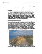
Picture of Gammon Head
As we can see, there are many types of processes that have shaped the way Gammon head is today. One such process is freeze-thaw weathering, which is when water gets trapped in the cracks of cliffs. Over night, temperatures fall below freezing point, when freezes the water in the cracks. This can expand the rock from up to 9%, which means that more water can fit into the crack, and the cycle continues. Over time, the rock will eventually break off, and fall into the sea, and change the appearance of the cliff face.
Another type of weathering on cliffs is salt crystallisation. This is when sea water gets into cracks of rocks. Sea water contains salt, and as the water dries out from the cracks, it leaves the salt, which will eventually grow into salt crystals. This will eventually break the rock, and over type change the landscape between Prawle Point and start bay.
Another type of weathering is biological weathering. This happens when vegetation grows on cliffs like the one shown in Gammon head. The roots from the vegetation on the cliffs get into cracks, forcing them wider. This eventually over time will break the rock, and cause a change in the landscape between prawle point and start bay
Picture of Langerstone Point
As we can see, due to erosion, and sea levels dropping, langerstone point’s appearance has changed a lot to how it was before. We can see a save cut platform, which is made when destructive waves constantly hit the bottom of cliffs. Causing it to wear away. This then develops a wave-cut notch, which is the ‘notch’ between the bottom of the cliff, and the top of the cliff. Over time the cliff becomes top-heavy, and breaks off, and falls into the sea, due to lack of support. A wave-cut platform is created.
Over time, due to the ice age the sea levels have dropped; causing langerstone point to look like it is today. Where the abandoned cliff was now, was once a raised beach, as the sea levels covered everything else. If sea levels were to rise, due to ice caps melting, from global warming, then the wave cut platform would be part of the sea bed, the raised beach would then become a wave-cut platform, and then abandoned cliff would become a cliff again. Hypothetically, everything would go down a level.
However, if the sea levels were to drop again; from another ice age, in contrast, everything would go up a level, so the wave cut platform would then become a raised beach, and the sea bed would then be exposed to erosion, which would over time, cause it to become the new wave-cut platform.
Sharpers Point
We then went to Shaper’s head (Grid reference – 78, 8, 35, 8 – from the south Devon OS explorer map – it is located to the right of Langerstone point), and looked at how the landscape has formed due to physical processes.
In Sharpers head, lies Sharpers cove, which is a very unstable cliff, formed from due to deposition. This deposition happened at the end of the last ice age, hence the term ice age cliff, which is what sharpers cove is. Large and small rocks were carried in ice, which was transported over seas, by meltwater. The rocks were then deposited when the meltwater met the sea. The cliff is entirely made up of sediment rock, hence why it is so unstable, and the rocks can easily be pulled out the cove, as they were deposited. The rocks also all point in the same direction, which shows us that they all came from the same direction, which was from the sea.