Bangladesh Brochure
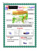
Location of Bangladesh Bangladesh is situated either side of the tropic of cancer. India shares its border with Bangladesh. The three main river flows through Bangladesh are the meghna, the Brahmaputra and the Ganges. The north of Bangladesh is the Himalaya Mountains, the highest mountains in the world. To the south is the Bay of Bengal. The Land & People Landforms: Flood Plains Population: 126 Million Delta Population Density: 800 per square kilometer The Land is Under 15 meters above sea levels 230 of rivers in Bangladesh What are Tropical Cyclones? Tropical storm, typhoon or hurricane is a type of low pressure system which generally forms in the tropics. While they can be highly destructive, tropical cyclones are an important part of the atmosphere circulation system which moves heat from the equatorial region toward the higher latitude. Keyword: Latitude: The distance of a place north or south from the equator (Places that are near to the equator or much warmer than places that are near the north and south poles.) How Are Tropical Cyclones Formed . Formative - clouds start forming over the ocean between 5 and 15 degrees latitude from the equator. 2. Immature - if the conditions are favorable, clouds

Travel and Tourism Worldwide Travel Destinations - Paris
AVCE Travel and Tourism Worldwide Travel Destinations Paris Task 1: General information: France is the second largest country in Europe and it fall into the northern hemisphere. In the northwest there is, the Brittany Peninsula, Normandy, which has fertile uplands, the Loire Valley and the Seine basin. In the south, the ground rises to the Massif Central; a region of high plateaux and in the east is the Rhone Valley. On the eastern boarders of France are the Jura Mountains, the Vosges and the Western Alps, which fall away on their northern slopes to Alsace-Lorraine. France has a population of 59 million people, who are scattered throughout the country, although Paris has 2.2 million people living in its city. The population is made up of: * French- 92% * North African- 3% * German- 2% * Breton- 1% * Other- 2% (Source: Lonely Planet guide for France) Government: The full name of France is the French Republic. The government type is called Republic and the president is Jacques Chirac. He was elected in 1995 while the prime- minister, Lionel Jospin, was appointed in 1997. The government has twenty-two administrative divisions, which consist of: * Alsace * Aquitaine * Auvergne * Basse-Normandie * Bourgogne * Bretagne * Centre * Champagne-Ardenne * Corse * Franche-Comte * Haute-Normandie * Île-de-France (Paris falls into this administrative division) *
Population Density and CBD
Name an area of the UK which you have studied describe and explain why it has a high population density. Greater London, in the South East of England is very densely populated. The area is situated around central London and the River Thames. The main economic reasons that London is densely populated are: It is the most accessible part of the UK with train links to all over the UK and Paris, France. Six Major motorways start from London and lead out all over the country, this makes it more popular for people who are commuting to and from London everyday and tourists from all over. The largest and the UK's wealthiest markets are situated in London, as well as businesses and other firms. This is because London is the capital city of England and has all the major government buildings as well. London also has a large variety of work, compared to other remote or less populated parts of the country, London has many more job opportunities, low and high paid. This attracts people to Greater London for residential purposes. Other reasons are, that London has an absence of harsh climates, which makes it more popular to live, other places like Scotland are higher up and nearer to the colder parts. This makes London more popular with tourists as well as residents. London also is the centre of all communications throughout the UK because it is the capital city. This brings more people to

Pros and cons of renewable energy - wind power, solar and biomass.
Advantages and disadvantages of wind power A wind turbine works the opposite of a fan. Instead of using electricity to make wind, like a fan, wind turbines use wind to make electricity. The wind turns the blades, which spin a shaft, which connects to a generator and makes electricity. Advantages * The wind is free and with modern technology, it can be captured efficiently. * Once the wind turbine is built, the energy it produces does not cause green house gases or other pollutants. * Although wind turbines can be very tall each takes up only a small plot of land. This means that the land below can still be used. This is especially the case in agricultural areas as farming can still continue. * Many people find wind farms an interesting feature of the landscape. * Remote areas that are not connected to the electricity power grid can use wind turbines to produce their own supply. * Wind turbines have a role to play in both the developed and third world. * Wind turbines are available in a range of sizes which means a vast range of people and businesses can use them. Single households to small towns and villages can make good use of range of wind turbines available today. Disadvantages * The strength of the wind is not constant and it varies. This means that wind turbines do not produce the same amount of electricity all the time. There will be times when they produce

How the types of shops in Stourbridge Change from street to street.
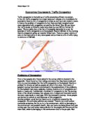
CONTENTS Study Area- 2 Study Area I am doing my survey in the dormitory town of Stourbridge, which is just outside Britain's second city of Birmingham and is on the edge of an area called the Black Country. Most of the people who live here usually commute into places like Merry Hill or into Birmingham where there are more jobs. The main industry in Stourbridge is its glass works and it is world famous for building the first steam locomotive to run in U.S.A called the Stourbridge Lion. Introduction The issue that I am going to be studying is how the types of shops in Stourbridge Change from street to street. This would be a good topic to study because of the different types of shops in the area vary a lot and I can see how the increase of the retail market in the area has attracted different types of shops there. I am conducting my study in Stourbridge town centre, which is the central retail district (CBD) in the area. There are three main streets in the town centre High Street, Talbot Street and Market Street. There is also a main covered shopping centre called the rye market where the main shops are. I am doing Talbot Street and Market Street as one whole street as the lack of data I got from the each street. Aims I intend to prove that the groups of shop in Stourbridge town centre are based on where their competitors in the shops field are. Hypotheses My
An Attempt to Delimit the C.B.D of Stamford.
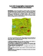
G.C.S.E Geography Coursework An Attempt to Delimit the C.B.D of Stamford- Introduction: The aim of this coursework is to define the edge or the boundary of the Central Business District of Stamford. Stamford is a market town that is situated 100 miles north of London, just off the main A1 road to York and Edinburgh. It is located at the southernmost tip of Lincolnshire, where it meets the counties Cambridgeshire, Northamptonshire and Rutland. Stamford is part of the South Kesteven District. The town is centrally located to the east of the existing motorway network and has good links to the rest of the country. The C.B.D is the central area of the town, which contains the main concentration of shops, offices, places of entertainment and public buildings. These are some of the characteristics of the Central Business District: ) Multi-storey development-High land values force buildings to grow upwards so the floor space of the C.B.D is much greater than the ground space. 2) Concentration of retailing-High levels of accessibility attract shops with high range and threshold characteristics such as department stores in the most central areas and the specialist shops in less accessible areas. 3) Public transport is concentrated-There is a convergence of bus routes on the C.B.D. 4) Few people live in the C.B.D- These are limited to a few luxury flats as well as some

Changes to the countryside, comparing the present day with fifty years ago.
Cara James, 7T (TE6) Monday, 5th February 2007 Changes to the countryside Present day contrasted with fifty years ago There is a huge contrast between the type of farming we have in Britain today and the farming we had fifty years ago. Machines, modern equipment, large commercial farms and chemicals did not exist in Britain fifty years back. Although all these modern day inventions have helped to make farming a lot easier and there is more environmental awareness, not all changes have been for the better. Forty years ago England was only producing 1/4 of the food that we consumed, all the rest of the food was imported mainly by ships! But in world war two, the German navy bombed many ships that were importing our food, or the food did not reach us for whatever reason. It was only then that the government started to pay farmers more money to grow more crops, and to get their buildings and farms up to scratch. As farmers got paid more money and the government began to take farming much more seriously, encouraged the production and development of machinery and fertilizers. The types of machines made, were used for ploughing, harvesting and fertilising the crops. This made a farmer's job and life a lot easier. Before the machinery was invented, some farms had about 50 people

Globalisation in India
The purpose of this paper is to identify the effects of globalisation on the development policies in India as the nation attempts to embed western style capitalist structure and technologies on to traditional way of life, and to find out how India is responding to these challenges in its drive towards economic development. What is globalisation? Globalisation is the shift toward a more integrated and interdependent world economy. This is largely the result of planning by politicians and business organisations to breakdown borders hampering trade to increase prosperity and interdependent thereby decreasing the chance of future wars. Globalisation is not a new concept, the potential effects of globalization, positive and negative were recognized 150 years ago by the political philosophers Marx and Engels. They did not use the word "globalisation", but their themes and concepts sound remarkably similar to our world in 2008 (Marx and Engels 1996, pp.98-137). The merging of historically distinct and separate national markets into one huge global marketplace, falling barriers to cross-border trade have made it easier to sell internationally. Also the sourcing of goods and services from locations around the globe to take advantage of national differences in the cost and quality of factors of production (such as labour, energy, land and capital). The development of communication

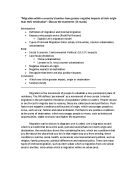
People use the cycle lanes more during weekdays than over the weekends.
Introduction Hypothesis People use the cycle lanes more during weekdays than over the weekends. The following is a fieldwork project looking at the cycle lanes in Broadstone. A cycle lane is a section of the road, which is only allowed to be used by cyclists it can also be a specifically marked path running through the woods. The lanes on the road are divided from the road using a white line; signs usually indicate the beginning and the end of the lanes. The part of the cycle paths that I am concentrating my survey on is part of the Castleman railway (see map on page 1). All around the world people are aware of the fact that pollution from cars, factories and other such man-made machinery, is causing permanent to the planet. Something has to be done to cut down the number of cars and to improve the environment. People nowadays are conscious of the fact tat that as a human race in total, we are becoming much lazier and lacking fitness due to the modern technology that we possess. The growing congestion of vehicles is beginning to become a major dilemma. Organisations, such as Sustrans, are trying to solve these problems by promoting and creating cycle lanes. Sustrans plans to complete a National Cycle Network that will be 7,000 miles long by the year 2005. It will create "safer routes and a healthier environment". But not enough people are moving to this type of transport,

I think the hypothesis of the CBD was a good place to start because it helped me to concentrate on the important things from the investigation, it also kept me focused and I had something to aim for.
Chapter 5 Evaluation I think the hypothesis of the CBD was a good place to start because it helped me to concentrate on the important things from the investigation, it also kept me focused and I had something to aim for. Questionnaire The questionnaire was an important method because by asking the public a range of questions it created lots of data. Although it was good some people could have answered twice which would have caused me to double up my results. I did a sample size of 50, which was too small; I should have done 100. Somepeople refused to answer the questionnaire that meant my results would have changed in a big way. Somepeople may not have known the area aswell so could have guessed for some questions. These things could have been improved by having a larger sample size of 100. Doing the questionnaire in parts on different days, which would have shown a more spread out set of results. Bi-polar Another important method we used was the bi-polar, it was attractive, clearly defined it showed good results and helped us find the zone of improvement and the zone of decay. The problem with these results were that people would have different opinions on the same area, for example I could mark area 1 (Wilkinsons) 79/100 and then another pupil from the same class could mark it 31/100 this can cause a problem in the final results. The weather can change from good to bad