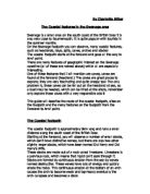
Studland Bay & Ballard Down
Another landmark near Studland is Ballard down, it is an area of chalk down land between Swanage and Studland. The down was an area of calcareous (Alkaline) grassland for up to a thousand years until WWII when there was a sudden rise in the need for available agricultural land to feed the soldiers. Since the need for agricultural land the Down is now owned by the national trust and has been returned to grassland, to accommodate species of clover plants, flowers and insects, particularly butterflies.
Ballard Down Grassland
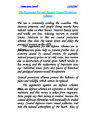
Lulworth Cove
Lulworth is a circular, sheltered bay by the village of west Lulworth on the Jurassic coast world heritage site in Dorset. Lulworth Cove was formed by the sea breaking through a comparatively thin layer of hard Portland Stone that runs parallel to the shoreline. Once through, the waves allowed much softer clays to be eroded away, much slower than the hard rock. When a straight wave hits a barrier with a hole in it, the wave pattern on the other side is semi-circular. The curved waves radiate out from the Cove entrance showing how Lulworth got it’s shape. Like below.
Durdle Door
Durdle is an erosional land form on the Dorset coastline. It is made of Jurassic limestone. You can only reach it on foot. Each year more than 200.000 walkers use the footpath between Lulworth Cove and Durdle Door, making it the busiest stretch in the south west.
Other landforms
Ringsted Bay- is another bay much like Studland
Kimmeridge- The sea has eroded and exposed layer after layer of rock on cliffs of Kimmeridge Bay. These layers are full of fossils from the Jurassic period. Even before Kimmeridge became part of the UNESCO Dorset and East Devon World Heritage Jurassic Coast, an entire stage of the Jurassic Period - the Kimmeridgian was named after it.
Depositional Landform
http://geobytesgcse.blogspot.com/2007/08/coastal-deposition-landforms-features.html
How beaches are formed
Beaches consist of all the material (sand, shingle etc.) that has built up between the high and low tide mark. The main source of beach material is rivers, where fine muds and gravels are deposited at the river mouth. Other sources of beach material include longshore drift (bringing material from elsewhere along the coast); constructive waves and from cliff erosion.
As constructive waves build up beaches, they often form ridges in the beach known as berms. The berm highest up the beach represents the extent to which the water has reached during high tide.
How Bars are formed
These form in the same way as a spit but are created where a spit grows across a bay, joining two headlands. Behind the bar, a lagoon is created, where water has been trapped and the lagoon may gradually be filled in as a salt marsh develops due to it being a low energy zone.
How Tombolos are formed
Tombolos are formed where a spit continues to grow outwards joining land to an offshore island.
How spits are formed
The formation of a spit begins due to a change in the direction of a coastline - the main source of material building up a spit is from longshore drift which brings material from further down the coast. There is a slight drop in energy, and this is where longshore drift deposits material quicker than it is removed. Quickly, a ridge builds up, projecting out of the sea.
The Geology of the area
The area is comprised mostly of clay, gravel, mud and limestone, most of which are easily eroded. This is why there are so many different landforms in the area, it's much easier for the waves to cut into the land and create the things we see there.
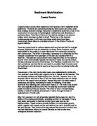
Coastal Management of Swanage
Swanage Bay has used Groynes to slow down the effects of longshore drift ( they are replaced regularly ) and used Beach Replenishment ( placing more sand on the beach from another source) .
The groynes were first built in 1925, eighteen of them were reconstructed in 2005-6 at the same time the beach was replenished.
The groynes cost £5000 each to build and replace, and the beach replenishment cost £3500 per metre.
The only drawback of Beach replenishments is the cost. Groynes are very useful for slowing the effects of longshore drift to stop the beach from being carried away, but they are expensive in the numbers required for them to be effective. Neither of these coastal defences are completely successful in defending against floods in Swanage.
Another type of Groyne is a Gabion Groyne. Gabion Groynes are not used in Swanage, they are gabions that are lined up horizontally to the shore and are used as groynes. Steel caged gabions will last 20-25 years, while stainless steel gabions will last much longer.