The changes in the river valley and features along the profile allow the river to be subdivided into three sections: the upper, middle and lower course. Features of the upper and middle course can be noted from Loughton Brook.
▼Figure 5 Transporting the river’s load.
The River Profile
The long profile of a river shows a steep gradient at the source. In the upper course the river has a lot of potential energy and is trying to reach base level, hence the main process is erosion. The river erodes vertically (downward direction) in order to reach base level. Gradually the gradient becomes less steep and lower until the sea is reached. The normal profile is smooth and concave.
The Upper course
The upper course of a river is the beginning of the river, close to the source. The main process in the upper course is erosion.
▼Figure 7 Upper course.
The Middle course
As the river flows downstream, further away from the source, the river is closer to base level and the gradient less then in that of the upper course. The major process of the river becomes lateral erosion, although vertical erosion does continue. A river has surplus energy as it flows from the upper course and begins to meander, this uses up the river’s energy. This can be seen in site 2 and 3. Erosion on the outsides of the meander removes interlocking spurs, a feature of the valley profile in the upper course. Interlocking spurs can be seen in site 1 of Loughton Brook but are not visible in site 2 and 3.
A meander is a bend in a river in the middle and lower course. On the outside of the meander the current flows fastest and the water is deeper. On the outside of the bend the water erodes and undercuts the river cliff, and hence causes the cliff to retreat. On the inside of the bend the current flows slower and the water is shallower. Sediment is deposited onto a slip off slope (deposition of sand and shingle). Eventually, the meander will migrate.
▼Figure 9 Meander formation. A: Plan view. B: Cross-section
Meanders become larger and bend more. Erosion on the outside of the bend and deposition on the inside of the bend will eventually lead to the formation of an ox-bow lake. The neck of the meander eventually is broken and a new straight channel is formed.
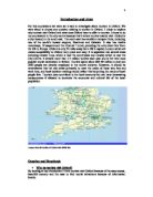
Methodology
In our investigation of Loughton brook, we collected data from three sites; one site in the upper course and two in the middle course. The data we collected from the sites was primary i.e. we collected it our self. The data received from the guide was secondary i.e. it was collected by someone else. The investigation was carried out in groups to speed up the investigation due to the time constraints of the field trip. Also, eating and drinking was not permitted while completing the investigation because of the risk of catching Weil’s disease from Loughton Brook which is caused by rat urine. The following characteristics of the river were measured:
Equipment:
Description of the methods:
The following are a description of the various data collection methods used in our investigation:
Water Width
We used a tape measure to calculate the length of the water surface between the left and right bank. The tape was taut, as perpendicular as possible to the both banks and just touching the surface when the measurement was taken.
The tape measure was used to calculate the water width because the width of the river (in site 2 and 3) was greater then one meter making the meter ruler unsuitable for the task.
We measured the Water Width to test out the hypothesis: water width will increase the further downstream of Loughton Brook. More tributaries will result in more water which should result in more erosion making the river wider.
Wetted Perimeter
The wetted perimeter is the total length of the bed and the water width added together. In preparation to take this measurement we cleared the leaves from the river bed. The tape measure was then laid on the river bed and the distance from left bank to right bank was measured.
The tape measure was most suited to this task due to its flexibility. Hence, the curved surfaces in the river bed could be measured accurately.
We measured the Wetted Perimeter to test out the hypothesis: the volume of water in the channel would increase the further down stream of Loughton Brook. More tributaries will join Loughton Brook, as can be seen on the map of Epping Forest, which means that there should be more water in the channel.
Water Depth
The water depth was taken on the LHS, M and RHS of the channel. We used a meter stick to measure the distance from the bed to the water surface. This measurement was taken in three places so that an average depth could be calculated.
The meter stick was most suited to measuring the water depth because it was 1meter long (greater then the depth of Loughton Brook), did not have to be stretched and measured the water depth to the nearest centimetre.
We measured the water depth to test our hypothesis: the water depth would increase the further down stream of the Loughton Brook. As there should be more water in the channel this will result in more erosion as the river will have more energy to carry sediment. More material in the water should result in more erosion and make the channel deeper.
Height of left bank / Left bank to water and height of right bank / right bank to water
.
The distance from left bank to water and right bank to water were measured to test the hypothesis: The distance from bank to water would increase the further downstream of Loughton Brook. The further downstream of Loughton Brook the more erosion would take place which should make the channel deeper and result in the height of the banks increasing,
Float time
The float time was calculated by timing how long it took a cork to float 50cm downstream of Loughton Brook. A meter ruler was placed on the water surface (and held in place by a team member) and then cork was dropped approximately 10 cm before the beginning of the meter stick. The time taken for the cork to go from the start of the meter stick and then 50cm downstream was measured.
Gradient (°)
The gradient was taken by placing two ranging poles 2 meters apart. A person held each ranging pole so that the tip was just touching the water surface. A Clinometer was then used to check the change in gradient between the two points.
A Clinometer was used to measure the gradient because it gave an accurate measurement of the gradient to the closest degree.
The gradient of measured to test the hypothesis: The gradient of the river would become less steep the further downstream of Loughton Brook. Vertical erosion is the most dominant process of erosion in the upper course as the river tries to reach sea level because of the action of gravity. As the river is closer to sea level in the middle course there is increased lateral erosion and less vertical erosion, This should result in the gradient becoming less steep in the middle course.
Pebble Analysis
The pebble analysis was taken by placing the meter stick along the river bed and choosing a pebble from the river bed every 10cm from a random point. The pebbles were chosen and the placed in a white container to be judged what category the pebble fell into; very angular, angular, sub-angular, sub-rounded, rounded or well rounded.
A meter stick was used as it could easily be placed on the river surface, because it is dense, hence would not move as a result of the water flow. The pebbles were then collected in plain white container with no lid.
We conducted a pebble analysis to test the hypothesis: Pebbles in the river would become smaller and more rounded (i.e. less angular) the further downstream of Loughton Brook. There is more water in the channel in the middle course so more erosion will take the place and hence, there will be more saltation.
Data Presentation
The primary data collected from Loughton Brook.
From this graph it can be seen that the water width increased the further downstream of Loughton Brook. The water width is significantly larger in site 3 then in site 1 and 2. (relate to river theory) There is a clear correlation; the further downstream of Loughton Brook the greater the water width. This supports my hypothesis made at the beginning of the investigation.
It can be seen that the wetted perimeter increased from site 1 to 3. The wetted perimeter is significantly larger in site 3 then in site 1 and 2. There is a gradual increase in the wetted perimeter from site 1 to site 2. However there is a rapid increase in the wetted perimeter from the site 2 to site 3.There is a clear correlation; the further downstream of Loughton Brook the greater the wetted perimeter. This supports my hypothesis made at the beginning of the investigation. INCLUDE RIVER THEORY IN EACH SECTION!!
WETTED PERIMETER TO DEPTH AND WIDTH OR VOLUME. The conclusion makes sense because the water depth has increased bla bla.
In site 1 the middle of the river is deeper then the sides which can be possibly be accounted for by vertical erosion. However in site 2 and site 3 one side of the river is deeper and the opposite side is shallower. In site 2 the right hand side is deeper than the left hand side. In site 3 the left hand side is deeper than the right hand side. This data can be accounted for the river meandering. The average depth increases the further downstream of Loughton Brook. This supports my hypothesis made at the beginning of the investigation.
The height of the left bank does not appear to correlate the way that my hypothesis made at the beginning of the investigation predicted. The height of left bank is less in site 2 then in site 1. This result is unexpected and may be due to human error or values being recorded that were not a true representation of the site. The height of the left bank is greater in site 3 then in site 1.
From this graph it can be seen that the distance from left bank to water increases further downstream of Loughton Brook. This supports the hypothesis made at the beginning of the investigation.
Other types of graph…complex list. Scatter graph with a line of best fit.
Photograph that has been heavily annotated.
Spearmans rank. Height and width correlation. Water volume and gradient. Any two pieces of data that had been collected.
The distance of the right bank to water follows the pattern that I would expect to see. This data supports the hypothesis made at the beginning of the investigation. The distance from right bank to water is greater in site 2 then in site 1 and greatest in site 3.