Transport problems - Pricing Road use for Greater Responsibility, Efficiency and Sustainability in cities. Progross is a research and demonstration project into road user charging in cities, supported by the European Commission
Transport Problems
Progress
Pricing Road use for Greater Responsibility, Efficiency and Sustainability in cities. Progross is a research and demonstration project into road user charging in cities, supported by the European Commission
Rome (Italy):
Rome, the capital of Italy, covers an area of 1,290 Km² and is located in the region of Lazio, on the west coast of the North-South centre of the country. The metropolitan area of Rome, instituted by law 142/90 covers 5,352 km² and 3,981,000 inhabitants. Rome's main activities, as country capital, are in the administrative, political and service sectors. Also the tourist sector, including transport, hotels and others, is an important asset of the City entrances: these economic activities are generally concentrated in the geometric centre of Rome, especially in the historic part.
In spite of this concentration of activities, a sufficiently developed radial system of connection and services has not been developed. In fact, the public transport system handles only 40 per cent of the total trips while 60 per cent of trips are made by private transport. This mode split is further characterised by a large number of private vehicles (about 1,800,000) despite the general lack of parking spaces.
This dominance of the private car is particularly difficult to manage given the urban fabric of Rome, which was not designed to accommodate cars with roads narrow, uneven, and not forming a grid pattern. Notwithstanding, through the development of sustainable mobility policies and the use of ITS systems (Traffic Control Room display in the picture), the City Administration is trying to reduce congestion, the impact of air pollution, long trip times and high transportation costs.
Rome's activities in PRoGR€SS
The demonstration site was already selected, either in terms of the pricing zone or for the necessary technological installations (entrance gates).
The access control system comprises 24 electronic gates able to effectuate, without user intervention, the identification and/or the applicable tariff for vehicle entrance into the restricted area. The work plan for the exit gates was defined and the implementation will begin in 2001. The infrastructure installation will expect a series of exit gates (approximately 29).
The gate infrastructure, based on the technology used for the TELEPASS system includes TV Camera and IR illuminators, Microwave Transponder, and On-board Unit with Smart Card (35,000 users, including freight delivery etc.) will be verified, both in terms of technological choices and ability to carry out the requested performances.
Example of a gate shown on the left, with an on-board unit depicted in the corner
The simulations of the possible Rome RP scenarios will permit to evaluate the results of the pricing program and to identify the optimal pricing configuration of the system, also integrated with the public transport supply, in orer to reach the objectives of the City Administration. The assessment of users' behaviour towards the RP measures and their level of acceptance will be taken into account.
The overall possible levels of an integrated urban pricing scheme (i.e. including on street parking strategies and P&R facilities) will be analysed, integrating the capabilities of both the key actors in mobility (the Municipality Mobility Agency STA and the public transport ATAC/COTRAL): possible service alternatives (in terms of frequency, vehicle type, number of stops, ticket costs, etc.) in order to analyse road pricing impacts on the new bus line will be formulated.
The demonstration in Rome will be long and articulated. It will begin in the year 2000 with the per-trip charging, using entrance gates. The second phase will provide data on a permanence of stay pricing program, using a closed system (with installed exit gates).
A series of experiments to assess behavioural responses to a number of possible charging regimes (e.g. from pay-per-trip to pay-per-time) will be done. Very important issues to solve are consultation and user needs analysis - throughout the entire project it will be a continuous information interchange with citizens and representative associations, aimed to calibrate and organise the Demo campaign on the basis of their needs and requests.
General information will be distributed on the phasing of the pricing program; to whom it applies, what exceptions exist (for example, how to handle emergency room visits for the hospital in the historical centre), impacts on tourism, etc.
Oxford Transport Strategies:
The aim of the Oxford Transport Strategy (OTS) is to achieve significant environmental improvements in Oxford city centre, whilst allowing continued growth of the city centre economy.
The Strategy is based on an 18-month consultant's study during 1992-93. The study included extensive public consultation and looked at many issues, including:
* the increasingly poor conditions in the city centre, particularly for pedestrians;
* the high levels of traffic-related air pollution throughout the central area and the increase in the number of buses in the main shopping streets; and ...
This is a preview of the whole essay
Oxford Transport Strategies:
The aim of the Oxford Transport Strategy (OTS) is to achieve significant environmental improvements in Oxford city centre, whilst allowing continued growth of the city centre economy.
The Strategy is based on an 18-month consultant's study during 1992-93. The study included extensive public consultation and looked at many issues, including:
* the increasingly poor conditions in the city centre, particularly for pedestrians;
* the high levels of traffic-related air pollution throughout the central area and the increase in the number of buses in the main shopping streets; and
* the unacceptably high number of road accidents, especially in High Street.
The Strategy, which is jointly supported by the City and County Councils and central Government, is tackling these problems and has been gradually phased in over the last five years.
Implementation of the full Strategy will transform the central area. Oxford city centre will then become a much more pleasant place in which to shop, work, visit and live. A series of opinion surveys since 1993 have shown that there is overwhelming public support for the Strategy. A public inquiry into measures to restrict general traffic in the city centre and to pedestrianise Cornmarket Street was held early in 1998. The Inspector fully endorsed both the broad approach of OTS and the specific proposals to restrict traffic the High Street, Cornmarket and Broad Street.
Improvements
When completed, around 90 individual measures will have been introduced on a step-by-step basis as part of the Strategy. Improvements to travel by bus, cycle and on foot need to be in place before measures to restrict car traffic in the city centre can be introduced.
So far the City and County Councils have carried out the following measures:
* bus priority along the Woodstock, Banbury, Abingdon and London Roads, and also on Botley Road where Oxford has the only bus "pre-signal" system outside London;
* SCOOT traffic signal control - ongoing;
* improvements to the City's cycle routes and parking, including an extra 350 parking spaces in the city centre;
* continual review of on-street parking controls and enforcement improvements - Oxford is a Special Parking Area;
* provision of over 700 extra spaces at the park and ride car parks, together with improved signing, information and security. The park and ride bus services now run late into the evening and all day on Sundays;
* major alterations to the ring road including junction signals;
* introduction of a Shopmobility scheme based at the Westgate car park, improving access to City centre shops for people with disabilities;
* pedestrianisation of Cornmarket Street and part of Broad Street;
* restriction of through traffic in High Street and Castle Street;
* creation of bus priority route around central area (as an alternative to using Cornmarket Street);
* removal of one-way streets around the west side of City centre;
* major changes to traffic management in Oxford city centre;
* more bus priority on the Abingdon & Botley Roads and at traffic signals throughout the City;
* parking controls in the central area and Norham Manor;
* traffic calming in the Science Area; and
* increase in parking for orange badge holders.
Oxford's two main bus operators continue to upgrade their fleets (the Park and Ride fleet was completely replaced in the summer of 1999), utilising the latest technology to reduce emissions and particulate matter, and have entered into a joint ticketing scheme with one another.
Environmental Enhancement
The City Council has appointed Gillespies as consultants to advise on how the benefits of OTS can be maintained in terms of improvements to the streetscape. A public realm strategy has been devised which sets out the policy context and objectives. It recommends design principles and guidelines for implementing enhancement schemes.
Singapore:
Top of Form 1
Bottom of Form 2
Land Transport
Singapore recognises the importance of an effective land transport network - one that is integrated, efficient and cost-effective, which meets the people's needs and expectations, and supports economic and environmental goals. To achieve its objective, the Government has adopted a multi-pronged approach:
* integrating land use and transport planning
* expanding the road network
* managing vehicle ownership and usage
* improving the public transport system
The Land Transport System
The Land Transport Authority (LTA), a statutory board under the Ministry of Communications & Information Technology, spearheads all land transport developments in Singapore. It plans, develops and manages Singapore's land transport system to support a quality environment while making optimal use of transport resources to serve the travelling public.
Roads
There are 3,122 kilometres of roads, of which 3,090 kilometres are asphalt-paved. There are eight expressways with a total length of 150 kilometres. The 41-kilometre Pan Island Expressway (PIE) is the longest road on the island. The longest of the 96 flyovers is the Keppel Viaduct which is 2.1 kilometres long. There are 396 pedestrian bridges made of steel and concrete. Along the Central Expressway (CTE) are two tunnels measuring 0.7 and 1.7 kilometres.
Motor Vehicles
As at 31 December 2000, there were a total of 692,807 registered motor vehicles in Singapore. This comprises 395,218 cars, 131,937 motorcycles and scooters, 134,756 goods and other vehicles, 18,327 taxis and 12,569 buses.
Electronic Road Pricing
The Electronic Road Pricing (ERP) system, which came into operation in 1998, replaced the coupon-based Area Licensing Scheme (ALS) and the Road Pricing Scheme (RPS) as Singapore's main traffic management tool. The ERP system charges motorists every time they drive past an ERP gantry during operational hours. Charges are deducted from a stored-value Smartcard inserted into the in-vehicle unit (IU) in the car following radio communication between the IU and the ERP gantry.
The ERP system is flexible as charges depend on location, vehicle type and the time of day. The charges are set higher during busy periods and lower during lull periods. Vehicles which take up more space and thus contribute more to traffic congestion can also be charged higher rates.
The ERP system is operational at 28 gantries in the Restricted Zone, 11 gantries at expressways, and three gantries at the outer ring roads.
The ERP operational hours are from Mondays to Fridays 7.30am to 7.00pm at the Restricted Zone, and from Mondays to Fridays 7.30am to 9.30am on the expressways and outer ring roads.
Bus Services
There are three companies, namely Singapore Bus Service (SBS), Trans-Island Bus Services (TIBS) and Singapore Shuttle Services (SSS) that provide full-day scheduled bus services. There are 268 services and a fleet of 3,633 buses. For faster service, seven express services with 83 buses ply the roads regularly. In addition, a 'Bus Plus' scheme provides upmarket minibus services during peak hours on weekdays. In 2000, 32 buses plying seven routes operated under this scheme. There are also special Night buses for commuters who travel after normal service ends at midnight.
Taxi Service
There are four groups of taxi operators, namely, Comfort Transportation (recognised by their light blue cabs), CityCab (yellow), TIBS (beige) and Yellow-Top (black and yellow top), operating a total fleet of 18,327 taxis at the end of 2000. Taxi fares were de-regulated in September 1998 and they compare favourably with most major cities in the world.
Mass Rapid Transit System
The 91-kilometre long MRT system is a conventional, electrically driven railway system. It has 48 stations and comprises two main lines - the East-West Line from Pasir Ris Station to Boon Lay Station and the North-South Line from Marina Bay Station to Jurong East Station via Woodlands Station.
North-East MRT Line
The 20-kilometre North-East Line, which is currently being built, has 16 underground stations. Running from the World Trade Centre in the South to Punggol in the North-East, it will be completed in 2002. This line will intersect with the existing system at Dhoby Ghaut and Outram MRT Stations.
Changi Airport MRT Extension
The six-kilometre Changi Airport MRT Extension will be an extension from the existing East-West Line and will link commuters to Changi Airport. The Expo MRT Station on this extension opened on 10 January 2001. The Changi Airport Station will open in early 2002.
Light Rapid Transit System
The Light Rapid Transit (LRT) System complements the main MRT system. The first LRT system in Singapore was launched on 6 November 1999 at Bukit Panjang. It is 7.8 kilometres long, with 14 stations. This system brings Bukit Panjang residents to the Choa Chu Kang MRT Station, providing them with easy access to the MRT system.
The Central London Congestion Charging scheme
Summary
On Monday 17 February 2003 drivers entering or driving within a cordon around the central area of London will incur a charge. This will launch the first major experiment that uses cordon charging to reduce traffic congestion in urban areas in the UK. A very small cordon charging scheme in Durham has produced a 90% drop in traffic since its introduction in September 2002.
The Central London scheme is an important initiative that fulfills a remit in the government's 10-Year Transport Plan to introduce schemes to reduce congestion and to fund public transport alternatives. The scheme is a significant milestone in the development of effective, sustainable measures for reducing traffic congestion. Experience gathered from its operation will inform the debate about long-term, nationwide congestion charging solutions.
Why a charging scheme is needed
* Every weekday morning in Central London too many vehicles try to use too few roads
* There is no possibility of building more roads in the centre of London
* Drivers spend up to 50% of their time crawling in jammed traffic
* Congestion in London is costing business about £2 million a week
* Static and slow traffic generates more air pollution and produces more carbon dioxide, the greenhouse gas. This has resulted in a general loss of amenity for Londoners in terms of quality of life on the streets
* No one would deny that congestion in London is causing more frustration and raising stress levels
Aims of the charging scheme
* Reduce traffic where it is most congested by between 10-15% year-round, ie to school summer-holiday levels
* Reduce delays by 20-30%
* Shorten journey time
* Make delivery times more reliable
* Save 2-3 million hours of journey time annually inside the zone and a further 4-7 million hours in the area between the zone and the North and South Circular roads
* Raise £1.3 billion over the first 10 years for re-investment in all forms of transport in London, including roads, buses, local streets and railways
* Increase public transport use in the central area by 1-2%
* Pay for itself within 18 months of starting
Charging zone
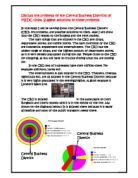
Charges are made on vehicles entering an area bounded by an Inner Ring Road that runs along Euston Road, Pentonville Road, Commercial Street, Tower Bridge Road, New Kent Road, Kennington Lane, Elephant & Castle, Vauxhall Bridge Road, Park Lane, Edgware Road and Marylebone Road. (See plan below.)
No charge is made for driving on the Inner Ring Road itself - only the area bounded by it.
Charging times
Charges are made between 7am and 6.30pm, Monday to Friday - excluding Public Holidays.
Charging costs
The charge is £5 a day for which vehicles can enter and leave the zone any number times on the same day.
Exemptions
A discount of 90% is available to residents living in the zone.
There is complete exemption for:
* Vehicles driven by or being used to carry disabled persons with a Blue Badge
* Vehicles used by certain NHS staff on journeys carrying bulky, heavy or fragile equipment, confidential patient notes, controlled drugs etc; and for NHS staff on-call for services in an emergency
* Vehicles used by certain NHS patients attending hospital appointments; patients who have compromised immune systems; patients requiring regular therapy or assessment or recurrent surgical intervention; and where the patient is clinically assessed as too ill, weak or disabled to travel to an appointment on public transport
* Vehicles used by firefighters for operational journeys between fire stations
* Motorbikes and mopeds
* Hackney carriages (black cabs)
* London licensed mini-cabs whose operator, driver and vehicle are all licensed
* Emergency service vehicles
* NHS vehicles that are exempt from vehicle excise duty
* Vehicles used by disabled persons that are exempt from vehicle excise duty
* Disabled passenger carrying vehicles that are exempt from vehicle excise duty (eg Dial-a-Ride vehicles)
* Buses and coaches with nine or more seats that are licensed in the 'bus class' with the Driver and Vehicle Licensing Agency (DVLA)
* Vehicles with nine or more seats that are not covered by the exemption above, eg community minibuses
* Emergency Vehicles used by fire, police and ambulance services
* Certain operational vehicles used by the eight local authorities within or partly within the charging zone, and the Royal Parks Agency
* Vehicles used for lifeboat haulage and by HM Coastguard, and Port of London Authority vehicles in use attending emergencies on the River Thames
* Military vehicles used by the armed forces
* The cleanest alternative fuel vehicles (band 4 as defined by the Powershift Register, www.powershift.org.uk)
* Electrically propelled vehicles
* Specially adapted recovery vehicles (eg those used by motoring organisations for breakdown removals)
* Breakdown vehicles in use to provide roadside assistance or recovery services operated by independently accredited organisations (eg AA, RAC, Green Flag)
Camera technology
* A network of cameras is sited on the boundary and throughout the zone. They cover all entry points to the charging zone, except cul-de-sacs
* CCTV cameras, similar to those used for ports, airports and the City of London's 'ring of steel', provide high quality video-stream (analogue) signals to an automatic number plate recognition (ANPR) computer system
* Every single lane of traffic is monitored at exit and entry points to the charging zone
* Tests show that there is an estimated 'capture' rate of 90% within the charging zone
* There are two types of camera in operation, colour and mono. The colour camera is used to show a vehicle in the context of its surroundings: the mono camera is used specifically for reading number plates
* Both cameras operate using a chip, a charged couple device (CCD), and X-wave technology, which enables the cameras to see far better in limited light conditions
* The system for capturing and processing this information combines the best and most reliable technology available, chosen specifically to match the needs of this particular scheme
* All captured images are streamed back in analogue to the ANPR system which produces a data block showing the exact time and date that the images were taken. Images from the colour camera and the mono camera, as well as the information from the ANPR reader are then stored as back-up in case the information needs to be compared
* All images are then automatically matched against a database of those people who have registered to pay. The details of those who have done so are discarded
* For those who have not paid the charge, all images are sent to the WORM drive ('write once read many'). Each image is encrypted and digitally signed at the first point of capture to prevent any modification to the original image. This is to ensure a complete evidence trail in the event of any disputed penalty charges
* Images of number plates, belonging to those who have not paid to register by midnight on the same day are manually checked against DVLA databases for a penalty notice to be issued
Enforcement
* A civil penalty system, like that for de-criminalised parking, operates
* Unpaid penalties are pursued through civil courts, with ultimate recourse to bailiffs if no payment is made
* Attempts to tamper with number plates or vandalise/deface signs or camera equipment are criminal offences
* A tamper-proof record of images is kept until penalties are paid, or the case closed. Transport for London (TfL) has powers to clamp or remove persistent evaders anywhere in Greater London - not just within the charging zone
* Foreign vehicles are also monitored and checks made through links between TfL and similar agencies in other countries
* Drivers of hired vehicles will be liable to pay and hire companies will be entitled to pass on driver details
* CCTV monitoring is fully compliant with the Data Protection Act. Only in circumstances where number plates do not match database records, will images be retained for enforcement purposes