Does Halstead Need a Bypass
Halstead is a small market town in South East England, North Essex, and within 15 miles west of Colchester. Halstead is next to the River Colne, and is situated in the Colne Valley. Halstead has a population of 10 000 and is also the only settlement of its size in the Essex region without a bypass. Halstead was also a weaving town (where sheep's wool is made into clothe). Halstead is central to several big towns, such as Colchester, Braintree and Haverhill. Everyday traffic from all these towns has to pass through Halstead high street in order to commute, this usually results in Halstead becoming greatly congested on a regular basis, increasing air and noise pollution, and therefore Halstead central could hugely benefit from a bypass. A bypass is a route, which is built to avoid or 'bypass' congestion in a built up town or village, this lets traffic flow without interferences from local traffic, this improves congestion and road safety. There are many reasons for and against the construction of a bypass. Advantages: * Less congestion in town. * Less pollution in town central. * Lorries would no longer have to drive through the town. * Both noise and air pollution would decrease in town. * Local builders would hugely benefit, from work needed. * It will be quicker for people to travelling to work. Disadvantages: * Expensive, local tax payers of Halstead would
Socio-economic and political impacts of climate change in Africa
'The cause of the warming of the African continent (and of the world as a whole) over the past 100 years is not clear. The change in atmospheric composition associated with rising levels of greenhouse gases must be one of the most plausible explanations, but there are other possibilities (Wigley et al., 1992). The trend may, for example, be the result of natural climate variability, shifts in the ocean temperature distribution or changes in the solar output. The progressive degradation of dryland areas, by reducing surface soil moisture, may have contributed to the warming over Africa, although the results of recent analyses suggest that the effects may account for no more than a small proportion of the trend observed over the continent as a whole (cf. Balling, 1991, with Hulme and Kelly, 1993). Whatever the cause of the warming trend, it provides one benchmark against which we can judge the projections of future climate warming for Africa' All that one needs to look at is the Annual rainfall during the mosts recent three decades to see that there has been around 20 to 40 percent less than was expected around the 1960's. Take extreme years such as 1984 and 1990 where rainfall levels have dropped below 50 percent of what is normally expected. But the real question we are trying to answer here is how sensitive are African natural resources, managed ecosystems and national

Why did so many people die in the Kobe Earthquake?
Why did so many people die in the Kobe Earthquake? Kobe is a major city in central Japan, its population is 1,528,948. It is situated on a minor fault, the Najima fault line. It lies above a destructive plate margin, hence why Japan has so many volcanoes. At 5.46pm, 17th January 1995 an earthquake measuring 7.2 on the Richter scale and lasting for 30 seconds, struck Kobe. This colossus earthquake was caused by "The Philippines plate" and the "Pacific plate", (Oceanic Crust) getting forced downwards when pressure was applied to it by the Eurasian plate (continental crust). The seismic waves caused by the plates rippled through the earth's surface. As well as causing earthquakes these events can cause Volcanoes. The magma rises out of the earth and out of the cracks which have been formed. Although this earthquake may seem big, it is still relatively small compared to the ones that the American people have to endure in San Francisco and California. These one's reach 8-9 on the Richter scale! They are located on the "Ring of fire", which also lies above a destructive plate margin. As you may or may not know, Japan is basically an island made up of volcanoes sticking out of the ground. This means there is very little flat land other than at the base of the volcanoes. Due to this, it is very crowded and congested. Believe it or not the population Of Japan is 124
Earthquakes in MEDC's and LEDC's
A well-known principle states that the impact of earthquakes in LEDC's or Less Economically Developed Countries is generally more severe when compared with MEDC's or More Economically Developed Countries. This shall be illustrated by comparing the Kobe Earthquake in Japan of 1995 with the Kashmir Earthquake of 2005. The Kobe Earthquake occurred on Tuesday, January 17, 1995, at 05:46 JST in the southern part of Hyogo Prefecture, Japan. It measured 7.2 on the Richter scale and lasted for 20 seconds. The duration of the tremors was around 20 seconds long. The focus of the earthquake was located 16km below the epicentre, on the northern edge of the Awaji Island, approximately 20km from Kobe. The proximity to the city was a major factor of its widespread devastation. The ground moved 18cm horizontally and 12 cm vertically. The Kashmir Earthquake was caused by the Eurasian and Indian tectonic plate boundaries colliding. Its epicentre was located in Azad Kashmir near the city of Muzaffarabad. It occurred at 08:52:37 Pakistan Standard Time (03:52:37 UTC) on 8 October 2005. According to the authorities, 79000 people died. A major factor in the severity of the earthquake was the poor construction - a salient feature of LEDC's. The Indian Plate which was moving 40 mm a year north collided with the Eurasian plate and was forced beneath it. It measured 7.6 on the Richter Scale. As is
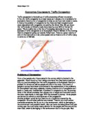
Economics Coursework- Traffic Congestion
Economics Coursework- Traffic Congestion Traffic congestion is the build up of traffic preventing efficient movement. In the UK, traffic congestion is a major issue as it causes a lot of problems for example is there is a lot of congestion in cities as well as main roads in towns. In theory the problem of congestion is that there are high marginal social costs associated with congestion not paid by the driver. Also did you know that traffic levels on Britain's roads have risen by over 80% in the last 20 years. This is mainly due to the fact of increasing demands for a car. An example of traffic congestion is on Sunnybank Road in Mirfield. In the morning there is congestion going up towards Roberttown. There is a great volume of cars on the road and at a very slow speed and so there is a lot of traffic trying to come out of Mirfield. Problems of Congestion From a few people who I have asked in the survey which is located in the appendix. I have found out from taking comments that they have made and from my own knowledge that the traffic congestion on Sunnybank Road is a problem for drivers as well as people who live in that area. Comments of people in survey have been summarised in the explanations of the problems. On Sunnybank road every weekday morning there is a lot of congestion as it leads to Leeds and Huddersfield. A problem of congestion is that the journey times
Mexico to USA Migration Case Study
MIGRATION GEORGE STANSFIELD CASE STUDY INTRODUCTION Migration is the movement of people from one area to another, be it across the road, or to the other side of the earth. Everyday over 2000 Mexicans try and cross the 2000km border that spans between Mexico and the USA. The immigrants walk for miles to try and illegally enter the country and for many it is a wasted journey as they are returned shortly after by the US border patrol police. The immigrants usually travel in groups of 10 and up, friends and families together as a large group. To try and make the journey easier they will often travel lightly, meaning they carry no heavy, but vital, supplies such as food and water. This often leads to things such as dehydration and death as they cross the hot and dry border. Another way the immigrants will try and gain access is through human smugglers, whereby the immigrants will pay the smugglers large sums of money to smuggle them across the border. Once across the border it's now a game of 'hide and seek' with the immigration officers. After crossing the border without being caught they will usually meet in some form of safe house, usually provided by the human smugglers. Once they are settled they will often rent houses in large groups so that can cut the costs dramatically and easily afford it. They can't stay for long though as eventually they would be caught,
Dharavi Slum in Mumbai
Dharavi Slum in Mumbai - Slumdog Millionaire The slum in Dharvi gives a general impression of a highly poor quality of life, a place where those who dwell within are unable to succeed past the limited microeconomic system in place within the slum, be this trade of pottery, a key trade1, or that of a more illegal nature - alike that of drug trade and prostitution. Conditions within the slum are of an extremely poor nature, the high population density alone a major issue, with over one million inhabitants living in the cramped five hundred and fifty acre sprawl of built upon land. Living in brick and tin shanty's those who live within the area can expect to be vulnerable to variable and often violent weather, with the structural support of their weak established housing being tested and frequently failing, laying out those within to the elements. This alone leads to many prominent issues, be it that of quickly contracting illness due to weakened immune systems from the wet environment or developing sanitary illness such as the deadly trench foot- caused by consistent ground water and a poor level of hygiene People within the slum are subject to the typical quality of life that one who resides in any slum world over will experience, apart from perhaps one key element to the Dharavi slum that differs from many others; the large number of inner slum jobs. There is a strong

The demographic transition model accounts for the rise and fall in population, the birth rate, death rate, population size and growth.
Population growth is ultimately decided by the amount of births and deaths, and the balance of the main inputs and outputs of population, inputs to the population being births and immigrants, outputs being the deaths and emigrants. The proportion to which is what really matters. The demographic transition model accounts for the rise and fall in population, the birth rate, death rate, population size and growth. Different cultures, society's and geographical places have different reasons for being either under or over populated. For example, the Philippines, a mainly catholic country, is very overpopulated, because of the religion of the vast majority of the country, they don't use contraception or family planning, and so families can end up having many more children than is the 'norm' for say England, where the average number of children per household is 2, whereas, in the Philippines the average number of children per house is 5, and so the population rises. However, in places like Canada, where the population is around 33,000,000 people, so why does Canada have a low population density? It's because Canada is such a large country, the whole population is distributed very sparsely and there are only 3.4 people in a km 2. Canada is in stage four of the DTM, this means that: * The birth rate is falling * The death rate is low * There is no population growth * And the
Chinas One Child Policy: The good, the bad, and the ugly
China's One Child Policy: The good, the bad, and the ugly China's present population is approximately 1.2 billion, which is about one fifth of the earth's entire population. China has to feed 22% of the world's people on 7% of the world's land, which is a considerable task. China's one child policy was established by Chinese leader Deng Xiaoping in 1979 to limit communist China's population growth. The one-child policy means that couples are only allowed one child in rural and urban areas. Parents with multiple births aren't given the same benefits as parents of one child. Many times the parents have to pay money to the government in order to get permission to have another child. The aims of the policy were to reduce the population rate of China. In the mid-twentieth century the population rate was 55 million (about the same as the UK's total population) every three years. To do this, families were restricted to 1 per family and the marriageable age was raised to 22 for men and 20 for women. Couples have to apply to be married and to have a child. Parents who have only one child get a "one-child glory certificate," which entitles them to economic benefits such as an extra month's salary every year until the child is 14, free education, priority housing and family benefits. Among the other benefits for one child families are higher wages, interest-free loans, retirement

A study of tourism on Bourton-on-the-water
A study of tourism on Bourton-on-the-water Name: Ethan Penney Tutor Group: 11T Introduction My coursework is a study of tourism on Bourton-on-the-water. In this coursework I will investigate two hypotheses. These are; . Tourism has affected the goods and services available at Bourton-on-the-water. 2. Tourism has affected the environmental quality of Bourton-on-the-water. A hypothesis is an idea which can be tested based on geographical theory. To test these hypotheses we will use data collected from our Environmental Quality Survey and our Traffic count. To carry out this study, we visited both Bourton-on-the-water and Charlbury. I went round in a group of four people and we all came to an appropriate final conclusion on each of the questions/observations asked of us. However due to any inaccuracies, we will be given a set of results that are most correct in future, to help us analyse the data as accurately as possible. The reason behind using Charlbury statistics is to compare Bourton-on-the-water to them and hopefully they will show a contrasting pattern, therefore telling us whether my hypothesis is correct or not. Bourton-on-the-water is a major tourist town, with picturesque views set in the heart of the Cotswold's. It has a steady growing population today but the 1991 census tells us that there was a population of around 3500 people. Bourton-on-the-water is