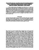
This was the first ward visited and due to the fact that this was the first time I had visited these wards, this ward has left an indentation in my mind of my first impression of Watford. We commenced north up Hempstead road and took a left into Stratford way, where our fieldwork began. Small detached housing covered this area. The field sketch below shows you how close the house’s boundaries are, as well as the style and age of the houses.
When we were at the junction of Stratford Way and Parkside Drive, the first environmental quality survey was taken. The results have been tabulated within the comparison and concluding paragraph at the end of this section. We then took a right, and headed up Parkside Drive, taking into account that we were on the boundary of detached housing and the Cassiobury Park. As we continued up Parkside Drive, we were confronted with semi-detached housing immediately after Richmond Drive on the right hand side. Semi-Detached housing could now be seen on either side of the road. We were due to take the next turning on the right which led us into Langley Way. On the junction of Langley Way and Parkside Drive, the second environmental quality survey was taken. As we turned up into Langley Way, we noticed semi-detached housing on either side of the road until Richmond road on the right, and until Bellmount Wood Avenue on the left. The stream of detached housing continued from there onwards. We carried on up Langley Way, until we met a roundabout which split Langley Way and Cassiobury Drive. Our first sighting of local shops were seen on the opposite side of the roundabout, this is coloured in RED on the colour-coded map. Besides these few shops and a pub on the left hand side, detached housing was all around us. We contined up Langley Way until Devereux Drive was seen at a 90’ angle to Langley Way. We proceeded left and were still surrounded by detached housing. At the top of Devereux Drive, we could see that the further up we went, the more trees and greenery were to be seen behind the houses, and at the top of the road, we took a footpath left which led us into “Rough Wood”. We followed the footpath round until we came into Glen Way, which was where we came across our first sightings of terraced houses. The third and final environmental quality survey for this ward was taken here. We followed Glen Way round to the right and hit the main road called Hempstead Road where we crossed onto the other side and took a left until we came across Rosecroft Drive on the right hand side. Where we left Glen Way and entered Hempstead Road, was the border between the two wards, Park and Nascot. So in summary, Park ward contains small detached houses in a calm atmosphere and well kept away from the busy Hempstead Road. Even though Cassiobury Drive, Parkside Drive and Woodland Drive are the three main roads of Park ward, they do not encounter problems of traffic which leaves Park ward as a calm and family-friendly area. The large park within the ward will indefinitely contribute to the property prices as property prices are strongly based on location, location, location, and due to the fact that they are detached, this leaves a good image in my mind of my first impression of Watford.
Nascot Ward
As we commenced our journey down Hempstead Road and into Rosecroft Drive, we noticed that although Hempstead Road is very busy, the houses within Rosecroft Drive and the surrounding road were fairly large detached houses. At the junction of The Ridgeway, and Rosecroft Drive, the first environmental quality survey of this ward was taken, which received high marks when taking into account it’s location next to an extremely busy road. We then took a right down The Ridgeway, and noticed how the houses were in good keep and fairly big. The road we were in (The Ridgeway) was fairly quiet and in good condition due to the fact that off road/private parking was available. The field sketch below, shows a typical house within Nascot ward.