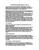
The Dutch were very successful in defending themselves against the sea’s water in the earlier years (which would cause floods) by an elaborate network of dykes 2,500 km (1,500 miles) long but this time the floodwaters came from the rivers. The source of the water was coming from a heavy rainfall in the Ardennes and a warmish winter so all of the snow and glaciers were melting from the Alps. There was too much water, and it came all too quickly. Some of the water was retained by the soil, some was absorbed by vegetation, and a small percentage evaporated. One may think that the dykes are sufficiently high to hold the huge amount of water however they couldn’t hold the amount that was produced from the mountains and rainfall. Dykes are made from sand and clay and act like a sponge, absorbing water. The longer the exposure there is a greater risk that the dyke might collapse. If the dykes did collapse the land would be submerged under 20 feet of water.
Many families tried to evacuate their houses and for some their farmland. However many dairy farms didn’t want to lose their cows in the floods. So most people decided to take these cows in transport to their next destination. When they started off on their journey, everyone was evacuating too, so as you can imagine the traffic was awful. It took over 8 hours for some people to arrive to their destination and by then the cows were stressed and tired. Due to their condition they didn’t produce very much milk and the owners lost even more money. In some cases if you were very unlucky the people before using the trucks to carry their cattle had foot disease. So some cows caught the disease and couldn’t produce any more milk, so the people lost even more money!
Some of the countries had a bigger problem. If they wanted to make their dykes larger then they were going to have to knock down people’s houses by the river. For some people it was a very painful process to see the house that they had spent all their lives in, being knocked down. The sad thing was they were going to loose it either way so they had no input on the decision. For others, they were over joyed. Insurance companies and the government had built modern houses for them higher up (they wouldn’t be affected by the floods). As you can imagine the insurance costs were unbelievably high and billions was spent on new housing developments. So the government came up with some solutions to solve these problems. Here is a couple.
- When a flood is about to take place, the government will warn you, and you are to role up carpets, move wooden shelves higher up, and stock chairs up on tables. (this way the insurance companies wouldn’t have to spend so much money in re furnishing everyone’s houses.)
- Build houses half a meter above ground so if a flood does occur then there is time to move things around inside the house.
- And increase in ‘water meadows’ must be encouraged which can be allowed to flood when necessary.
- The sealing of the soil of surface with tarmac of concrete in vulnerable areas should be limited to slow the water run of into rivers.
Germany, France, Belgium and the Netherlands suffered heavy economic costs in terms of damaged property and lost output. However flooding may also be beneficial. Farmers growing crops on floodplains gain a lot, for it fills their crops with nutrients from the rich soil.
If you earn your money on fishing, floods are devastating for you. Spawning grounds for fish and other wildlife habitat are often destroyed. If you fish on the rivers that flood regularly, the fish will die when the levees overflow because they won’t be able to breathe. This puts many fishermen out of business.
Many people fell sick in the floods, which increased insurance costs even more. The main problem was the condition of the water, as all of it was considerably polluted, one reason for this is because floods disrupt normal drainage systems in cities, and sewage spills are common which then got into the water supply, bacteria and mold from the dampness inside the house affected the condition of the water too. People didn’t know what to do. They couldn’t boil the water with a kettle because if their house were flooded there would be no electricity. So the country had to import water from other countries and the people would have to buy it. It was the only way it could be handled. IF you were living in an LEDC it would be very different because they couldn’t afford to import the water.
The Floodwaters disrupted public and personal transport. It was a great struggle for those who were trying to earn a living. Floods cut off road and railway lines. It also affected communication, as most telephone lines get cut off or get seriously damaged. It affected the electricity and most houses lost their supply impacting their everyday life.
By Georgina Keeley
10.2
Mr. Thomas.
(1101 words)