(Fieldwork notes in appendix)
Processes of data analysis
Data record
A line graph is most suited to the pH as it is easy to interpret and read.
Again I used a line drawing here as they are good for showing trends along transects such as the one used in the investigation. The values A, B, C and D correspond to the data analysis processes described on page 3. The column under “%” shows the percentage of soil moisture lost from the samples after they have been heated at
105 ˚C.
This (below) graph demonstrates the correlation between wind and temperatures in biodiversity. As the wind speed increases the temperatures decrease. Interestingly biodiversity does not decrease but remains the same. The variables are still all present albeit that their frequency has decreased (this is the decrease in temperatures). The increase in wind, in terms of frequency, balances these decreases. Since biodiversity involves variability these eco-factors add to the ecosystem’s complexities and hence its biodiversity.
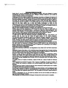
*(Pg 12 shows plants going inland graph)*
Description & Explanation
At site 1 on the fore dune the only plant to be found was marram grass. This a typical plant to start and stabilize sand dunes and is particularly suited to this as it needs little water due to xeromorphic adaptations. As the dunes progress inland more species are found at each site. Moss soon appears, as does evening primrose, vetch, wild parsnip and other such plants not suited to the most arid of soils but perfectly adapted to gathering as much moisture as possible from the yellow and grey dunes. After site seven there is a large increase in the variety and quantity of species. For example the vetch increased from 16 % in site 7 to 60 % in site 11. Mouse’s Ear, broomrape and shepherd’s cress are amongst the species found inland on the transect. The plants found at this end of the transect often have a shallower root system and leaves more adapted for photosynthesising rather than conserving water.
The soil has also changed inland. The samples and data analysis show that pH has decreased from 8.5 to 7.1 over 225 meters from site 1 to 15. This is because as the dunes progress inland, there are fewer shells of marine organisms. These are made of calcium carbonate, which is alkaline. Hence the reason why the dunes become more acidic further inland; there are simply fewer marine exoskeletons.
The dunes also display varying degrees of moisture, with the fore- dunes having little moisture, the yellow dunes having more and the grey dunes showing a drop and then a very large increase.
There was also a temperature decrease along the transect in both ground and air temperature which can be seen on the graph entitled “Factors possibly affecting biodiversity”. The latter may have been caused by the wind, which can also be seen to be increasing from 0.5 m/s in the early stages of the survey to 3.9 m/s later on. Air temperature and time of day and the position of the sites also affected ground temperatures. For example, the ground temperature on the for- dunes was 17º C, yet only 11º C further inland where there was a wide dip in the dune profile.
Overall the graph that shows vegetation heights doesn’t change very much along the transect. This is because the results used were taken from the mode of the average plant height in each transect at each site. Marram grass was present along most of the transect so the average plant height was brought up higher than it would be if there were no marram grass. The huge decrease in site seven is because marram grass is the only tall plant here. Moss is the other predominant species and it is very short so the average is brought down. After site 12 the vegetation height progressively decreases because of the increase in short herbs that bring down the average plant height.
There is a relationship between temperatures; wind and soil moisture and these contribute to biodiversity. Certain plants prefer different conditions or are not adapted to extremes. That is why i.e. that Marram and Lynne grass live on fore- dunes. They can tolerate salinity and a lack of water whilst i.e. moss needs more water and salinity damages root nodules.
Statistical analysis
The Chi-square test: X²= Σ (O – E)
E
The Null Hypothesis states that biodiversity is the same along the transect.
^ Observed no. of species
There are 137 species.
^ Expected numbers if biodiversity was increasing
^ Biodiversity increasing inland – observed and expected
Categories tested- 1= Degrees of Freedom
15- 1= 14
Total= 76.9
The critical value at DoF= 14 is 23.68
The calculated value of X²= 76.9 which is higher than this critical value. There is therefore a significant difference between observed and expected values. Null hypothesis is therefore rejected.
The X² probability test
The critical value at Degrees of F = 14 is 23.68 at 5%
Calculated X² value = 76.9 is greater than this critical value i.e. there is a less than 5% probability that the differences between observed and expected value are not related, suggesting a difference between observed and expected results.
It can therefore be concluded that biodiversity increases along the transect going inland as the Null Hypothesis is rejected.
Simpson’s diversity index (D)
D = N (N-1)
Σ (n,(n,-1))
Site1
Species n, n, n (n-1) N (N-1) = 930/930 = 1
Marram grass 31 930 Σ (n, (n-1))
Total (N) 31 930 D = 1
(Slight diversity)
Site 3
Species n, n, n (n-1) N (N-1) = 2162/2162 = 1
Marram grass 47 2162 Σ (n, (n-1))
Total (N) 47 Σ (n, (n-1)) 2162 D = 1
(Slight diversity)
Site 6
Species n, n, n (n-1) N (N-1) = 56882/18642 =
Marram grass 90 8010 Σ (n, (n-1))
Lynne grass 23 506
Dandelion 4 12 D = 3.05
Hawk’s bit 2 2 (Diversity is increasing)
Evening primrose 14 182
Ragwort 6 30
Moss 100 9900
Total (N) 239 Σ (n, (n-1)) 18642
Site 9
Species n, n, n (n-1) N (N-1) = 51756/9508 =
Marram grass 27 702 Σ (n, (n-1))
Dandelion 8 56
Hawk’s bit 3 6 D = 5.44
Evening primrose 21 420 (Diversity almost doubled)
Ragwort 13 156
Moss 82 6642
Other grass 5 20
Vetch 30 870
Hawks weed 21 420
Shepherd’s cress 15 210
Broomrape 3 6
Total (N) 228 Σ (n, (n-1)) 9508
Site 12
Species n, n, n (n-1) N (N-1) = 66822/11454 =
Marram grass 21 420 Σ (n, (n-1)
Dandelion 8 56
Hawks bit 7 42 D = 5.83
Evening primrose 32 992 (Slight increase in diversity
Ragwort 5 20 but relatively stable)
Moss 90 8010
Other grass 16 240
Vetch 35 1190
Hawks weed 3 6
Shepherd’s cress 15 210
Broomrape 3 6
Cat’s ear 1 0
Polypodoly 16 240
Great vernet 5 20
Newberry 3 6
Wild parsnip 2 2
Total (N) 259 Σ (n, (n-1)) 11454
Site 15
Species n, n, n (n-1) N (N-1) = 47306/7024 =
Marram grass 8 56 Σ (n, (n-1)
Dandelion 4 12 D = 6.73
Hawks bit 5 20 (High diversity)
Evening primrose 10 90
Ragwort 1 0
Moss 72 5112
Other grass 16 240
Birch 1 0
Vetch 5 20
Hawks weed 6 30
Shepherd’s cress 10 90
Broomrape 11 110
Cat’s ear 3 6
Polypodoly 31 930
Great vernet 12 132
Newberry 13 156
Ripwort plantau 4 12
Groundsel 2 2
Primrose 1 0
Burnet 3 6
Total (N) 218 Σ (n, (n-1)) 7024
Analysis.
The statistics show that biodiversity does increase inland at Crymlyn Burrows. This makes sense because the embryo dunes close to the sea do not contain the soil nutrients capable of sustaining the more complex plant species; only grasses can tolerate soil moistures as low as 4%.
As the dunes come inland they (naturally) age. As they age they change and the sand becomes closer and closer to becoming soil as humus gathers from decaying plant vegetation. It becomes less prone to erosion and hence plants need less deep roots. This factor also allows it to store more water as it forms a crustier, denser surface. As colonizing plants die of they create humus that is decomposed by bacteria. As the bacteria break down the dead vegetation ammonia is produced which in turn is converted to nitrates by another kind of bacteria called nitrogen – fixing bacteria. Then plants such as hawks weed can use this and concentrate more energy on adapting for photosynthesis rather than only xeromorphic adaptations, which are all grasses such as lynne grass, have time for. These soil and microclimatic changes maintain and increase biodiversity. Only human intervention can radically change them in the case of Crymlyn Burrows.
There is also more moisture to found inland which also affects the type of plants to be found. They have shallower root systems and are not adapted to salinity. This does not matter however as there is sufficient water for a shallow root system to be adequate and that same water dilutes the salts. Far more plants are suited to these conditions rather than the harsh ones of the fore- dunes. That is why biodiversity inland is so much broader. The plants that take advantage of these improved conditions are known as opportunist species. Most of the plants in the survey are opportunist species. They compete for space as they expand their “colonies”. This interspecific competition is what maintains biodiversity. Eventually shrubs and then trees will colonize the area, there was however, only one birch along or even near the transect so this does not apply in this survey.
I used chi-squared statistics to investigate the Null Hypothesis that biodiversity along the transect is all the same. This test is very accurate and useful in establishing how much biodiversity increases inland. I then used the chi-squared probability test to show how unlikely it was that the null Hypothesis might be true. Simpson’s diversity index enabled results that could be compared to a biodiversity scale i.e. as the diversity number increases so does the biodiversity. The tables also show the distribution of plants along the transect. These can also be seen on
The evaluation provided acceptable results. Human error may have interfered with the latter a little though. Some results were estimated i.e. vegetation height although the use of the modal range should have for a better part eradicated any defected results. Unfortunately the survey was taken on one day at one time of year. Weather conditions will have inevitably affected results, especially those of the soil and perhaps some of the seasonal plants.
The investigation showed how biodiversity develops and is specific to its ecosystem. The complexities and levels building up this system all depend on each other. For example, without the pioneer species the others would not exist because no humus would have been created. The transect showed that biodiversity increases inland as the variables increase in frequency. The temperature is affected by the wind and both affect the plants and they in turn affect the soil and vice-versa.
All in all, the purpose of the investigation was centralized on whether biodiversity does increase inland biodiversity. All of the statistics clearly displayed this trend and the graphs showed the same pattern. The hypothesis was proved and suited modern theories concerning sand dunes and their ecosystems.