My second hypothesis however, namely buildings within the same vicinity will be of approximately similar heights was proved correct. As you can see the from the map there is a strong congregation of buildings with 2 or 3 floors situated predominantly in the north east of Stafford. While there is a number of one storey high buildings right in the centre of Stafford. The buildings also tend to increase in height towards the centre of Stafford. This is because the further away from the CBD you are the lower the land prices are, so building owners decide to build across rather that up because it is easier for the consumer. As you get closer to the CBD though land
prices increase massively so the buildings get taller but not as wide.
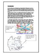
Land use Investigation
The way the land is used is also a major factor when trying to investigate different areas of Stafford, such as the CBD etc. This is the reason why I decided to research Stafford’s land use and see if there is a reason why it is like it is. I will investigate both the ground floor and the first floor of each building in order to see if land use changes from floor to floor. With this in mind I have decided to explore these three simple questions:
- Does Stafford have a distinct Central Business District?
- How is the land mainly being used and why?
- Is there any change in the land use in the centre of Stafford vertically and why this may be the case, i.e. from floor to floor?
Data Collection
The information was gathered by pairs of pupils being assigned to different stations all over Stafford. We then had to walk all around our designated area and record what the land was being used for; this had to be carried out for both the first floor and the ground floor. The stations were located both in the main streets and side ones. This was so we could get a true picture of Stafford’s building land use as a whole.
Two large A3 maps of Stafford were produced, consisting of every class members results. These are displayed on the following page. This is because they will be easier to analyse as a group of results rather than separately. Also if all the results are displayed together identifying possible links and trends will be easier to analyse. The recording of the land use data was not specified to a particular time, as the time of the day did not affect the reliability of the results.
While collecting my personal data I encountered only a number of problems. One of which was, that I found it difficult to find exactly where each building was on the map. This is because the map was extremely small and the location of each specific building was hard to locate. I rectified this problem by approximating where displayed buildings were displayed. The second problem I encountered was that when identifying the land use we were given a white slip with codes to symbolise a certain type of building, and some of the building types were not on the sheet so we had to from our own coding system. For example I used ‘Ch’ to symbolise a charity shop. With everyone deciding on their own abbreviations for types of buildings this made analysis problematic and individuals used their own interpretations.
In the future I would suggest a number of improvements in order to enhance the quality of the students results; the first of which is, I would issue each pair of students a large, up to date map of the specific chosen area. This would make the process of the data collection both more accurate and efficient. Finally I would also give each group a very precise code sheet to help with the identifying process and thus stop the confusion caused by made up abbreviations. Clear planning is vital if results are to be both valid and reliable.
Analysis
Stafford does have a Central Business District although it’s not a clearly defined area. Stafford’s CBD is mainly located along its high street namely, Green Gate street. Its boundary can be identified on both, ground level and the first floor. On the ground floor map you notice the land use is very mixed within the CBD. The majority of buildings consist of, major shopping centres and professional buildings such as offices. This does not surprise me because as land prices are exceptionally high it is understandable that only large organisations can afford the high prices. The professional buildings are also located there as the buildings are used as solicitors and banks etc. These types of buildings serve the general public, which is why they choose to locate them-selves within close proximity to the CBD with the aim to try and attract local custom. Land use on the first floor consists mainly of offices and professional services and there is a lack of retail stores, which are mainly found on the ground floor. The reason for this is because companies feel it is far easier to attract custom if there stock is on one floor in order to get the most sales and maximum revenue. Spreading stock over more that one floor is inconvenient to customers and expensive for owners.
From the maps of Stafford’s land use I can say that the ground floor appears to be used for retail with the majority of the buildings aimed to attract public custom. The fist floor however consists mainly of offices and storage. This is because building owners tend to want all their merchandise on show. So the first floor is an ideal place to keep stock or use as the business’s office.
Transect Survey
I have selected 10 buildings that are located along Stafford’s main high street namely, Green Gate street. I have done this so I can see if the land use and number of stories change as we move further away from the central business district.
Before I do this though I have decided upon three hypotheses that I will explore. They are as follows.
- The height of the building will increase the closer to the CBD you get.
- The land use within close proximity to the CBD will be used for retail purposes.
- The width of the buildings will also increase the closer to the central business district you get.
Delimiting the boundary of the CBD
Every town and city has a central business district and Stafford is no exception. The central business or CBD is the main part of the town. It is made up of predominantly retail stores with also an array of banks and solicitors etc. So before I recorded where the CBD in Stafford was I came up with two hypotheses, which I will explore in my analysis. My hypothesis’s are as follows:
1.) Stafford will not have a strict CBD
pattern
2.) How does the land use change
beyond the CBD
Data collecting
In order to get a precise and accurate picture of Stafford’s central business district we were asked to walk all around Stafford and draw the outline of the CBD on a large A3 map. This was done in pairs to make the whole process a lot less tedious. Once we had recorded the boundary of the CBD we then had to analyse what the land use was beyond the CBD and record that on the map as well. We recorded all our findings on a map, which is illustrated on the following page. This was done so analysing the map will be easier and trying to match Stafford’s CBD layout to one of the two CBD sector models, namely Burgess’s concentric circle model and Hoyt’s sector model. An example of both these will be displayed in the analysis.
While collecting the required data I didn’t really encounter any major difficulties just one or two minor problems. The first was, misinterpreting my whereabouts on the map, which made the recording process very hard on occasions. One of the only improvements I would suggest would be to carry out the data collecting in groups to try and make the process a lot more efficient, less rigorous and tedious. The only other way that I feel the accuracy of the results can be improved would be to give the groups the job to draw the edge of the CBD for just their sector. This will hopefully mean that the process would seem more appealing and may even improve the accuracy of the drawing and thus enhance the validity of my final results.
Analysis
From my map I can see that the CBD is an irregular shape, which proves my first hypothesis correct, namely, Stafford will not have a strict CBD pattern.
When trying to compare it to one of the existing CBD sector models it definitely bears more of a resemblance to the one produced by Burgess. Both the sector models are illustrated below.
Burgess concentric circle
Hoyt sector model
Now I have established the true pattern of Stafford’s central business district and related it to an existing CBD model, I will now analyse my findings and investigate whether my second hypothesis, namely, how does the land use change beyond the CBD is correct. From my map I am able to say that beyond the CBD there are many different types of land use ranging from,
Questionnaire
It is vitally important when investigating any town or city carry out some primary research. In my case this was done in the form of a questionnaire. The results that I obtain from this questionnaire will be plotted into graph form and analysed in the results section. I will analyse each graph and state how the class may have arrived at each of the outcomes. All my results were placed into Microsoft excel. Once there I used the chart wizard to construct each graph. For each question the answer will be in either the form of a simple pie chart, bar chart, paragraph and in one occasion the results will be plotted on a map displaying Stafford and the surrounding area. The questionnaire consisted of 11 questions. The answers to each of these questions were either closed choice answers or an opportunity open answers. A copy of the questionnaire, which I asked along with my own personal results, will be displayed on the following page.
Results and analysis
Question 1 – male or female?
As you can see from this graph the number of males and females questioned were identical at 55 each. This is a very big coincidence but will make our results more accurate as both males and females evenly represented throughout the questionnaire. This is lucky because if you did the same survey on another day you would almost certainly get more of one gender than the other. This will then make the results more gender biased and the reliability of the results will decrease dramatically.
Question 2 – what is your age?
As you can see from the pie chart there is roughly an even spread and representation from all the given age groups. This will also increase the reliability of our results, as there is an equal representation from all the age ranges. This is extremely fortunate because with it being a school day it would have been unlikely to get a far representation from the under 20’s as the majority of the would be in school or work. On the other hand though I would have expected a much larger representation by the over 60’s as they are retired and most have no working commitments.
If you repeated this experiment on a weekend then I would expect to see far more under 20’s and far less over 60’s. This is because the under 20’s don’t have to go to school so they spend their leisure time at town. I would also expect to see this for both 20 – 40 and 40-60 age groups, as they aren’t at work.
Question 3 – how often do you shop at Stafford?
As you can see from the graph the majority of the people asked gave the answer ‘weekly’. This means that the majority of people asked shop at Stafford only on that day. This means that if we went back to Stafford on another day other than Friday we may receive different results.
In order to make these results more accurate I suggest that if you get the most popular choice to be weekly then I suggest you collaborate the results with another classes who went on another day. This would increase the accuracy and the reliability of our results.
Question 4- where do you live?
For this answer I have constructed a ‘sphere of influence’ chart. This was display where each person interviewed has come from. The data is show as a map displaying Stafford and the surrounding cities, towns and villages. This map then has a piece of acetate place on top and it is on the acetate where the results are drawn. The sphere of influence will be shown on the next page.
Question 5- why do you shop here?
This pie chart shows why the people who were asked visited Stafford. It clearly shows that the majority of people queered replied that the reason they shopped in Stafford was because, ‘it was near home.’ I doubt this result would change if the survey was done on another day because convenience is a main factor in people coming to shop in their local town.
Question 6- what do you usually buy here?
This bar chart displays the results for the question, ‘what do you usually buy here?’ Its results show that there are three main reasons shopped in Stafford on that day, they were, for groceries, clothes and shoes and everything. As this questionnaire happened on a weekday I believe the results will differ if it were a weekend. I believe this would be the case because at weekends the largest proportion of people in Stafford would be school pupils and mothers. These people will visit Stafford mainly for clothes and other goods apposed to groceries as their grocery shopping would be done at a supermarket.
Question 7- other shopping centres used?
This pie chart shows what other local shopping centres people use. As you can see there is a lot of variation but the most popular other shopping centre used is either Merry Hill or Wolverhampton, This is not very surprising as both are in close proximity to Stafford and consist of a wide range of shops some of which Stafford does not have.
Question 9- Have your shopping habits changed?
This bar graph show that the majority of people questioned have not had their shopping habits changed because of the introduction of large out of town shopping centres. This was very surprising and I expect that if we asked the same question on a weekend then the response would be the other way around. This is because their was a high representation of elderly people most of whom do not have the means to get to an out of town shopping centre. So they just settle for the nearest place with good public transport connections.
Question 8- how did you travel to Stafford
This bar graph shows that the majority of people in Stafford either came in a car or by the bus. Again I feel these results would be different if asked on a weekend because most of the teenagers living in the surrounding villages such as Penkridge will catch either the train if possible or the bus. So if this question was asked at a weekend I would expect to see both the train and the bus as the most popular type of transport.
Question 10- if yes how have they changed?
This question relates to question 9, namely, Have your shopping habits changed? My findings for this question meant that I was unable to put them into visual for. Therefore I will display them in bullet point form so it is easier to observe the given answers.
They go to larger stores
They find shopping more pleasant in out of town
shopping centres.
They prefer shopping indoors.
They like the easy and free parking that comes
with an out of town shopping centre.
People shop less in a town
People shop more in a town
Question 11- Recommended further improvements for
Stafford
This question was the person replying to the questionnaire’s personal opinion. This meant that this question had an open answer thus I was unable to produce a graph. The responses we got were as follows;
More seats in the centre
More specialist shops
For Stafford to be cleaner
Better public transport required
Cheaper and more car parks required
More of Stafford to be pedestrianised
A crèche for the children
Less cyclists and skate borders