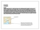
Bangladesh is an economically developing country in south East Asia (See map). The capital city of Bangladesh is Dhaka, which has a population of 8.5 million. Bangladesh has a dense population. Its population is 129 million. Its annual growth is 4%. Its inflation is 7%. Its major industries are Jute manufacturing, cotton textiles, food processing, steel, fertilizer’s, rice, tea, wheat, sugarcane, potatoes, beef, milk and poultry. Its major trading
Partners are Western Europe, US, Hong Kong, Japan, India, China and Singapore. It has an area of 143,998 sq km. Most of Bangladesh’s population live on the floodplain and delta of the Ganges and Brahmaputra rivers. 50% of the land lay 15m below sea level. Bangladesh has a monsoon climate, therefore it receives between 1400-1480mm of rain per annum most of which falls between May and October. It has a beautiful land scope with
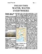
a lot of history and a variety of attractions. It has the longest beach and the largest littoral mangrove forest in the world. Flooding is a common problem, which occurs annually and affects large areas of the country. In 1998 a flood lasted 65 days and destroyed crops, houses, roads and railways and left many people dead. Flooding may be a result of natural or human activities. In this article I will find out if the floods were from a result of natural or human causes and if anything can be done to prevent future flooding.
Drainage basin
Trees at the foothills of the Himalayan Mountains intercept most of the rainfall that falls in the area (see figure 1). Rain, which does find its way to the ground, infiltrates into the soil in both the lowland and high land areas, the mountains. The infiltrated water then makes its way to the Ganges or Brahmaputra via groundwater or through flow. Any water that hadn’t made its way through the vegetation and remained there goes back into the atmosphere via evaporation. Once the ground is completely saturated and the water table can no longer take any more water, any water that reaches the ground reaches the river by overland flow, which eventually runs off into the rivers. Some water from overland flow reaches the atmosphere through evaporation from the ground. The water in the river eventually reaches the Ganges delta and then the bay of the bangal.