Volcanism throughout the solar system.
AA2281 Exploring the Solar System Assessment F: Volcanism throughout the solar system "Volcanism is one of the major processes, whereby a planet transfers heat produced in its interior outward to the surface" (Encyclopedia of the solar system).Volcanism is part of the process of bringing material up from the deep interior of a planet and spilling it forth on the surface where it cools and becomes solid. At least three quarters of the surface rocks on earth and Venus can be attributed to volcanic activity. There are two styles of volcanic activity explosive or effusive. Explosive is when magma is disrupted into fragments which are called pyroclasts by the expansion of exsolved gases. Effusive eruption is when magma escapes through a vent, there is no significant disruption, but a lava flow is formed. To understand the volcanic processes of the earth the products of volcanic activity have been studied under a wide range of environmental conditions such as gravity and atmospheric pressure. There are quite a few other planets which have volcanoes on the surface, including Venus, Mars, and Jupiter's moon Io. Other planets exhibit the results of volcanic activity. These include Mercury, the Earth's Moon, Jupiter's moon Europa, and perhaps Neptune's moon Triton. Planetary bodies, like Jupiter's moon Europa also exhibit icy volcanism where water takes the place of lava. Eruptions
The igneous rocks of north-east England
The igneous rocks of north-east England The area of north-east England, east of the Pennines and between the Scottish border to the north and Teesside to the south has a variety of igneous rocks of different ages, and in this essay I will try to describe the major types that are found, concentrating on the Whin Sill, the Cheviots, and the Weardale Granite in particular, but also commenting on other igneous rocks of the region. I have included a map of the area to show the main bands of igneous rock. The main igneous rock of the north-east is the Great Whin Sill, the largest hypabyssal intrusion in Britain which was intruded approximately 295 million years ago. As the name suggests, it is an example of a common concordant intrusion known as a sill, and the whole Whin Sill complex is a number of lenses of differing thicknesses linked together at depth. The sill sweeps in an arc around the Cheviots and forms many of the most recognisable geological features of north-east England, the best known perhaps being the north facing scarp in Northumberland upon which part of Hadrian's Wall stands. The Farne Islands are part of the sill, as are the crags at Bamburgh, which are home to the castle. The coastline between Dunstanburgh and Cullernose Point, as well as the rock that leads to High Force waterfall in Co. Durham are also parts of the Whin Sill. The Whin Sill has a total area of
Discuss the Contention that Landscape Development is Largely Driven by Periods of Tectonic Activity.
Discuss the Contention that Landscape Development is Largely Driven by Periods of Tectonic Activity. Landscapes are constantly changing. Whether it is a local landscape, a country or the entire planet, landscapes are changing. The current position of the earths land masses have changed over millions upon millions of years from one super-continent 160 million years ago, to the almost fully dispersed positions they are in today (Burbank and Anderson 2001). This move from a super-continent to the fully dispersed state is thought to be a cycle, which once it is fully dispersed the continents will move back together to reform a super-continent once more (Burbank and Anderson 2001). The theory of continental drift has become more and more widely accepted for two reasons, firstly, the fit of continental shelves on both sides of the Atlantic and remarkable exact depths of 900m, and secondly, the symmetry of the mid-Atlantic Ridge (Pitty 1971). This essay intends to recognise the importance of tectonic activity in the development of landscapes and discuss the theories put forward by geomorphologists to try to explain landform development. This essay will also attempt discuss to what extent these geomorphologists see tectonic activity as a primary role in landscape development. Tectonic activity also produces its own landforms. Not only is it responsible for continental positioning
Report of the Geology Studied in South Wales on the First Year Field Trip
Report of the Geology Studied in South Wales on the First Year Field Trip The geology studied on the field trip to South West Wales was based on the coastal locations. This is because the coast consists of exposed rocks due to marine erosion. The coast therefore provides a cross section into some geological structures and stratigraphical sequences. Study of the coast showed a large variety of different rock types which can be grouped into rocks of similar geological period. These different rock types could in many places be seen in a recognisable stratigraphic sequence. These sequences had in most cases been re-orientated, folded and faulted, but still super positional younging in one direction was still valid. I will therefore describe the geology in order of geological age. This will mean the may jump from site to site, as the whole geological record of the area could not be viewed in one trip. The location of the sites is shown on the map at the end of this report. The ages of the rocks studied varied from the most recent period in the area, the Carboniferous to the most ancient in the area, the Precambrian. No close up examination of Cambrian or pre-Cambrian rock landscapes or beds took place. However at Settling Nose, just north of Broadhaven Cambrian and pre-Cambrian rock could be observed to the north, stretching west (Cambrian) to east (pre-Cambrian). These are
Discuss the following within the context of quaternary environmental change: 1). Biological proxies2). Milankovitch cycles3). Reconstruction of former ice flow directions
Discuss the following within the context of quaternary environmental change: ). Biological proxies 2). Milankovitch cycles 3). Reconstruction of former ice flow directions. There are approximately six main proxy sources of data which are used to reconstruct the quaternary environments. Included in the list is 'glaciology', 'geology and geomorphology', 'archaeology' and 'biology and biogeography'. The latter can be split into two sub-categories: Continental biology such as tree rings, insects, plant micro/macro fossils and vertebrate fossils and Marine biology which comprises primarily of diatoms, coral reefs and foraminifera. Plant remains provide major source of information on environmental change. Macrofossils of plant remains such as leaves can be acknowledged in sedimentary deposits. They are primarily used to reconstruct local communities such as wetlands. Microfossils such as fungal spores and pollen, with the use of a microscope, can also be identified. Palynology (the study of pollen) is another source of reconstructing environments, for example the research undertaken by Moar and Suggate (1979) on the West Coast of New Zealand. Pollen grains are highly resistant to decomposition, thus some are preserved in sediments and become fossilised. The extraction, identification and counting of preserved pollen grains has provided much information on the
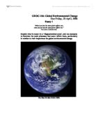
Global Environmental Change
GEOG 106: Global Environmental Change Due Friday, 28 April, 2006 Essay 1 "What I put into the atmosphere affects you: what you put into the atmosphere affects me." NATIONAL GEOGRAPHIC Explain what is meant by a 'biogeochemical cycle', and use examples to illustrate the main processes that occur within them, particularly in relation to their importance for global environmental change. The Blue Marble (NASA 2002) Introduction In this essay the Earth's biogeochemical cycle will be presented as a closed system that exists with finite resources. The parts of the biogeochemical cycle to be described are the atmosphere, lithosphere, hydrosphere and biosphere; and their dynamic series of complex exchanges. Natural processes inside the biogeochemical cycle shall be identified. Global environmental change will be examined as the ongoing transformation over time of the worlds land surfaces, water, the atmosphere, (in terms of its chemical makeup, temperature fluctuations and climate change), and the responding flora and fauna adaptations. The links between changes in the biogeochemical cycle and global environmental change will be explored, citing increases in atmospheric carbon dioxide levels and subsequent warming, and ozone depletion. Finally, reference will be made to the impact of human activities, such as industrialisation and deforestation, on the biogeochemical cycles
The Role of Wnt Signalling in Neural Crest Development.
UNIVERSITY OF EAST ANGLIA School of Biological Sciences NAME: ...Noel Slattery.................. SCHOOL: ...BIO... YEAR: ......2........ UNIT NUMBER: ...BIO-...2B06...,........ UNIT ORGANISER: ...Jelena Garilovic..... ASSIGNMENT e.g. essay/prac report/review: ...essay............. ASSIGNMENT MARKER (if different from Unit Organiser): ....Grant Wheeler............. GUIDELINE FOR LENGTH (no. of words or sides): ...1500/2000............. ACTUAL LENGTH (no. of words or sides): ...1663............ (You should be aware that work that significantly exceeds the guideline length is most unlikely to gain extra marks by so doing) DATE DUE IN: ......21/03/03.................. DATE HANDED IN: ...24/03/03............ PLAGIARISM AND COLLUSION Definition of plagiarism: To take or to use another person's thoughts, ideas and/or writing in such a way as to give the impression that it is your own work. Definition of collusion: A form of plagiarism involving at least two people both with the intent to deceive. (For full details of the University's policy, see Appendix A of the BIO Students' Guide) I (please print your name) ............Noel Slattery................... have read and understood the above definitions. I certify that the assignment which I am submitting, entitled ..............The role of Wnt signalling in neural crest formation.................... is my own work
A map projection is a systematic representation.
1. Attempt a classification of Map Projections and write the merits and demerits of any Two of the following map projections: a. Bonne's b. Mercator's c. Mollweides MAP PROJECTION: A map projection is a systematic representation of the parallels of latitude and the meridians of longitude of the spherical surface of the earth on a plane surface. In other words, it is a method of representing the parallels and the meridians of the earth on a plane surface. The network of the parallels and the meridians so formed is called a graticule. On our earth resembles a sphere. Therefore, a globe being spherical in shape represents the earth truly. Thus a globe is a true representation of the earth. In other words, a globe is true map of the earth. Since a map represents a flat surface and a globe a spherical surface, the shape of the network of the parallels and the meridians on a map is always different from that on a globe. There are a number of methods of transferring the parallels and the meridians of a globe on a plane surface, i.e., constructing map projections. The shape of the network of the parallels and meridians drawn by one method differs from that by the other methods. Therefore, there is a great variety of graticules. A variety in the graticules is necessary to meet various

Is LA prepared for the BIG one?
Is LA prepared for the BIG one? The Earth's crust is split into about 12 pieces called plates. Earthquakes occur due to convection currents radiating out from the liquid core, causing these plates to move. There are regions where the plates drift apart from one-another, which give rise to the creation of new land and crust. However, the world cannot expand, and where land is created in some zones, land has to be destructed in areas where plates converge. It is at such zones where earthquakes are most likely to occur. Where plates collide, friction occurs as the oceanic plate slides beneath the continental crust of the land. Pressure builds up between such converging plates when slipping cannot occur. Eventually the pressure becomes so great that the plates suddenly slip, causing seismic waves to travel through the earth and the pressure released causes earthquakes. The San Andreas Fault occurs on a conservative plate margin. The oceanic crust, the pacific plate and the continental crust, the North American plate are moving parallel to each other. As the two plates move past each other, friction causes pressure to build up. The pressure is eventually released causing the two plates to jerk forward, sending seismic waves through the earth. These waves are released at the epicentre causing earthquakes. The San Andreas runs 1200km through the length of California. The fault is

The shapes and forms of volcanoes
The shapes and forms of volcanoes "A volcanic cone is the result of the accumulation of ejected material around a vent", and many different shapes can be identified. It is thought that there is somewhere in the region of 600 active volcanoes (erupted in the last 25,000 years ) currently on land or exposed above the sea on islands, with many more extinct ones, but this is nothing compared to the number of submarine volcanoes under the oceans. There is more than 50,000 under the Pacific alone ( Summerfield, 1990 ). The location of volcanoes is not random, almost all are found at plate boundaries where new crust is either created or destroyed. The actual form of the volcano differs from one place to another, and they can be classified by two separate factors, the shape of the volcano, or the type of eruption that led to its formation. In this essay, I plan to concentrate on the former of these two things, and look at how the shape of a volcano differs, along with what causes it to do so in each case. The main factors important in volcano form include: the shape of the vent, the number of eruptions from a single vent, the surface environment around the vent, how viscous the magma is, the nature of the eruptive activity, the time between eruptions, and the volume of erupted material. Shield volcanoes are some of the largest volcanic structures on the planet, the absolute height