Introduction
My aim is to find out why farming changes between Bredon Hill and Birlingham. The order of my workings is:
- Identify my aim’s
- Choose my hypothesis or a key question I want to test
-
Do some research into the area + topic + write up my introduction
-
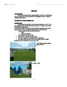
Find out what methods I can use to collect the data I need to answer my hypothesis. Explain what equipment is needed. Also how and why I need to use these pieces of equipment and methods (justify them)
Then go on a fieldtrip and collect the data
-
I will then put my results into charts, tables, graphs, maps and sketches etc. Use a statistical test if needed
- Analyse my data – describe what it shows and use it to answer my hypothesis.
-
Decide on my conclusions and evaluate the success of the investigation.
Factors that affect Farming decisions
'Arable' is the term used to describe the system of farming which uses ploughed fields to grow crops.
Pastoral farming is when farmers keep cattle and livestock for a living either for meats, market or milk.
Factors that affect farming decisions are those like the weather where you can be hot, warm, wet or even frosty. The amount of rainfall also affects the decision. The type of soil plays a big part as well as the weather because if the soil is too stony or clayey then certain crops won’t grow.
Then we come on to the relief of the land whether it is steep which is bad for crop growing but good for hill sheep, or flat which is very good for crops but not so good for animals. The value of crops at that precise moment in time is a big thing as well because if the farmer is in an area with lots of wheat and he grow corn then he can charge more because it is more rare.
The key questions and aspects of the questions I will be answering are:
- What are the key advantages of the vale of Evesham for market gardening?
- The Vale of Evesham is better for market gardening because it has a longer growing season and more arable farming.
- Market gardening is more likely to occur in areas with good communication with supermarkets and other shops.
- How and why does the land use change between Bredon Hill and Birlingham?
- ASA gradient increases, farming changes from arable to patrol.
- The importance in soil drainage and sandier texture will lead to an increase in market gardening.
- How has farming changed over the last 45 years?
- Field sizes have changed to allow more crops to be grown but this has led to environmental problems.
Hypothesis One
*The Vale of Evesham is better for market gardening because it has a longer growing season and more favourable climate conditions.
*Market Gardening is more likely to occur in areas with good communication links.
In order to answer hypothesis 1 I have taken a cross-section through England and Wales. All 3 points that I am comparing are all on the same Latitude of 52 north. I have chosen these places because they are more of a controlled comparison, and the latitude can’t be a climate factor as they are all on the same point.
Then I drew 3 climate graphs; one from Cambridge, one from Pershore and another from Aberporth. The graphs each show the weather over a year and these are the places I have choosen to compare.
Pershore’s climate graph shows that the temperature rose towards the 6th month of the year, and then drops again at December. The lowest temperature recorded was 3.5 in the month of January, and the highest was 16 in July. The amount of rainfall was quite varied. It seemed to be higher in winter and summer, but falling in spring and autumn. The most rain that was recorded to fall was in August with 73 mm, and the least was recorded in February with only 34mm falling. As it’s in the middle of England, slightly west, Pershore receives mostly frontal rain. Warm wet air from the gulf stream, has to rise over colder drier air from the north pole. As the air rises, it cools to dew point, which causes rain. This type of rain is more common in winter, which is why Pershore receives a lot more rain at this time of the year.
The growing season, is the time when the temperature is above 6c.
In Pershore the temperature was above 6c from March until November, so it was a 9 month growing season. This is quite a long growing season, which means that Pershore had a benefit over many other farmers in the country. The crops they plant will be ready first which means they can get the best price in the market (as if it isn’t the strawberry season and the strawberries are ready the supermarket will pay more for the strawberries than usual.) This shows it is a good place for market gardening. If you look at the cross section through England and Wales you can see it’s in a valley. These sloping valley sides allow cold air to drain away, which reduces frost risk. Starting in March, the number of frost days, drops dramatically, and then stays low all the way through until October when it starts to rise again. Pershore also receives warm air which is funnelled from The North Atlantic Drift, up the Severn Estuary in winter and early spring. This is why the summers are hotter, so the growing season is longer.
Cambridge climate graph shows that the temperature rises in the summer months. The highest temperature is in July at 16.6c and the lowest is in January with 3.4c. The rain also rises towards the summer. The most rainfall per month was in July, with 60mm, and the least rain fell in February with only 31mm falling. This shows that Cambridge receives mostly convectional rainfall. As the land heats up, the water on the surface evaporates and rises. As the wet air rises in convection currents, it cools and produces thunder storms.
Looking at the cross section through England and Wales, you can see that Cambridge is situated on very flat land. This is suitable for growing arable crops. The flat relief of the land means it’s easily accessible for machinery, which makes farming quicker and easier. Cambridge also has a long growing season. With temperatures above 6oc for 7 months of the year, these from April to October, it has a reasonable growing season. However it’s not as good as Pershore for market gardening.
Aberporth’s graph has a totally different story to tell. The graph shows that rain falls a lot all year round, but more falls in winter. The least rain recorded is in October with only 10mm, and the most is in November and December with 100mm. Aberporth is at the base of the Welsh mountains so it receives Relief rainfall. Evaporation over the Irish Sea reaches the mountains, and has to rise. Then it cools to dew point, condensation occurs and clouds form. This makes it rain all year round.
Like the other two places I’ am studying, summer has the hottest weather, and winter has the coldest. The growing season in Aberporth is 9 months, from April to December. Although it has the same length growing season as Pershore, the temperature doesn’t rise above 6c until after Pershore, which means Pershore still has an advantage over earlier crops.
However, it’s not only climate that affects what type of farming can be done. The relief of the land is also very important as if you have tractors then they cannot drive on land over 12% sloping land. Aberporth is a very mountainous area, which means it’s not very good for growing crops or heavy weight tractors. The higher up you go, the harder it is for tractors and machinery to work, and the poorer the soil is. This means the land is much better for growing grass, and raising animals than it is for market gardening or arable farming. Cambridge is situated on flat land, with only occasional hills.
Pershore is in a valley between a) the Malvern Hills and b) the Cotswold Hills which I have mentioned before. This means the land between the hills is very flat. This makes Pershore an idea place to grow plants and crops. As the River Avon runs close by, it could also mean that the soil around parts of Pershore is much richer because of nutrients from the river that have been left when the river has flooded time and time again.
Aerial map of Aberporth
O.S map of Aberporth
Aerial map of Cambridge
O.S map of Cambridge
Aerial map of Pershore
O.S map of Pershore
Hypothesis 5
This hypothesis is “The last 50 years has seen an increase in field size”.
Over the last 50 years the landscape in the vale of Evesham has been changed by farmers to maximise crop growth, which in the long run there is more income for the farmers, and it is easier for the farmers to manage fewer smaller fields and to concentrate on a small area of large fields which therefore helps to accommodate for wildlife be it birds foxes or other small mammals that get forgotten..
To prove this hypothesis I will need to compare two maps of field boundaries of the study area. One is from 1952 and the other is from the present day. To make the differences of the 2 maps clear I have traced the fields of the present day map in red pencil and have put the tracing paper over the 1952 map.
The most striking thing I noticed was that the present day field sizes are a lot bigger and have a more regular shape (mostly square or rectangle); whilst in 1952 the fields were more broken up and had a more irregular shape which isn’t very good for big equipment such as modern day tractors, having large regular shaped fields helps produce more of an income as the machinery can get around the fields easier. This also means more crops can be grown in the extra space that the farmers are left with.
A disadvantage to destroying hedges to make the fields bigger is that the hedges act as a physical barrier to wind erosion and surface run off. Also this is destroying habitats for rodents and birds which in the long run are helping the animal species that lives in the hedges population to decrease.
As farmers have to keep the hedges tidy they have to get the right equipment which can be very expensive. Cutting back the hedges is also time consuming, time which the farmers may need to spend doing other things in other fields such as harvesting or planting. The wildlife in the hedges can become a nuisance as some species of animal will eat the crop. Hedges may also block the sunlight which is needed for crop to grow sufficiently although the hedges aren’t that tall it will still block the sun if the crop is near the edge of the field.
Hypothesis 3
This hypothesis is “As gradient increases farming changes from Market Gardening to arable and then pastoral”.
It seems clear that the farming does change from market gardening to arable then pastoral according to how steep the gradient is. You can see this more clearly on maps 1 and 2 which show which areas are used to farm arable pastoral and market gardening it is easier to see how steep the gradient becomes by looking at the cross section labelled cross section 1.
Gradient does affect the type of faming, depth of soil and type of soil in the ground which at site A is generally upper lias. This is mostly composed of clay this meaning that when it rains and gets wet it will slide which is bad for the crops and tractors. The slope gradient according to my results shown in table 1 was about 10 degrees which makes it very hard to work machinery on as at about 11 degrees farm machinery can start toppling over. The aspect of the hill is north facing so the crops don’t get as much sun as is necessary. Because of the gradient of the slope the soil is very thin this is unsuitable for farmers to grow crop. Site A’s farm land is used for pastoral farming as sheep and cattle can climb steep hills and the animals don’t need a lot of sunlight and deep soil to live healthily.
Site B is situated on middle lias and according to the table has a gradient of about 1 degree which is perfectly safe for farming machinery to operate. As the slope has a very slight gradient the aspect is only slightly facing a north direction, so more sunlight can reach the fields meaning that the crops grow better here than at site A. Site B is an arable field used for Hay for the dear at the farm too eat.
Site C is very close to the river Avon meaning that the geology here is alluvium. This is the soil found on the banks of the river which means they will be fertile and very flat. This is because the river is constantly depositing on the banks of the river leaving the soil of a very fine grain that is very fertile. Because the soil is distributed by the river water the ground will be extremely flat any that isn’t will be eroded the next time the river floods .The angle of the slope here was 0 degree’s meaning that it is perfect for crops hence the field being used for the arable crop rape seed. The field hasn’t got an aspect as the land is very flat so the crops can receive a healthy amount of sun through out the growing season.
Site D is made up if lower lias which is generally very flat and fertile soil. The land is very good for market gardening because of the low gradient which I recorded at about 3 degrees and has very deep soil as you can see on the table provided. This is also a good place too have a feild as there is a south east aspect meaning that the crop gets a good amount of sun.
Hypothsis 2
'Market gardening is more likely to be within large areas of good communication'
Take the Vale of Evesham; it is in the near enough middle of Britain so it is near the main motorways of the country such as:
The Vale of Evesham also has lots of main roads and dual carriage ways near it. It has also two rivers, The River Severn and The River Avon which passes through the centre of it and they also meet at Tewksbury which is about 10 mins away from Evesham so that is another benefit for market gardening with good links. There is also a very good railway track and service around this area. The market gardening place’s are no longer in rural areas because They need to be quite close to roads like I mentioned before. However they shouldn’t need to that close because of the use of refrigerated lorries which help keep to preserve vegetables without freezing them. They do this because scientists believe that freezing takes out at least 60% of the goodness from the fruit or vegetable. And also they need to be closer too cities, markets, and motorways because there will then be no big travel costs.
Geography Coursework
“How Does Farming Change Between Bredon Hill and Birlingham?”
By Luke Pallett