Hypothesis 3 – The Gradient of the River Decreases with Distance Downstream
This hypothesis was proved correct because figure six shows that the depth of the river steadily decreases with distance downstream. The gradient of the river increased from -5º at site 1 (Debden Brook) to -4º at site 2 (Debden Brook) and -2º at site 3 (The River Roding). This is because rivers have their source in the watershed before descending to sea-level at the mouth. The long profile of a drainage basin clearly shows a decrease in gradient. This hypothesis corresponds with the Bradshaw model because fig.6 shows the gradient of the river decreasing with distance downstream.
Hypothesis 4 – The Velocity of the River Increases with Distance Downstream
This hypothesis was proved correct because figure seven shows that the surface velocity of the river significantly increases with distance downstream. The Surface Velocity of the river increased from 0.08 at site 1 (Debden Brook) to 0.09 at site 2 (Debden Brook) and 0.35 at site 3 (The River Roding). This is because the increased volume of water entering the river from tributaries will result in increased weight and therefore increased momentum and velocity. This hypothesis corresponds with the Bradshaw model because fig.7 shows the velocity of the river increasing with distance downstream.
Hypothesis 5 – The Cross Sectional Area Increases with Distance Downstream
This hypothesis was proved correct because figure four shows that the cross sectional area increases quite rapidly with distance downstream. The cross sectional area of the river increased from 6.64m² at site 1 (Debden Brook) to 40.95m² at site 2 (Debden Brook) and 469.15m² at site 3 (The River Roding). This is because of an expected increase in width and depth as width times depth equals the cross sectional area. This hypothesis corresponds with the Bradshaw model because fig.4 shows the Cross Sectional Area of the river increasing with distance downstream.
Hypothesis 6 – The Wetted Perimeter Increases with Distance Downstream
This hypothesis was proved correct because figure three shows that there is a steady increase in the wetted perimeter of the river as you go downstream. The wetted perimeter of the river increased from 1m at site 1 (Debden Brook) to 2m at site 2 (Debden Brook) and 10.94m at site 3 (The River Roding). This is because of greater downwards (vertical) and sideways (lateral) erosion due to increased water velocity, discharge and load,resulting in more abrasion due to traction and saltation as well as hydraulic action. This hypothesis corresponds with the Bradshaw model because fig.3 shows the Wetted Perimeter of the river increasing with distance downstream.
Hypothesis 7 – The Discharge of the River Increases with Distance Downstream
This hypothesis was proved correct because figure eight shows that there is a rapid increase in the discharge of the river as you go downstream. The discharge of the river increased from 0.53 at site 1 (Debden Brook) to 3.28 at site 2 (Debden Brook) and 164.20 at site 3 (The River Roding). This is because of an increase in velocity and cross sectional area. This hypothesis corresponds with the Bradshaw model because fig.8 shows the discharge of the river increasing with distance downstream.
The Bradshaw Model
Limitations/Evaluation
In this section I am looking at factors that will have affected the accuracy of my results and ways in which methods might have been improved:-
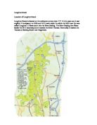
- It was only possible to examine a limited number of sites on the stream. This was because we were only able to carry out the study over a small amount of time (during school hours) therefore we didn’t have enough time to do extra sites. If I was carrying out this study with sufficient time to study further sites I would have covered a possible 10 sites at differing times in order to improve the accuracy of my results.
- Averaging out results could lead to unreliable results. This would have applied to the depth as we took three different measurements for this piece of data and averaged them out.
- The standard of equipment was good but, we were not using scientific professional equipment so some inaccuracies may have occurred. For example: a flow meter to measure velocity instead of a stop watch to measure the time it took for a cork to pass a set distance. This is not very reliable as the cork may have been affected by turbulent flow and people moving in the river. Human error may also have contributed which would be less likely to occur if we had the high tech equipment. The method did not prevent human errors like not stopping the stop watch at the exact right time.
-
The roundness of the pebbles was judged by human observation resulting in possible inaccuracies as people interpret things differently. However if I was carrying this study out from a professional perspective I would be taking pictures and scanning them into a super computer to would judge the rock more accurately.
- The weather was a big factor in changing the accuracy of our results. In our case the rainfall recorded for the day before showed that there was a reasonable amount of rainfall which would have changed our results significantly. This would mean that the river was now deeper and wider than usual, because of the extra intake of water. This would in turn affect all other results such as wetted perimeter, cross sectional area, velocity and the discharge.
- One inaccurate reading could affect other data. For example if the water width was wrong then this would make the cross sectional area wrong as well. The more complex the data the more likely the inaccuracy of the measurements. By using more scientific equipment we would be able to reduce the likelihood of inaccurate results.
- Our method of collection and results will only reflect a particular river at a given time when the readings were taken and therefore could not necessarily be applied to other rivers. An example would be the river Thames which follows the general trend of most rivers and the Bradshaw model, whereas in contrast the River Mersey doesn’t follow this general trend and regularity due to urbanisation. Changing factors such as weather conditions as well as static factors such as the type of underlying soil and geology and slope, mean that our data could not be taken as representing the usual behaviour of other rivers.
Glossary:
Traction - This is when the force of the water simply rolls large rocks along the riverbed. The river usually only has this much force in times of flood.
Saltation - Little pieces of gravel and sand bounce along the riverbed in a series of short hops as the river picks them up then drops them again because they are not light enough to be kept afloat.
Hydraulic action - This is when the water simply hits part of the riverbank so hard it sweeps it away.
Abrasion - A wearing of away of material by friction (the river walls and bed in this case).