COLORADO RIVER Hydrosphere
A case study of
* River management
* People interfering in the hydrosphere
* Balancing water from one area to another
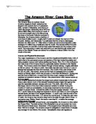
The Colorado river - basic facts
It flows through southwest United States and northwestern Mexico.
It is 2334 km (1450 miles long), the longest river west of the Rocky Mountains.
Its source is west of the Rocky Mountains which is the watershed in northern Colorado, and, for the first 1600km (1000miles) of its course, passes through a series of deep gorges and canyons that were created by the eroding force of its current.
The river flows in a generally southwestern direction across Colorado into south eastern Utah, where it is joined by its chief tributary, The Green River. After crossing the northern portion of Arizona, the Colorado flows west for 436 km (271 miles) through the majestic Grand Canyon. Then it flows in a generally southerly direction and forms the boundary between Arizona and the states on Nevada and California. Near Yuma, Arizona, the river crosses the international border into Mexico and flows for about 145km (90 miles) to its mouth on the Gulf of California.
The River Colorado drains parts of 7 states, a total area in Colorado, Wyoming, Nevada, Utah, Arizona, New Mexico and California, of about 626,800sq km.
A case study of
* River management
* People interfering in the hydrosphere
* Balancing water from one area to another
The Colorado river - basic facts
It flows through southwest United States and northwestern Mexico.
It is 2334 km (1450 miles long), the longest river west of the Rocky Mountains.
Its source is west of the Rocky Mountains which is the watershed in northern Colorado, and, for the first 1600km (1000miles) of its course, passes through a series of deep gorges and canyons that were created by the eroding force of its current.
The river flows in a generally southwestern direction across Colorado into south eastern Utah, where it is joined by its chief tributary, The Green River. After crossing the northern portion of Arizona, the Colorado flows west for 436 km (271 miles) through the majestic Grand Canyon. Then it flows in a generally southerly direction and forms the boundary between Arizona and the states on Nevada and California. Near Yuma, Arizona, the river crosses the international border into Mexico and flows for about 145km (90 miles) to its mouth on the Gulf of California.
The River Colorado drains parts of 7 states, a total area in Colorado, Wyoming, Nevada, Utah, Arizona, New Mexico and California, of about 626,800sq km.