One of the main problems with his theory was that he did not propose a driving mechanism for the motion of the continents. After Wegener published his theory, major technical and scientific developments allowed scientists to map the ocean floor and to detect paleomagnetic reversals in the rocks on the ocean floor. These two sets of data provided geologists with additional evidence for the process of continental drift.
In a 1962 paper entitled "History of Ocean Basins," Harry Hess, a geologist at Princeton University, proposed that the mid-ocean ridges marked regions where hot magma rose close to the surface. Further, he suggested that the extrusion of magma at the ridges pushed the ocean floor away from the ridges like a conveyor belt. In deep trenches like those found off the coast of South America and Japan, the spreading ocean floor was forced down below the thick continents into subduction zones. Hess's theory of "seafloor spreading" offered a compelling driving mechanism for Wegener's continental drift, but it needed more proof.
The same year that Hess proposed his theory, the U.S. Navy published a report that summarized findings concerning seafloor magnetism. During World War II, ships dragging devices to measure magnetism found bands of alternating strong and weak magnetism in the rocks of the seafloor (originally these magnetometers had been designed to locate submarines). These bands, irregular in width, not only paralleled the mid-ocean ridges, but were patterned symmetrically about the crest of these ridges.
The magnetism was caused by the presence of magnetic minerals in the rocks. Scientists were not surprised to learn that seafloor rocks contain the magnetic mineral magnetite.
In 1963, Fred Vine and Drummond Matthews, two British geologists, joined the map of the Mid-Atlantic Ridge with the symmetric bands of magnetism on the seafloor. Where the Navy ships mapped strong magnetism, rocks showed normal polarity; where they mapped bands of weak magnetism, the rocks showed reversed polarity. These strongly patterned paleomagnetic reversals recorded on the seafloor provided the necessary proof of Hess's seafloor spreading. Specifically, they proved that new crust was continuously being generated at the mid-ocean ridges, where magma cooled and magnetite crystals "locked in" according to the orientation of the Earth's magnetic field at that time. The continents no longer had to "drift" to their present locations-they were driven by the slow and steady magma conveyor belts at the mid-ocean ridges.
If the crustal plates are pulling apart at boundaries like the Mid-Atlantic Ridge, the sea floor near these ridges should be very young geologically, since it is formed of material upwelling from the interior. This is the case as the map which is on a separate page shows, the red parts which are the youngest being at the sites of the plate boundaries. The oldest parts which are blue and green are far away from the plate boundary because of sea floor spreading.
The original conjectures concerning plate tectonics were based on circumstantial evidence like the shapes of continents being such that they would fit well if pushed together. Today, we have a much broader set of evidence in favour of the hypothesis.
- The shapes of many continents are such that they look like they are separated pieces of a jig-saw puzzle. For example, look in the adjacent map at the shape of the east coast of North and South America relative to the shape of the west coast of Africa and Europe.
- Many fossil comparisons along the edges of continents that look like they fit together suggest species similarities that would only make sense if the two continents were joined at some point in the past.
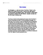
- There is a large amount of seismic, volcanic, and geothermal activity along the conjectured plate boundaries. This is shown clearly below in the figure labelled "Crustal plate boundaries" where the epicentres of earthquakes above Richter magnitude 5.0 are plotted for a 10-year period. The concentration is striking, and indeed this plot serves to define the plate boundaries extremely well.
- There are ridges, such as the Mid-Atlantic Ridge where plates are separating that are produced by lava welling up from between the plates as they pull apart. Likewise, there are mountain ranges being formed where plates are pushing against each other (e.g., the Himalayas, which are still growing).
"Crustal plate boundaries"
Today, much of the evidence the plate tectonics is acquired with satellite technology. Through use of the Global Positioning System (GPS) and other satellite-based data collection techniques, scientists can directly measure the movement and speed of plates on the surface of the earth. Speeds range from 10-100 mm per year, confirming the long-held belief that plates move at a slow but constant rate.