
Ballybay River Study.
Ballybay River Study Introduction Aims and Objectives - The Ballybay River Study has introduced six new fieldwork techniques. These tasks were to measure the width and depth, wetted perimeter, channel bed gradient, current velocity and bed load of each site. The aims of the study are to work together in a group, each introducing their own knowledge, to help understand, and how to complete each tasks and to understand fully how the river channel changes and why it changes. Our aims are to find if the discharge of the Ballybay River increases downstream, if the river's velocity decreases with distance from the source and the channel efficiency increases downstream. Plus to find out if the following hypotheses matches with the theory - * The discharge of the Ballybay River increases downstream * The river's velocity increases with distance from the source * The channel efficiency increases downstream * The size and shapes of the river's load varies downstream I also aim to test four hypotheses using the data collected from the Ballybay River. To successfully use the pieces of equipment correctly, and record accurate results of the Ballybay River sites, will be our objectives. Six specific sites will be used for sampling. The field trip will last one day, as the river study is dynamic. As if it was a two day study the data recorded on the second day would be
"Big River"
"Big River" At the time when I purchased the tickets for the Broadway production of "Big River", a production of The Deaf West Theatre, I did not know what to expect. I questioned how they were going to express the sign language as well as singing and voice all in one. I wondered if there was going to be interpreters or was the whole story going to be told in sign language. When I first arrived and walked up to the crowd of people in line I realized that only a few people out of at least a hundred people were communicating in sign language. I found that a little surprising due to the fact that the performance was put on by a lot of deaf performers; therefore, I assumed that the majority of the people in attendance would be from within the deaf community. But, to surprise my assumption had been wrong...completely wrong. After getting seated and comfortable I began looking around at the different people in attendance for this performance. From where I was sitting I could only see about five different groups of people signing. The majority of the people I could see were the deaf volunteers working for the theatre. The people all around us were all communicating with speech, I doubted that any of them were deaf. I found it funny because once the show started most of the people that were communicating in voice had changed there communication form to sign language. I had

River Chess Coursework
River Chess Coursework My coursework involve a study of the river chess near Amersham. It is obviously based on the work that we did as part of the Rivers module. My work will show how this river changes as it moves downstream. Firstly, the River Chess springs from the Chess Valley in Chesham and Hertfordshire which is in South-East of England. The reason why we studied R. Chess is because the nearest river to us and it will be wise to take measurements of the size of a small river instead of a large e.g. Thames, where it will be difficult to take measurements. Chess River has a drainage basin of 105 square km that covers parts of Chesham, Buckinghamshire and Hertfordshire. Site 1: 1.5 km from source Site 2: 16km from source Site 3: 17 km From source It is important to study the rivers and systems, so we know what to expect and will be able to control them in different ways Leaves example - where the rivers it will not lead to a disaster to the surrounding villages as we all know that if a major river flood can cause devastation as when the Mississippi flooded in New Orleans in 2005. Therefore studying the history and the rivers we have Aid to bring about the prevention of floods. However, the study of rivers in the summer is different than in the winter because the river depth varies depending more rain in

The river Tees
What evidence is there that the river Tees has a upper and lower course? The Tees is a river in Northern England. It rises on the eastern slope of Cross Fell in the Pennines, and flows eastwards for about 87 miles (137 km) to the North Sea, between Hartlepool and Redcar. It drains an area of 708 square miles (1834 square km), and subsumes no important tributaries. The river formed the boundaries between the historic counties of County Durham and Yorkshire. At its lower reaches it now forms the boundary between the ceremonial counties of County Durham and North Yorkshire. Like most rivers, the River Tee has an upper and lower course. The upper course is the start of the river. This is known as the source. The upper course is typically steep and straight with lots of fast flowing water. The source of the River Tees starts is journey in Cumbria at 600 metres above sea level. A succession of falls or rapids, where the river traverses a hard series of black basaltic rocks, is called "Cauldron Snout". From a point immediately below this to its mouth, the Tees forms the boundary between the traditional counties of Durham and Yorkshire almost without a break, although since 1974 much of it lies wholly in Durham. The dale becomes bolder below Cauldron Snout, and trees appear, contrasting with the broken rocks where the water dashes over High Force. These materials are materials

River course project.
Map of Area List of Apparatus * Chain * Clinometer * Net * Bucket * Tape Measure * Measuring Poles * Flow Metre * Ruler (1 metre) * Dog Biscuits * Stop Watch Aims * To measure the length of the wetted perimeter * To measure of the river * To measure the depth of the river at five different intervals * To study the velocity of the river at five different intervals * To measure the gradient of the river * To study the level of pollution in the river Methods Used Wetted Perimeter Measuring the length of the river 4 sites along Afon Conwy 10m sections. A chain (red) and a tape measure were used to work out the wetted perimeter. The chain from the water surface on one bank was taken to the opposite bank and the length of the chain was measured. Measuring the Wetted Perimeter (above) Width Measuring the Width (below) A tape was used to measure the water surface on one bank to the water surface on the other bank. (Hypothesis 1) Depth The width of the channel was taken and divided into six. The depth was measured at five different intervals using a 1 metre ruler. (Hypothesis 3) Velocity Measuring the Velocity (below) The width of the channel was taken and divided into six. The flow meter was two-thirds of the way down and timed 30 seconds to see how many revolutions the impeller turned in order to work out the velocity of the river using a flow

River Processes Revision Notes and Questions.
River processes (Page 6-7) Erosion can affect the length, Depth and Width of a river Vertical erosion deepens river channels. It happens in the upper stages of a river. Lateral erosion makes the river wide. This happens in the middle and lower stages of a river. Headward erosion makes the river longer. It happens near a rivers source as throughflow and surface runoff causes erosion at the point the water enters the river channel. . Hydraulic Action – the pressure of the water breaks rock particles away from the bed and the banks. Its strongest in rapids and waterfalls and during floods. 2. Abrasion (Corrasion) – eroded pieces of rock in the water scrape and rub against banks, removing material. Most erosion occurs this way. 3. Attrition – eroded rock smash into each other and break into smaller fragments. Their edges get rounded off as they rub together. Attrition doesn’t erode the bed and banks, just makes rock in river smaller and rounded. 4. Cavitation – air bubbles in turbulent stretches of water implode causing shockwaves that break pieces off the banks and bed 5. Corrosion (solution) - the dissolving of rock by chemical proces. Carbon dioxide dissolves in water to form a weak acid, which reacts with rock like limestone and chalk, breaking them down. Transportation Deposition: process of dropping ERODED material Occours when the river loses

The River Ganges
The Background of the River Ganges The most sacred river of the Hindus, the Ganges flows 2,510 km (1,560 miles) from the southern parts of the Himalayas in Northern India, to its mouth into the Bay of Bengal at Bangladesh's Meghna estuary. Hindu pilgrims bathe in the Ganges' waters to purify themselves of sin. Water from the river is also given to the dying as a final act of purification for over 2000 years. Millions flock to the river to rid themselves of sin. However, deforestation and industrial waste has led to loss of animals' around the rivers habitat and now there is not much left of the Ganges that is clean. The major tributaries of the Ganges are the Brahmaputra, which joins the Ganges near its mouth in Bangladesh; the yamuna, Gogra, Gandak and Kosi rivers also join up to the Ganges. The Ganges basin is India's main site of agriculture and is the most densely populated area. The main crops grown on the plain include: rice, sugarcane, lentils, oil seeds, potatoes, and wheat. Almost all of the plain has been cleared of its former grasslands and forests to make way for crops. Typically, the banks of the Ganges are lined with swamps and lakes. In these areas including the fertile delta, crops such as rice, legumes, chillies, mustard, sesame, sugarcane, and jute are grown. Only a stretch of the south-western delta, covered with mangrove trees, is untouched. The
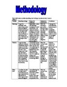
River Darent - Methodology
Now I will create my table describing how I will get my data and why I need to collect it. Variable Sampling strategy Reason for collecting Explanation of technique Limitations Discharge To get the discharge I will need to use a cross sectional diagram of each site and put in the water level and then get the volume of water in each section and then I will have the discharge at each site. Hypothesis 1 states that discharge increases as I move downstream, this means the amount of water in the river increases as I move along it, this data is needed to see if any tributaries join the river Darent or if any other water sources affect it. With this technique I get a rather accurate result and also I will have each discharge easy to see on different cross sectional areas diagrams. I may get the cross sectional area wrong and it is not completely accurate as it would be hand drawn so it isn't in a complete degree of accuracy. Velocity To get the data needed for velocity I will firstly need to measure out a five metre course down the river. Then using a cork I will see how long it takes for the cork to travel the whole course by timing it with a stopwatch and I will do this three times in total for accuracy. This shows the rate that the water flows down the river this I am collecting this to complete aim 2 because if the river has too greater velocity at a site then it is

The Amazon River
Amazon The Amazon River is the second longest river in world. The headwaters begin high in the soaring Andes Mountains and stretches 6,400 km across the South American continent to the Atlantic Ocean. It discharges between 34 to 121 million liters of water per second, and depositing an average of 3 million tons of sediments near its mouth. The outpouring of water and residue is so vast that the salt content and the color of the Atlantic Ocean are altered for a distance of about 320km from the mouth of the river. Also, unlike many other rivers it¡¯s wide and straight from the headwaters to the mouth. During a new or full moon, a wave front from the ocean sweeps 650km upstream at speeds of 65km/h and this causes waves as high as 5m. Because of its vastness, annual floods, and navigability, the Amazon River is often called the Ocean River. The Amazon River is the largest and wettest tropical plain on Earth with heavy rains. Europeans were not the original keepers of this vast rainforest. The Amazonians are trapped between the old and new customs, and since they have traditions, their technology isn¡¯t as modern as the rest of the worlds¡¯. They live on the richest land with a wide variety of flora and fauna. With such great resources, including the river as transportation, almost anybody would want to seize the land and gain profits easily. The Amazonians have little

The River Rhine
By Jasen Chawda 10AM The River Rhine rises in the Swiss Alps about 3,353 metres above sea level and flows north, passing through or bordering Switzerland, Liechtenstein, Austria, Germany, France, and the Netherlands and then its mouth is located at the North Sea. The Rhine is usually at its maximum volume during the seasons of spring and summer; this is due to the fact that there is the melted water of snow and glaciers. In this enquiry I am looking at the aspect of river flooding in the Rhine, particularly in 1995. A river flood is when a river spills its banks onto areas of land surrounding it that are not usually covered by water. The main causes for river flooding are: * Heavy rainfall - causes soil to become saturated and not allow infiltration. * Rapidly melting snow * Dam bursts * Soil saturation - this may cause a river to flood as the water would not be able to infiltrate the soil and so will encourage overland flow. * Deforestation - this may cause flooding as there are no trees to intercept the rain and so the soil will become saturated. * Ploughing - this may cause flooding as it creates gullies which water can flow down towards the river * Urbanisation (extending built up areas) - this may cause a river to flood as the concrete and tarmac that is laid over the soil send more water to the river than to the fields which they replaced. As you can


