Morpeth Coursework
Is the quality of the environment equally good in all parts of Morpeth? Chapter 1 - Introduction This enquiry will test the question "Is the quality of the environment equally good in all parts of Morpeth?" In simpler terms this means, are the surroundings in Morpeth as good as each other. I am investigating this topic because I have not yet studied towns or cites and I feel this would be a good opportunity to find out what cause certain environments to increase or decrease the quality of the environment. this investigation will include; the amount of traffic in different areas, noise pollution, air pollution, the general quality of the environment, litter count, number of pedestrians per area, vandalism and graffiti. By analyzing these different factors I can explain clearly the answer to the question. Here are two maps that I have described in detail where the key features are; A map to show the key feature in the United Kingdom A map to show key feature in and around Morpeth Morpeth is situated in the Northern east of England in Northumberland. It's approximately 15 miles north from Newcastle upon Tyne and 5 miles west of the North Sea. The River Wansbeck flows through Morpeth into the North Sea. It is exactly 7.5 miles north to the Newcastle International Airport and is 1-2 miles east from the A1 main road. This shows that Morpeth

how brent fits the burgess model
. Introduction * The location of Brent in Greater London 3 * Urban Models 5 * Aims of the investigation 11 * Applying the Burgess model to Brent 12 * Hypotheses 14 2. Methods 15 * Choosing sites around Brent 15 * Methods of collecting Primary data 16 * Methods of collecting Secondary data 19 3. Results and Analysis 20 * Primary data: Results from the 5 sites 20 * Secondary data: Demographics 44 * Secondary data: The geography of Brent 48 * Secondary data: The value of land 53 * Secondary data: The history of Brent

Enquiry: Investigation into Retail.
Enquiry: Investigation into Retail. Rotherham and Sheffield are two of the boroughs that make up South Yorkshire, the others being Doncaster and Barnsley. Heavy industry in Rotherham and Sheffield has declined in importance. Steel is still a fairly important factor; especially in Sheffield, but the coal industry has almost disappeared. Rotherham and Sheffield are in the north of England, close to two motorways. These are the M1 (near junctions 33 - 35), the M18 (near junction 1), and major A-roads (including the A630 and A631), putting other major cities within easy reach. The location and pattern of the retail industry has changed over the recent years. We looked at two separate areas using Rotherham to investigate the characteristics of shopping centres and to see if the following hypotheses were correct. Some things that I used in the investigation will be put in the appendix, as they would take up too much room in the investigation (e.g. the questionnaire answers). These are in italics underneath each hypothesis. Central Business District (CBD) - Rotherham Town Centre: . Services, major chain stores and shops selling low order goods dominate the CBD. Original map produced on trip 2. Most people were found where there are major stores and this corresponds to the highest land values. None 3. Shopping quality and street appearance deteriorate away from the town

Has the regeneration of the Quayside Area along the River Tyne been a success?
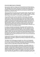
Managing the Human Environment The Key Idea: In the GCSE Geography Course we are suppose to study human environment management, we have chosen the Newcastle Quayside as it is a perfect example of regeneration in progress and to find whether the regeneration process is working and how successful it has become. Land-use zoning and city cycles Cities are based on sectors and land use zones but these land zones change we are going to study one of the changing areas in Newcastle upon Tyne. There are lots of factors effecting the change and regeneration in the land use zones. The sector we are studying is the Quayside and whether the change and regeneration is working? Why is Regeneration Needed? As time goes by, economic advancements happen, i.e. economic changes in the way that industry changes too. The UK has significantly changed economically from being a manufacturing country with factories and lots of work force to a country providing services (tertiary). These changes cause cities to keep up with the up to date economic ways of the UK. In the nineteenth century high density terraced houses built on the original edge-of-the-city, new furniture, iron and steel related factories built round docks are some of the significant changes made in the 19th century that kept up with the economy of the time. As the patterns of industry change in the 1920's shop lifters and railways

An Investigation Into Kingston Area Shopping Centres and Their Patterns of Use
An Investigation Into Kingston Area Shopping Centres and Their Patterns of Use Name: Simran Singh Kooner Examination Candidate Number: 3572 School's Name: Tiffin School Centre Number: 14429 CONTENTS PAGE INTRODUCTION AND AIM- SECTION 1.....................................................................3-11 DATA COLLECTION AND RECORDING- SECTION 2.................................................12-16 DATA PRESENATION- SECTION 3........................................................................17-38 ANALYSIS - SECTION 4........................................................................................39-55 CONCLUSION - SECTION 5...................................................................................55-58 INTRODUCTION AND AIM- SECTION 1 Background Knowledge on Kingston upon Thames The Royal Borough of Kingston upon Thames is a suburban town, situated within Greater London to the southwest of the capital. Kingston is located in the southwest of London, in the county of Surrey. Located on the bank of the River Thames providing bridging and nodal points, the town extends some way along the side of the river, although it does not extend over to the area on the other side of it. Some of the surrounding boroughs include: Richmond upon Thames, Sutton, Esher and Croydon. Kingston is superb example of a town with strong historical
Geography Tourism Coursework
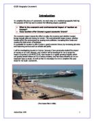
Introduction To complete this piece of coursework, we went away on a weekend geography field trip. The purpose of the trip was to answer the following enquiry questions * What is the economic and environmental impact of tourism on Cromer? * Does tourism offer Cromer a good economic future? The economic impact means the effect on jobs, the economy and whether tourism brings enough jobs and money to Cromer. The environmental impact means, whether tourists affect the environment by causing more pollution, increasing litter levels and causing the destruction of landscape. It is possible for tourism to offer Cromer a good economic future, by increasing job rates and improving services such as schools and parks. I will be investigating tourism in Cromer, because I have previously studied the impact of tourism in an LEDC (Kenya), and I think it will be beneficial for me to study the impact of tourism in an MEDC (U.K). Also tourism is a rapidly growing industry which can greatly benefit Britain as it is a tertiary industry, and has many benefits so it is an important topic to study. As well as this it is necessary for me to complete this case study for my GCSE coursework. (The Cromer Pier in 2006) Sequence of Investigation In this section of the coursework I will describe the sequence of my work and what will be in each different section. Location- In the location I will use

The aim of my coursework, investigating shopping patterns in Brent, is based on answering one fundamental question, 'is there a shopping hierarchy in Brent?' as well as several others, which I myself have chosen all relating to the investigation
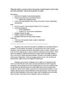
By Derrick Gachiri Context > Introduction - Page 3 > Background - Page 4-6 > Hypothesis - Page 7 > Geographical Theory - Page 8-10 > Methodology - Page 11-12 > Analysis - Page o Graphs - Page13-16 o Bi polar analysis - Page 17-19 o Picture grams - Page 20-21 o Sphere of influence maps - Page o Spider graphs - Page > Conclusion - Page 22-25 > Evaluation - Page 26 > References - Page 26 Introduction The aim of my coursework, investigating shopping patterns in Brent, is based on answering one fundamental question, 'is there a shopping hierarchy in Brent?' as well as several others, which I myself have chosen all relating to the investigation: > Does the quality of the environment affect the success of the shopping area? > Will technological advances affect the way people shop and therefore the success of these shopping areas? > Is there a similarity between the sphere of influence of the shopping areas and their success? > What factors determine the success or failure of these shopping areas? I will set out to achieve this task by gathering as much information as I can from the various locations in Brent my class and I will visit - which are Brent Cross, Staples Corner, Kilburn High road, Harlesden High Street and my local corner shop that I will do individually in my own time - all helping me to form the foundation and back bone of coursework. While on

Urban regeneration
Afzol Ahmed Candidate number: 4012 Centre ID: 13212 Introduction * Sequence of investigation Page 3 * Purpose of Study Page 4 * Identify the location Page 5 * About Stratford City Page 8 * Brownfield Site Page 9 Data Collection (Method) * Nature of information and data required Page 10 * Method table Page 11 * Survey Page 14 * Survey method explained Page 15 * Group interview with project directors... Page 17 * Environmental quality index explained Page 20 * Traffic Survey explained Page 22 Data analysis and presentation * Survey Page 23 * Environmental Quality index Page 39 * Traffic Survey Page 42 Conclusion) Page 43 Sequence of investigation: I have created the flow chart below to show a rough outline of the steps I will take in order to carry out my investigations. Investigating the impact of Stratford city redevelopment Purpose of study: As a class, we have decided to base our hypotheses for our GCSE Geography coursework on the development of Stratford City.

Geography Fieldwork - The effects of Tourism in Keswick
Content Page Content Page 1 Introduction 3 Background to the Lake District. 4 Theory 5 Tourism 5 Footpath Erosion 6 Key Terms 12 Aims 13 Hypothesis 14 Sampling 15 Systematic sampling 16 Random Sampling 16 Methodology 16 Analysis 22 Human Analysis 22 Physical Analysis 24 Evaluation 26 Bibliography 27 Introduction The Lake District is a rural area in North West England; it is located in the county of Cumbria. Refer to the maps for further location information. The areas of the Lake District we are focusing on are the town of Keswick and the walk up to the peak of Cat Bells Background to the Lake District. * The size of the national park is 2,292Km2 * It has a population of 42,239. * It became a national park in 1951. There are many types of rock in the Lake District according to wikipedia some of the rocks date back '500 million years' and include limestone, sandstones, siltstones, mudstones and slate. The Lake District has one of the dampest climates in England. According to wikipedia the average annual precipitation is over '2000mm', this is mainly due to the relief and northerly position. The Mean temperature ranges from '3 °C in January to around 15 °C in July' says wikipedia this is relatively high for it's latitude for example when compared to Moscow which has the same latitude, ranges from -10°C to 19°C. In Fact The Lake District is one

Geography of haiti.
Haiti is an independent country in the West Indies, west of the Dominican Republic, whom it shares the island of Hispaniola with. (Dominican Republic owns two thirds of the island, and Haiti owns the western third). The country is approximately 28,000 square kilometers and has a population of nearly 9 million people, which grows at an annual rate of 2.5%. Port-au-Prince is the country's capital and largest city. Haiti is defined by rough and mountainous terrain, and so has been named "land of mountains". It also has small coastal plains and river valleys. Haiti has a tropical climate, but lies in the middle of the hurricane belt and is prone to severe storms from June to October, with occasional flooding, earthquakes and periodic droughts. French and Creole are the official language of Haiti, as it was a French colony for a period of time. Today, Haiti is the poorest country in the Western Hemisphere, with a GDP of only $1,900, with two thirds of the people unemployed and three quarters living in poverty. Haiti's international debt is more than $1 billion. (www.cia.gov) Haiti has numerous development indicators to show how well the country is developing. The main ones are explained below, each with potential solutions to further develop the country and improve standards of living. SOURCES OF FINANCE Currency: Gourde( HTG) Exchange Rate: $1 to 37.138 Haitian Gourde