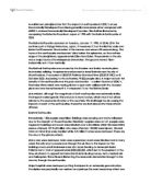
Volcanoes - Comparing Mount Fuji and Vesuvius
Volcanoes Location Page 1 Why did they erupt? Page 2 Human Impact Page 3 Physical Impact Page 4 Similarities & Differences Page 5 Conclusion Page 6 Bibliography Page 7 The volcano, Fuji, is found on the southern Honshu Island in Japan. It is the largest and most popular volcano in Japan, rising to 12,388 feet (3,776 m) above sea level and has a perimeter base of 50km. Fuji is a typical cone shaped volcano and has kept its shape for around 5,000 years. Fuji consists of three different volcanoes called Komitake, Ko-Fuji and Fuji which lie one upon the other. Mount Vesuvius is a volcano in the east of Naples in Italy. The volcano is over 17 000 years old and is still at this moment, active. It is only 4190 feet tall (1277 m) with a base of 48km (3 miles) but its past eruptions have been very dangerous, killing a vast amount. So far Vesuvius has had 50 eruptions and in only one of these eruptions, it has killed over 3 000 people. The volcano is moderately young but has erupted several times and most of these eruptions have been somewhat large in size, but overall, Fuji has had 2 mainly damaging eruptions. Any volcanic eruption is normally caused by plate boundaries. Mount Fuji is an island-arc volcano which means that three

Describe and explain the economic and social costs and benefits of ageing and youthful populations
Describe and explain the economic and social costs and benefits of ageing and youthful populations Ageing populations usually shows that a country is an MEDC, which of course is a good thing. It shows that medical care is very good, diseases are low, diets are nutritional and that there is a good standard of living. The benefits of having lots of elderly people is that the death rate is lower, some provide a service for the country if they are still working and often they are involved in politics using their wisdom to help the country, so in an MEDC an ageing population can be a good thing. However if they are too many elderly then problems start to develop. After all the elderly are part of the dependant population and most, although some do, don't have jobs and contribute to the country and its economy. They do not pay taxes because they are not earning and so just take money from the country in the form of state pensions and other social security benefits. The young and active population therefore has to work hard to support the dependant population so that they can obtain their pensions. However if there are too many elderly people then the country, for example the United Kingdom, which has an ageing population will become very strained. They are too many elderly dependant people to support, this occurs when the active population cannot equal by working the amount of
Letter about a volcanos DRAFT
Dear Senor Jose Cruz You asked me to find out about your volcano poco-poco. I am going to tell you where volcanoes occur and why they erupt in these places, the dangers of them and the dangers of them happening in Mount Isle, what happens when they erupt and the process of getting to the eruption, why volcanoes erupt in the Caribbean region, other examples of eruptions in the Caribbean region, how scientists can monitor and predict volcanic eruptions, why there has been little research on Poco-poco in the past and how the citizens of Iguana Cay could prepare for a possible eruptions and what they should do in the event of an eruption. Volcanic eruptions occur only in certain places in the world and do not occur randomly. That's because the Earth's outermost shell is broken into a series of slabs known as tectonic plates. These plates are rigid, but they float on the hotter, softer layer in the Earth's mantle. There are 16 major plates as you can see in the map. As the plates move about, they spread apart, collide, or slide past each other. Volcanoes occur when this movement occurs. As you can see the Caribbean is next to a plate boundary. This explains why eruptions happen in this area. There have been several eruptions in the Caribbean region such as Montserrat in 1995. St. Kitts has erupted 27 times and St. Eustatius last erupted 1,600 years before present. Future volcanic
Discuss the environmental imapact of Mt. St. Helens tectonic eruption.
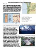
Discuss the environmental impact of a Mount St. Helens tectonic event. Introduction Mount St Helens is an active volcano, south-western Washington in the Cascade Range. The volcano which had been dormant since 1857, began to show signs of renewed activity in early 1980. On May 18 1980, it erupted with such violence that the top of the mountain was blown off and a cloud of ash and gases was sent to an altitude of 19 km (12 mi). The blast killed 57 people and destroyed all life in an area of some 180 sq km (70 sq mi); an even wider area was covered with ash and debris. It continues to emit ash and steam intermittently. As a result of the eruption, the mountain's elevation was decreased from 2,950 m (9,677 ft) to 2,550 m (8,365 ft). A National Volcano Monument was established here in 1982. May 18th 1980 a kryptodome appeared on the north side of the volcano, before this the volcano hadn't erupted for over 120 yrs. March 20th an earth quake happened right underneath the volcano signalling an eruption. Unfortunately Lavafrom the last eruption had acted as a plug, and blocked the volcano. Magma was rising at a rate of six feet a day, casing a bulge on the side of the mountain (Kryptodome). Scientists were using GPS (global Positioning satellites) to monitor the Volcano. March 31st state of emergency announced, 20m exclusion zone was placed around the volcano. May

River Chess Coursework
River Chess Coursework My coursework involve a study of the river chess near Amersham. It is obviously based on the work that we did as part of the Rivers module. My work will show how this river changes as it moves downstream. Firstly, the River Chess springs from the Chess Valley in Chesham and Hertfordshire which is in South-East of England. The reason why we studied R. Chess is because the nearest river to us and it will be wise to take measurements of the size of a small river instead of a large e.g. Thames, where it will be difficult to take measurements. Chess River has a drainage basin of 105 square km that covers parts of Chesham, Buckinghamshire and Hertfordshire. Site 1: 1.5 km from source Site 2: 16km from source Site 3: 17 km From source It is important to study the rivers and systems, so we know what to expect and will be able to control them in different ways Leaves example - where the rivers it will not lead to a disaster to the surrounding villages as we all know that if a major river flood can cause devastation as when the Mississippi flooded in New Orleans in 2005. Therefore studying the history and the rivers we have Aid to bring about the prevention of floods. However, the study of rivers in the summer is different than in the winter because the river depth varies depending more rain in

Development is hazardous to natural and build environments
Developing country areas will decrease the amount of poverty throughout all of Asia, including the assistance to the countries economic growth. The development of road built infrastructure, water availability and aid will assist in the reduction of poverty. "Infrastructure development is a driving factor that can affect poverty negatively and positively. Infrastructure is important for poverty reduction. This can be the case where development aid, road construction or water and sanitary investments have been made with poverty reduction in mind." - (Environmental Knowledge of Change) The increased development and aid from more developed countries would help reduce the amount of poverty in many developing countries, also helping the population's health while helping to deteriorate the amount of poverty driven families. Economic growth can be helped by increasing the amount of contact within inland areas around Asia. "Rapid economic growth in recent years has put enormous pressure on Asia's transport, energy, and communications infrastructure. Unless these can be improved, they will continue to be a bottleneck to growth...Better connectivity with inland areas, for instance, would boost trade and economic growth in both coastal areas and inland...Following the 1997-1998 Asian financial crisis, countries with significant investments in infrastructure recovered faster than
Climate Change
U.K Climate Change and its Effects The threat of climate change will have impact in the following areas of life in the British Isles: • Sea level rises • Flooding • Ocean currents • Health • Agricultural • Wildlife However there may be new opportunities offered by a warmer climate. However, the overall effect of climate change for the world is NEGATIVE. Rising Sea Levels Sea level will rise by between 10cms and 90cms this century depending on how we reduce CO2 emissions. The coastline of Britain could change dramatically. Low lying areas could be invaded by the sea e.g. East Anglia Ocean Currents The Gulf Stream brings warmth to the UK and north-west Europe and is the reason we have mild winters. The average annual temperature of north-west Europe is about 9C above the average for our latitude. If greenhouse gas emissions continue to increase, the temperature and density of the sea water in the North Atlantic will change with dramatic consequences. The gulf stream may stop or be greatly reduced. This would mean that less heat is brought to north-west Europe - harsher winters and mild summers. Flooding The UK has experienced devastating floods throughout the last five years, which have affected thousands of people and caused millions of pounds worth of damage. Last Summer's floods shocked the country - Large town were cut off or under

Why is Antarctica so important?
The last great wilderness is very important to us and to everyone else. This unique, wonderfully, and beautiful place is a place almost entirely covered with snow and ice, it maybe doesn't look like the most important thing in the world but it is one of those things that is made important. The continent of Antarctica is important to us because it has become an international science laboratory where scientists study its weather and climate, oceanology, meteorology, astronomy, ozone layer, marine life and geology. We are only now beginning to realize the profound effects that Antarctica has on our environment and way of life. Antarctica may hold the key to understanding food chains, and the role of plankton in those chains. It is possible that these small organisms form the base of the ecosystems that support all living things. The continent of Antarctica is also important because it is thought to have large deposits of valuable mineral resources including platinum, gold and silver. Coal in commercially attractive deposits has been found, but no other minerals are known to exist in potentially useful amounts. Large deposits of oil and natural gas are believed to exist in Antarctica's continental shelf. In understanding global change the Antarctic has a crucial role to play. Locked up in its 4 km thick ice sheet is a record of past climate for the last 500,000 years.
Outline the factors influencing a rivers flood hydrograph.
Outline the factors influencing a rivers flood hydrograph. A flood hydrograph shows river discharge over a period of time. It shows the response of a river to a specific rainfall event. There is usually a time-lag between the peak rainfall intensity and peak flood flow. There are a number of factors that influence a flood hydrograph. A flood hydrograph is split in two, with the baseflow (which is mostly groundwater flow through rock) and the stormflow (overland flow, throughflow and direct channel precipitation) stormflow accounts for most of the hydrograph. The graphs different shapes depend on a number of things, the flatter hydrographs tend to occur if the storm is light whilst the steep ones when there has been a lot of overland flow. One factor that impacts the graph is the type of bedrock. Bedrock can be permeable or impermeable. Impermeable bedrock, like shale, does not allow water to pass though it whilst permeable rocks such as chalk does. There are two types of permeable rock; porous, which contains pours that fill with and store water as well as pervious. Pervious bedrock is cracked and so allows water to run in its joints. An example of this is carboniferous limestone. A basin with impermeable bedrock is likely to produce a much more dramatic hydrograph than one with permeable bedrock. The basins drainage density is another factor. Drainage density is defines

Can We Win The Race Against Desertification?
Can We Win The Race Against Desertification? What is desertification? Desertification is a process in which more of the land is becoming desert. It isn't becoming a major problem because the land is hot and dry, but it is becoming a problem because the soil is useless for growing crops. Desertification is most likely to happen when there isn't much rainfall. Already around 10 percent to 20 percent of deserts around the world have been degraded to a certain extent. According to experts, around 1 percent to 6 percent of the people living in dry lands actually live in areas that have undergone desertification. However, due to overgrazing, over cultivation and a lot deforestation, more dry land areas are under threat of desertification, which is why we need to prevent this. How can we prevent it? * Planting trees- this reduces soil erosion, sand movement and traps soil moisture and to keep nutrient levels high in soil. We should do this because one of the main causes of desertification is unabated cutting of trees and planted. When this happens, the surface of the soil becomes dry and the top soil gets blown away by wind or washed away by floods and rainwater. * Wells- this is a very reliable source to have water supply, to water the crops when there isn't much rainfall * Sand Traps- you can use this to prevent any sort of sand blowing into cultivated lands *