Velocity of the water will increase steadily as down stream
River Velocity Hypothesis I think that the velocity of the water will increase steadily as we go down stream. This is because at site one the river shouldn't be very wide and deep, so the velocity will be slow as there will be more friction, as you go down stream the river should get wider and deeper so there will be less friction increasing therefore increasing the speed of the river. Method To measure the velocity of a river I will need to: a. Measure out a 10m stretch of river, b. At the beginning of the 10cm I will drop the cork into the river and start the stopwatch, c. When the cork reaches the end of the 10cm stretch I will stop the stopwatch and collect the cork. d. I will then repeat steps b and c a further, two times. e. I will then average out the three speeds. f. Once I have the results I will use the following equation to work out the speed of the river: Stretch of river = speed in metres per second Average time in cork I will repeat the steps a to f at each site. Results Velocity Site one Site two Site three st cork 75.92 secs 8.98 secs 33.90 secs 2nd Cork 82.26 secs 21.46 secs 31.90 secs 3rd cork 50. 30 secs 22.93 secs 32.83 secs Average Cork 69.49 secs 21.12 secs 32.54 secs Speed of river 0.14 m/s 0.47 m/s 0.31 m/s Conclusion From the results, you can see that a site one the river was
How and why do glaciers erode?
How and why do glaciers erode? Glaciers are found where temperatures have stayed below 0?C for a period of time long enough that the snow from one winter survives the following summer. Then it will be covered with fresh snow in the winter. As the amount of snow falls it is compacted, and through partially melting and refreezing air is removed. Over time a glacier will form. Before an area is glaciated it will be affected by tundra conditions. These are extremely important, with regard to the later erosion processes, because they determine the amount of debris available for use in abrasion. The more joints in rocks that are exploited by freeze-thaw weathering then there will be an increase in the tools available for erosion when the glacier forms. If the area is tectonically active or the rocks are well jointed then the amount of glacial erosion may be increased (or continued) due to the increase in (or constant supply of) debris and weathered rock. However, though debris is required at the base of the glacier so that erosion can occur, if there is too much debris then the speed of movement will be reduced by the 'load' and with it the rate of erosion will fall also. This is also true with the amounts of water at the base of the glacier; 'Just a few millimetres of water at the base of a glacier to in crease the speed of the glacier by 40% to 60%' (Weertman). This is why
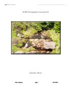
Loughton Brook River Studies - Epping Forest
GCSE Geography Coursework (2003) Loughton Brook River Studies - Epping Forest Shah Azizur Rahman 11Q/3850 Ms Begum Stepney Green School (10548) Contents . Introduction 2. Method 3. Results 4. Description of results 5. Analysis of results 6. Conclusion 7. Limitations 8. Bibliography 9. Appendix GCSE Geography Coursework For my GCSE Geography Coursework I will be studying a river. My objective will be to see the river processes, natural features and the river landform through my investigation. The aim of my fieldwork is to investigate the characteristics of the Loughton Brook as the river goes downstream. We did this investigation on the 15th January in the winter season. The weather was very windy and it started to rain in the middle of the process of recording the results. The Loughton Brook, a small stream that flows through Epping Forest (Northeast of London) and the town of Loughton, Essex. The Loughton Brook is one of the many tributaries of the River Roding that eventually runs down to the River Thames. The Loughton Brook catchment (drainage basin) covers an area of 5.8km². 60% is within Epping Forest. The remaining 40% is in Loughton. A drainage basin is......................... The Loughton Brook and its tributaries rise in dense vegetation mostly different kinds of trees flowing over impermeable Clay gate beds and London Clay drift material.
Define the term permafrost
A) Define the term permafrost and distinguish between the three types. Permafrost is defined as frozen ground that has been frozen for at least two consecutive summers. For permafrost to develop the mean annual temperatures needs to be at most -4°C and it exists of three types. The first of these is continuous permafrost, which occurs where the upper limit of the permafrost remains at ground surface throughout the year and there are no unfrozen patches. Continuous permafrost is only found in the Arctic circle and is commonly over 300m in depth. Discontinuous contains noticeable unfrozen ground called talik within the permafrost. It also tend to be less deep, between 10 and 50 meters deep. The surface shows a significant depth of melting in the summer, forming an active layer. The last type is sporadic permafrost which occurs where there is more talik than permafrost. The mean annual temperature in these areas may be around 0°C B) Describe and explain the variety and location of periglacial landforms. There are a number of periglacial landforms caused by permafrost. One of the largest, as a single object, would be pingos. These are rounded ice-cored hills that can reach up to 90 meters high. They are formed by ground ice which develops in the winter months as temperatures fall. There are two types of pingos open and closed system. Open pingos are formed in valley

Flooding on the river Lea is a natural phenomenon which needs to be managed.
FLOODING ON THE RIVER LEA IS A NATURAL PHENOMENON WHICH NEEDS TO BE MANAGED The catchments area of the river Lea covers 1,420 square kilometers of land. It has a length of 85 kilometers (23 miles) which is from the source to the mouth. The source is in the north west of Luton in the Chiltern Hills and the mouth is a meander which leads to the Thames (the Bow Creek). The lower course of the river Lea is tidal because it has waves coming in from the Thames. 10% of the lakes connecting to the river Lea are tidal. The River Lee or River Lea (both spellings are in general use) is a river in England. It originates at Luton in the chalk beds of the northeast Chiltern Hills and flows generally east and then south to London where it joins the River Thames. Once an important commercial waterway, certain sections were canalized as part of the River Lea Navigation. Another artificial channel, the New River was constructed to take clean water to London from the Lee and its catchments areas and bypass the polluting industries that had developed in its downstream reaches. The New River is a man made waterway in England, opened in 1613 to supply London with fresh drinking water. It starts in between Ware and Hertford in Hertfordshire and travels 20 miles down to Stoke Newington. Among the districts it flows through are (from north to south). The River Lea Navigation is a canalized river
Geograpgy glendun river
Contents Page 1 Front cover Page 30 Location - map showing bed load distribution Page 2 Contents Page 31 Evaluation Page 3 Section 1 - Applied understanding Page 32 Evaluation Page 4 Location Page 33 Evaluation Page 5 Location - map Page 34 Evaluation Page 6 Theory - Ideal stream Page 35 conclusion Page 7 Ideal stream table Page 36 Bibliography Page 8 We should expect to find at: Upper course Page 37 Appendix Page 9 Middle course Page 10 Lower course Page 11 Glossary Page 12 Glossary Page 13 Methodology Page 14 Equipment used Page 15 Data table Page 16 A comprehensive range of techniques Page 17 A comprehensive range of techniques Page 18 Originality Page 19 Results and analysis - Hypothesis 1 Page 21 Results and analysis - Hypothesis 1 Page 22 Results and analysis - Hypothesis 1 Page 23 Results and analysis - Hypothesis 1 Page 24 Results and analysis - Hypothesis 1&2 Page 25 Hypothesis 2 Page 26 Hypothesis 3 Page 27 Hypothesis 3 Page 28 Conclusion Page 29 Originality GCSE Geography Coursework Section 1 - Applied understanding Why? We are doing this study to test all the text book theories. It brings all the ideas that we read in a book to real life, we can see exactly what happens for ourselves we get the chance to record the results ourselves also this is a requirement for our geography GCSE and the study is worth 25% of our

York Flood Management Report
Geography Stephen Mathieson York Flood Management Report The city of York was originally built in a superb defensive position, it was an island almost completely surrounded be water from the river Ouse and the river Foss. With York being surrounded by the Vale Of York it is often under threat from flooding, records of flooding in York go back to the 14th century, but many archaeologists believe that York suffered from a major flood during Anglo-Saxon times. The worst flood witnessed by York happened in 1947 when the river Ouse burst its banks. This was due to the thaw of the river as it was frozen solid, it was so hard that a horse and cart were able to cross the river. York was again hit by a major flood in 1982 when flood levels reached 16feet high. York is often under threat to flooding because of its situation. The river Ouse is the principal drainage basin in Yorkshire. The Ouse is formed by the confluence of the Ouse, Gill, Beck and the river Ure, a few kilometres downstream of the confluence of the rivers Swale and Ure. The Ouse the flows southwards and is joined by the Nidd just to the north of York. The river Ouse meets the river Foss directly in the heart of the city centre. The tributaries of the Wharfe, Derwent, Aire and Don all join the Ouse further downstream before it meets the Trent to become the Humber Estuary.

Letter to the World Bank - What are the causes and effects of flooding in Bangladesh?
Cross unit task What are the causes and effects of flooding in Bangladesh? World bank, My name is Corrina I am writing to make you take notice of the horrific times Bangladesh has to face. At least once a year they suffer from a serious flood, which have awful effects. They have a huge amount of crops ruined, which means no food for the hungry young children and the adults. Having no food maybe bad but seven million homes are damaged or totally destroyed. So means people in Bangladesh are made homeless. One flood causes 2,379 deaths. So people loose loved ones. After reading this I hope you offer Bangladesh help. Bangladeshis is in Southeast Asia. Its latitude is between 20'34 and 26'39 and its longitude is between 88'00 and 92'41 east. It has a high population of 118.000.000 and an area of 144.000 sq km. This makes it one of the most densely populated countries in the world. It has a population density of 824 people per sq km. Bangladesh is boarded by India on the north, west, and east, Myarmer on the south-east, and the Bay of Bengal is to the south. The capital city is Dhaka, which is 1,400 km from India and roughly 600 km from Mandalay. The 3 main rivers are the Ganges, the Jamuna, and Bramaputra. The Brahmaputra being in the north the river Ganges being northeast and the river Jamuna being in the centre of them all. Land is located on the delta of the Padma River.
The Changes in Loughton Brook as it Moves Downstream
Geography Coursework The Changes in Loughton Brook as it Moves Downstream My general aim for this enquiry is to investigate the processes and changes of Loughton Brook as it moves downstream. In order to do this I have chosen three theories to investigate. To conduct my research I visited Loughton Brook in Epping Forest. Epping Forest lies to the north-east of London. It forms a large crescent of land stretching from Wanstead in the south to Epping in the north. The main part of the 19km forest lies on a high ridge of land (a watershed) between the valleys of the River Lea to the west and the River Roding to the east. On top of the ridge are patches of pebble gravel overlying bagshot beds which consist mainly of sand and clay, and at the bottom of the ridge is London clay. The top two layers are essentially free draining while the lower layers are relatively impermeable. This gives rise to a series of springs which emerge at the junctions between different layers. These springs are the source of a number of streams which drain the edges of the Epping Forest ridge. One of the largest is Loughton Brook which rises near High Beach and flows through the urban area of Loughton in to the River Roding. In the past, the area was used as a Royal Hunting Forest, but was also used by local people for grazing and as a source of fire wood. Approximately two thirds of the

Main features and landforms of glacial erosion.
Main features and landforms of glacial erosion. MICRO-SCALE: Striations: When a glacier moves across the underlying rock, the process of abrasion wears it away. It is the fragments of rock held in the ice that do the abrading, scraping across the rock surface like nails across a wooden desk top. Larger rock fragments leave deep scratch marks behind them. These scratch marks are straight parallel lines that reveal the direction of ice movement. Freshly exposed striations have a preferred orientation of rock grains. By lightly running a finger along the striation it is possible to discover that when moving one way along it, the rock feels smooth, but when moving the other way it feels coarser. The moving ice leaves the rock grains aligned with the direction of movement, so when the striation feels smooth, your finger is moving in the direction of ice flow. When the striation feels rough, you are moving against the ice flow. This test doesn't always work, and won't work on striations that have been exposed for a long period of time. Crag and tail: A crag and tail is a larger rock mass than a Roche moutonnee. Like a Roche moutonnee, it is formed from a section of rock that was more resistant than its surroundings. On the lee side of the resistant rock, the bed rock was protected from the erosional power of the glacier. The volcanic rocks on which Edinburgh Castle