Global warming effect on Ice and Snow resources
Global warming effect on Ice and Snow resources This essay is to look at snow and ice resources around the world and to understand the effect global warming will have them By looking at what snow and ice is used for it will enable me to conclude how much global warming is becoming a problem to natural resources and populations around the world. Global warming,Is the warming of the Earth by means of green house gases. Green houses gases such as Methane; Carbon dioxide and water vapour get trapped in the ozone layer and break it down. This is due to the chemical reactions that occur when these gases combine with the ozone (O3) Ice and snow is used as a major resource it provides four main resources to a population. Glaciers are the main source of ice and are not just a different landform but an attraction of tourists to an area. Glaciers now a day are seen to be a natural resource like coal was in the 1950's some thing to be harnessed by growing populations. They are used in the following ways - As a source of drinking water People living in countries such as Bolivia rely on ice melt from nearby ice caps to provide water during dry seasons - To produce hydroelectric power Damming melt water for glacier's to provide high energy and wave levels to generate electricity through hydroelectric means - Snow and Ice bring tourists to an area. Polar bears nature and
To investigate the effects of coastal management, and to investigate the effects of longshore drift.
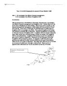
Year 11 G.C.S.E Geography Coursework (Umar Sheikh 11GS) Aim: 1. To investigate the effects of coastal management. 2. To investigate the effects of longshore drift. Introduction This coursework is on the fieldtrip to Somerset, Nettlecombe to investigate the effects of coastal management and longshore drift. Porlock Bay is in the south west of England just below Wales. This course work is mainly on the coastal processes and management which deals with the protection of land from the sea. As we went to Somerset we did field work to collect data on longshore drift to investigate its effects. We explored longshore drift along the coastline of Porlock Bay in Somerset. Coastal management is important in this area because of longshore drift. Longshore drift is transport along the coast when waves move material across a beach; we will go over longshore drift in more detail later. Longshore drift causes one part of a coastline to gain more of beach by deposition. Deposition is the dumping of material. Longshore drift is caused by waves. In response to LSD they have built groynes, sea walls and boulder barriers which are all types of sea defence. There is a lot of tourism in Somerset. One place were there is a lot of tourism is in Lynmouth which went through a vicious flood. There is a lot of agricultural in Somerset as it is not as modern as the city of London.
Geography Fieldwork Write-up
Geography Fieldwork Write-up Analysis Size of the Channel - the channel width grew larger the further downstream you were. This is shown on the diagrams of cross sections of the channel at 3 different points in the river. This is because of the higher discharge in the lower course of the river due to tributaries adding more water to the main river, therefore the river widens to be able to transport this extra water. Relationship between Velocity and Discharge - The Spearman Rank Correlation Co-efficient suggested a strong positive relationship between velocity and discharge. In other words, the higher the velocity of the river, the higher the discharge of the river. Roundness of the Load - the further down the river, the rounder the load was. This is because the further a rock has been in the river and has travelled in the river, the more erosion processes, such as abrasion and attrition, and transportation processes, such as saltation and traction, it will have been exposed. These processes will have gradually eroded the angular parts of the rock until eventually the rock is left roughly rounded. However there were notable anomalies to this theory, such as a rock which was picked up at survey site 10 (a site in the middle course of the river), being the most angular rock, measuring 50 on the R.I. scale (measured by Roundness Index) found in all parts of the river. You

Dune Evaluation
Dunes: Artificially defended; naturally retreating. How do humans influence dunes? What management strategies are in place for coastal dunes in Nova Scotia, Canada? Nature is not static, thus it would make sense that coastlines, too, would be in constant fluxuation. For millions of years the morphology of Nova Scotian [see Figure1], as well as global, coastlines have been changing. Beaches are a fine balance between accretion and depletion of sediments but go through cycles of creation and destruction (Taylor). Dunes, the accrual of beach sediment, act as a barrier against storm surges and as a habitat for coastal species, including many types of dune grass, birds and insects. Generally the dunes in Nova Scotia are moving landward (Taylor). However, it is when costal erosion interferes with human development, that it becomes a problem. Humans have the ability to protect the forty-five dunes, over a kilometer in length in many different manners (Hale), including hard and soft defenses or leaving an area to the course of nature. Of the wide variety of hard defenses, groynes are arguably the most effective at creating dunes. While deposition generally equals erosion on the leeside, a properly placed groyne can be extremely successful. Waterside, Pictou County, has the fastest growing dune system in Nova Scotia, due to a groyne [See Photo 1]. The groyne is ideally
Effects of Hurrricane Katrina
Effects of Hurricane Katrina on people and property. An area the size of the UK was impacted by the hurricane's destruction. Within this was the city of New Orleans in Louisiana that suffered most. Much of the city flooded rapidly as three protective along the lake and river gave way. Over 1000 of the cities 460,000 died, whilst the homes of many were destroyed or severely damaged. Over half a million US citizens became refugees, it was the poor, working class population, often without insurance, who suffered the most. The state population fell by over 8% and within Louisiana, areas outside New Orleans grew in numbers as the city's people fled. In the coastal state of Mississippi 109,000 were made homeless and over 230 died. Housing damage and destruction was widespread and stretched up to 100km from the hurricane centre. At least 100,00 temporary homes were set up across the region.. Services in New Orleans were severely damaged. Even after 6 months after the hurricane there was no functioning sewage system and gas and electricity supplies were unavailable. Agriculture suffered great losses including the death of nine million poultry in Mississippi, while in the same state the dairy industry lost $12 million.. The forestry industry in the region also suffered heavily; over a million acres of forest was destroyed. Due to Katrina, the total financial loss to the timber

I am trying to find out how footpath erosion on Pen Y Fan which is a national park, compares to footpath erosion on Cock Marsh which is in a village and is not in a national park.
Section 1 I am trying to find out how footpath erosion on Pen Y Fan which is a national park, compares to footpath erosion on Cock Marsh which is in a village and is not in a national park. The question is 'how does footpath erosion on Pen Y Fan compare to footpath erosion on Cock Marsh'. Backround information on Pen Y Fan and the Brecon Beacons The Brecon Beacons is a lived and worked in national park. The area within the national park covers 519 square miles. Nearly half of this is 1,000 ft above sea level. Pen Y Fan is the highest mountain in South Wales and is 2,907 ft above sea level. The Brecon Beacons also has other peaks such as cribyn and corn Du. the east of the brecon beacons are known as the black mountains. In the far west of the national park is the upland range known as Black Mountain. This is a remote location and has a well-known ridge walk called the beacon horseshoe. In the south there is a place called waterfall country and in the north is sennybridge. Pen Y Fan has a problem with footpath erosion due to walkers walking over the footpath with heavy walking boots which pulls up mud and vegetation and it falls off in a different area. Also this may get worse and the footpath may widen because the footpath is stoney and the walkers would find the grassy banks easier to walk on so the boots would erode the banks and the process wont stop. There are many
Describe and explain how waves influence beach profiles.
Describe and explain how waves influence beach profiles (25) Waves are the main factor of shaping the coast. Their erosive capacity is partly due to the effect of impacts of water against the coast and partly due to the action of beach material moved by the waves themselves. Nevertheless, there are several factors that influence the erosive force of waves: Strength of wind, length of time wind blows and the fetch. Waves with a large fetch and subjected to strong winds are generally known as destructive waves. These waves are steep and tend to break downwards onto the beach. They possess both a strong swash and a strong backwash, the latter being sufficient to erode the beach yet the former being able to build a large berm by adding material to a zone, which the backwash cannot reach. Therefore, destructive waves tend to erode the beach yet leave a constructional feature at the highest point reached by the waves during their period of occurrence (usually a storm). Destructive waves erode the coastline via a number of processes. The most powerful and active form of wave erosion is hydraulic pressure (Wave Quarrying). This occurs when waves break against the face of a cliff and cause the air in rock cracks to be compressed with pressures reaching up to 50 kg/cm2. The retreat of the wave causes rapid expansion of the compressed air, exerting a huge force, which can be
What are plate margins?
What are plate margins? Plate margins are the edges of the plates, where all the power of nature is released in earthquakes and volcanoes. There are three main types of plate margins: - Spreading Boundaries There are two types of spreading boundary Ridges, where new rock is formed, pushing the plates apart, and Rift, where the plates pull apart, and the earth between them sinks. On the ocean floor the plates are spreading. All along the mid ocean ridge, volcanic activity is pouring new lava out onto the seabed. As it hardens, it becomes new rock, gradually pushing the crust, on either side of it away. Another type of spreading boundary is the African Rift Valley. As the two plates are moving apart, the earth between them is becoming stretched. As it stretches it sinks, because it is thinner. It is a little bit like taking a piece of gum, and stretching it out. The pieces in your fingers stay thick, but the piece in the middle gets thinner and thinner, as it is stretched. Converging Boundaries Converging (coming together) Boundaries, are where two plates are banging into each other. What happens when they collide depends on the type of plate they are. In a subduction zone one plate is being pushed beneath the other. It happens when a lighter plate hits a heavy plate. The lighter plate is pushed under the heavier one. This often happens where continents meet the ocean.

Examine the factors influencing the movement of glaciers.
Examine the factors influencing the movement of glaciers. Glacier is defined as, 'a mass or river of ice moving very slowly'. Glaciers range in size considerably, Antarctica being the largest ice mass at 12.5 million km and a smaller ice mass of 12km existing in Africa. Glaciers move due to the force of gravity from areas of high altitude to lower areas. There are different mechanisms of glacial movement depending on the type of glacier. Cold (polar) glaciers are frozen to the underlying rock surface. These are found in high-latitude locations where the relief is low and basal temperatures are below the pressure melting point. Cold glaciers have very slow rates of movement, e.g. The Meserve glacier in Antarctica moves only 3-4 metres per year. Warm (temperate) glaciers on the other hand are not frozen to their bed. This type of glacier is found in high-altitude locations where the relief is steep and basal temperatures are at or near the pressure melting point. Temperate glaciers move very rapidly, e.g. The Franz Josef glacier in New Zealand moves approximately 300m per year. It is the basal temperature that determines the mechanism of movement. In what follows I will explain the factors influencing different mechanisms of movement. Temperate glaciers move mainly by basal sliding. If the basal temperature is at or above pressure melting point, a thin layer of meltwater
With reference to a specific area and its ecosystem(s) explain how the natural environment can be used, abused and conserved.
With reference to a specific area and its ecosystem(s) explain how the natural environment can be used, abused and conserved. An ecosystem can be described as the relationships between the biotic or living members of a community, e.g. plant life, birds and the abiotic or non-living elements, including water and soil which form the natural environment. The essay will examine the ecosystems of Sand Bay and surrounding shoreline, including Sand Point and Middle Hope. The essay will comment on evidence of land use, misuse and attempts to conserve the habitat, based on evidence gathered during a field visit to the site during December 2001. For ease of identification, I have referenced some locations described on the enclosed map. Location Sand Bay is located in the county of North Somerset in the south west of England. The area of Sand Bay and Middle Hope occupies an approximately 2 mile long stretch of coastline on the south side of the Seven Estuary, approximately 4 miles north east of the seaside resort of Weston Super Mare and 18 miles west of Bristol. Ecosystems There are a variety of ecosystems along the Sand Bay coastline, the major ones are the marine ecosystem, the salt marshes (1) on the north side of the bay, the sand beach, Swallow Cliff and the surrounding grassland. There are many smaller ecosystems within these major ones, including the rock pools and


